
Data
Browse real-time data, data releases, software/code releases and more.
Filter Total Items: 209
Factors affecting the spatial distribution of Niangua Darters (Etheostoma nianguae) in the Osage River basin, Missouri, USA, 2010-2011 Factors affecting the spatial distribution of Niangua Darters (Etheostoma nianguae) in the Osage River basin, Missouri, USA, 2010-2011
These data include information from 74 sampled stream reaches in the Osage Ecological Drainage Unit (EDU) within the Osage River Basin, Missouri. Streams with a Strahler order from three to six were systematically sampled to assess Niangua darter resource selection across three spatial scales macrohabitat, reach, and watershed scale. Variables used to explain Niangua darter presence at...
Elicited constructed value of information scores for American kestrel uncertainties in the United States from a 2023 structured decision making workshop Elicited constructed value of information scores for American kestrel uncertainties in the United States from a 2023 structured decision making workshop
The American kestrel (Falco sparverius; hereafter kestrel) is a widespread but declining raptor species in North America. We organized a rapid prototyping workshop to use decision analysis to develop research priorities for understanding environmental drivers of population decline in the United States for the kestrel. The virtual workshop spanned 2.5 days and was held in-person in...
Michigan Mammal Monitoring Project 2025 Michigan Mammal Monitoring Project 2025
The Michigan Mammal Monitoring Project is a collection of wildlife camera trap data from within the state of Michigan. It contains camera trap data associated with a number of different projects lead by the U.S. Geological Survey's Michigan Cooperative Fish and Wildlife Research Unit as well as data from all contributors within Michigan to already published Snapshot USA projects. These...
Predictive layers of trace elements in soil in the conterminous United States Predictive layers of trace elements in soil in the conterminous United States
This dataset provides posterior mean predicted rasters of the distribution of trace elements important to vertebrate health (cobalt, copper, iron, manganese, selenium, and zinc) in the soil across the conterminous United States. Rasters were generated using a Bayesian modeling framework implemented in R with the R-INLA framework (Integrated Nested Laplace Approximation) and the...
Wyoming Range fish data 2012-2019 Wyoming Range fish data 2012-2019
The goal of the study associated with this dataset was to characterize flow-ecology relationships for Mottled Sculpin (Cottus bairdii) and Mountain Sucker (Catostomus platyrhynchus) in snowpack driven headwater streams of the Upper Green River Basin in Wyoming, U.S.A. Our objectives were to: 1) evaluate whether variation in Mottled Sculpin and Mountain Sucker abundance is driven by...
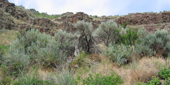
Radio telemetry tracking data for sagebrush songbird fledglings in Wyoming, between 2021-2023 Radio telemetry tracking data for sagebrush songbird fledglings in Wyoming, between 2021-2023
Sagebrush songbird fledglings (Brewer's sparrow, sagebrush sparrow, and sage thrasher) were measured and tracked using radio telemetry in Pinedale, Wyoming during 2021-2023.
National Ecological Observatory Network Volume 1 (2024) National Ecological Observatory Network Volume 1 (2024)
This volume's release consists of 31524 media files captured by autonomous wildlife monitoring devices under the project, National Ecological Observatory Network. The attached files listed below include several CSV files that provide information about the data release. The file, "media.csv" provides the metadata about the media, such as filename and date/time of capture. The actual media...
Observations of tear-drinking by lepidopterans on moose (Alces americanus americanus) in northeastern North America Observations of tear-drinking by lepidopterans on moose (Alces americanus americanus) in northeastern North America
This volume's release consists of 80 media files captured by autonomous wildlife monitoring devices under the project, USDA Green Mountain National Forest. The attached files listed below include several CSV files that provide information about the data release. The file, "media.csv" provides the metadata about the media, such as filename and date/time of capture. The actual media files...
Fish fin and muscle stable isotope data for four species of the Red River in Oklahoma and Texas, 2023 Fish fin and muscle stable isotope data for four species of the Red River in Oklahoma and Texas, 2023
Fish fin and muscle tissue natural abundance stable isotope data for four prairie fishes native to the upper Red River basin of Texas and Oklahoma, USA, including plains minnow (Hybognathus placitus), prairie chub (Macrhybopsis australis), Red River shiner (Notropis bairdi), and Red River pupfish (Cyprinodon rubrofluviatilis). Fish fin and muscle tissue were analyzed for 13C and 15N...
Fish passage classification of the stream network in the Willamette River Basin, 1990-2020 Fish passage classification of the stream network in the Willamette River Basin, 1990-2020
The U.S. Geological Survey (USGS) Oregon Water Science and Forest and Rangeland Ecosystem Science Centers have developed a spatial database of the stream network in the Willamette River Basin classified by degree of obstruction to fish passage. This effort was funded by the USGS Ecological Flows program in cooperation with the Integrated Water Availability Assessments in the Willamette...
North River Gameland, North Carolina Myotis septentrionalis Day-roosts North River Gameland, North Carolina Myotis septentrionalis Day-roosts
These data contain located day-roosts for the northern long-eared bat (Myotis septentrionalis) at the North River Game Land, North Carolina in May and June of 2019. Data contained include individual bat tracked, date day-roost was found, day-roost unique ID, geographic coordinates of day-roost, tree species of day-roost, diameter breast height (cm) of day-roost, day-roost decay-stage...
Carolina northern flying squirrel presence and pseudo-absence points in the Southern Appalachian red spruce-Fraser fir sky islands Carolina northern flying squirrel presence and pseudo-absence points in the Southern Appalachian red spruce-Fraser fir sky islands
Carolina northern flying squirrel presence and pseudo-absence points for eight high elevation North Carolina, Tennesse, and Virginia red spruce-Fraser fir forests. Data includes corresponding habitat variables (distance to spruce-fir forest, northern red oak forest, northern hardwood forest, open areas) and topographic variables (elevation, topographic exposure index, aspect), latitude...