U.S. flag

An official website of the United States government

Videos

Videos intro.
Filter Total Items: 53
thumbnail turkey earthquake press conference Earthquake Activity in Turkey and Syria [Press Briefing]
Earthquake Activity in Turkey and Syria [Press Briefing]

On February 6, around 4:15 a.m. local time, a magnitude 7.8 earthquake struck south-central Turkey near the Turkey/Syria border.

Mapping the Ground Failure—Puerto Rico Post-Dec 28, 2019 Quake

My name is Kate Allstadt. I’m a research geophysicist with the U.S.

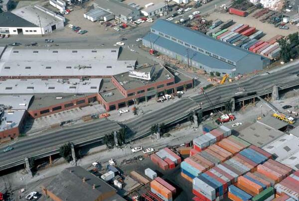
Initial Observations of Cypress Structure Collapse, Oakland, CA 1989

Retrospective interview with USGS Geophysicist Susan Hough about the collapse of the Nimitz Freeway (known as the Cypress Structure) in Oakland, CA, during the October 17, 1989 Loma Prieta Earthquake and how the first responders reacted to the event.
 

Retrospective interview with USGS Geophysicist Susan Hough about the collapse of the Nimitz Freeway (known as the Cypress Structure) in Oakland, CA, during the October 17, 1989 Loma Prieta Earthquake and how the first responders reacted to the event.
 

Sight Response and Cypress Structure Collapse, Oakland, CA 1989

Retrospective interview with USGS Geophysicist Susan Hough about her early earthquake work during the 1989 Loma Prieta earthquake. The interview covers how the Cypress Structure collapse in Oakland, CA, served as a site response study for seismic research.
 

Retrospective interview with USGS Geophysicist Susan Hough about her early earthquake work during the 1989 Loma Prieta earthquake. The interview covers how the Cypress Structure collapse in Oakland, CA, served as a site response study for seismic research.
 

October 17, 1989 (Part 4)

On October 17, 1989, at 5:04 pm a magnitude M6.9 earthquake struck near Loma Prieta, California. It was a tragic reminder of the destructive power of earthquakes. However, it was also a watershed moment in seismic research. 30 years later, we revisit the earthquake through the eyes of the scientists who experienced it. And studied it. These are their stories.

On October 17, 1989, at 5:04 pm a magnitude M6.9 earthquake struck near Loma Prieta, California. It was a tragic reminder of the destructive power of earthquakes. However, it was also a watershed moment in seismic research. 30 years later, we revisit the earthquake through the eyes of the scientists who experienced it. And studied it. These are their stories.

October 17, 1989 (Part 1)

On October 17, 1989, at 5:04 pm a magnitude M6.9 earthquake struck near Loma Prieta, California. It was a tragic reminder of the destructive power of earthquakes. However, it was also a watershed moment in seismic research. 30 years later, we revisit the earthquake through the eyes of the scientists who experienced it. And studied it. These are their stories.

On October 17, 1989, at 5:04 pm a magnitude M6.9 earthquake struck near Loma Prieta, California. It was a tragic reminder of the destructive power of earthquakes. However, it was also a watershed moment in seismic research. 30 years later, we revisit the earthquake through the eyes of the scientists who experienced it. And studied it. These are their stories.

October 17, 1989 (Part 2)

On October 17, 1989, at 5:04 pm a magnitude M6.9 earthquake struck near Loma Prieta, California. It was a tragic reminder of the destructive power of earthquakes. However, it was also a watershed moment in seismic research. 30 years later, we revisit the earthquake through the eyes of the scientists who experienced it. And studied it. These are their stories.

On October 17, 1989, at 5:04 pm a magnitude M6.9 earthquake struck near Loma Prieta, California. It was a tragic reminder of the destructive power of earthquakes. However, it was also a watershed moment in seismic research. 30 years later, we revisit the earthquake through the eyes of the scientists who experienced it. And studied it. These are their stories.

October 17, 1989 (Part 3)

On October 17, 1989, at 5:04 pm a magnitude M6.9 earthquake struck near Loma Prieta, California. It was a tragic reminder of the destructive power of earthquakes. However, it was also a watershed moment in seismic research. 30 years later, we revisit the earthquake through the eyes of the scientists who experienced it. And studied it.

On October 17, 1989, at 5:04 pm a magnitude M6.9 earthquake struck near Loma Prieta, California. It was a tragic reminder of the destructive power of earthquakes. However, it was also a watershed moment in seismic research. 30 years later, we revisit the earthquake through the eyes of the scientists who experienced it. And studied it.

Prototype Earthquake Early Warning System (Interview)

Retired seismologist David Oppenheimer reflects on the first prototype earthquake early warning system used during the 1989 Loma Prieta earthquake. Scientists deployed an analog system to notify first responders of impending earthquake activity as they worked on rescue efforts at the Cypress Viaduct collapse in Oakland, CA.
 

Retired seismologist David Oppenheimer reflects on the first prototype earthquake early warning system used during the 1989 Loma Prieta earthquake. Scientists deployed an analog system to notify first responders of impending earthquake activity as they worked on rescue efforts at the Cypress Viaduct collapse in Oakland, CA.
 

Animation of a Scenario M6.9 Earthquake on the Rose Canyon Fault

This video presents an animation of computer-simulated ground motions that might occur for a magnitude 6.9 earthquake rupturing the Rose Canyon fault in southern California. The scenario earthquake ruptures a 65-km-long section of the Rose Canyon fault that lies just offshore of San Diego, California, and Tijuana, Mexico.

This video presents an animation of computer-simulated ground motions that might occur for a magnitude 6.9 earthquake rupturing the Rose Canyon fault in southern California. The scenario earthquake ruptures a 65-km-long section of the Rose Canyon fault that lies just offshore of San Diego, California, and Tijuana, Mexico.

ShakeAlert Sensor and Station

This is b-roll footage of a ShakeAlert earthquake early warning system seismic station. These seismic stations and sensors are deployed around California and are used to monitor earthquake activity.
 

This is b-roll footage of a ShakeAlert earthquake early warning system seismic station. These seismic stations and sensors are deployed around California and are used to monitor earthquake activity.
 

Animation of Ridgecrest Foreshock Seq up to M7.1 (Prelim. Results)

This animation shows preliminary results from precise relocation of the Ridgecrest foreshock sequence, up to the the time of occurrence of the M 7.1 mainshock.  The animation begins in a map view and then transitions into a rotating vertical slice.  Earthquakes are colorcoded by time of occurrence, with early events in dark blue and later events (up to the

This animation shows preliminary results from precise relocation of the Ridgecrest foreshock sequence, up to the the time of occurrence of the M 7.1 mainshock.  The animation begins in a map view and then transitions into a rotating vertical slice.  Earthquakes are colorcoded by time of occurrence, with early events in dark blue and later events (up to the

Animation of Ridgecrest Earthquake Seq. thru July 6 (Prelim. Results)

This animation shows preliminary results from precise relocation of the Ridgecrest earthquake sequence, through July 6 (UTC), including the foreshock sequence and the first ~20 hours of aftershocks from M 7.1 mainshock.  The animation begins in a map view and then transitions into a rotating vertical slice.  Earthquakes are colorcoded by time of occurrence

This animation shows preliminary results from precise relocation of the Ridgecrest earthquake sequence, through July 6 (UTC), including the foreshock sequence and the first ~20 hours of aftershocks from M 7.1 mainshock.  The animation begins in a map view and then transitions into a rotating vertical slice.  Earthquakes are colorcoded by time of occurrence

California Earthquakes (July 2019) - Animation Sequence

This video shows the earthquake events a few hours before the M6.4 on July 4th, 2019 till after the M7.1 on July 8th, 2019. The blue dots are the events associated with the M6.4 and then red dots are events associated with the M7.1

This video shows the earthquake events a few hours before the M6.4 on July 4th, 2019 till after the M7.1 on July 8th, 2019. The blue dots are the events associated with the M6.4 and then red dots are events associated with the M7.1

Shaking of Atwood Building, Mw 7.0 November 30, 2018, Anchorage quake

This video presents a visualization of how the Atwood Building in Anchorage, Alaska, shook during the Mw 7.0 November 30, 2018, Anchorage, Alaska, earthquake. The building was instrumented by the U.S. Geological Survey to obtain data to study its behavior and performance during strong shaking.

This video presents a visualization of how the Atwood Building in Anchorage, Alaska, shook during the Mw 7.0 November 30, 2018, Anchorage, Alaska, earthquake. The building was instrumented by the U.S. Geological Survey to obtain data to study its behavior and performance during strong shaking.

Shaking of BP Exploration Building, M7 Nov. 30, 2018, Anchorage Quake

This video presents a visualization of how the BP Exploration Building in Anchorage, Alaska, shook during the moment magnitude (Mw) 7.0 November 30, 2018, Anchorage, Alaska, earthquake. The building was instrumented by U.S. Geological Survey (USGS) to obtain data to study its behavior and performance during strong shaking.

This video presents a visualization of how the BP Exploration Building in Anchorage, Alaska, shook during the moment magnitude (Mw) 7.0 November 30, 2018, Anchorage, Alaska, earthquake. The building was instrumented by U.S. Geological Survey (USGS) to obtain data to study its behavior and performance during strong shaking.

Shaking of Frontier Building, M7.0 November 30, 2018, Anchorage Quake

This video presents a visualization of how the Frontier Building in Anchorage, Alaska, shook during the moment magnitude (Mw) 7.0 November 30, 2018, Anchorage, Alaska, earthquake. The building was instrumented by U.S. Geological Survey to obtain data to study its behavior and performance during strong shaking.

This video presents a visualization of how the Frontier Building in Anchorage, Alaska, shook during the moment magnitude (Mw) 7.0 November 30, 2018, Anchorage, Alaska, earthquake. The building was instrumented by U.S. Geological Survey to obtain data to study its behavior and performance during strong shaking.

PubTalk 9/2018 - Hayward Earthquake

Title: The 150th Anniversary of the Damaging 1868 Hayward Earthquake: Why It Matters and How We Can Prepare for Its Repeat

Title: The 150th Anniversary of the Damaging 1868 Hayward Earthquake: Why It Matters and How We Can Prepare for Its Repeat

Northwest ShakeAlert Sensor Station

Maintenance of a high-quality ShakeAlert sensors, power and telemetry stations.

Maintenance of a high-quality ShakeAlert sensors, power and telemetry stations.

B-Roll California ShakeAlert Sensor

Maintenance of high quality ShakeAlert sensor, power and telemetry station.
 

Maintenance of high quality ShakeAlert sensor, power and telemetry station.
 

HayWired Scenario - Movie

The HayWired earthquake scenario, led by the U.S. Geological Survey (USGS), anticipates the impacts of a hypothetical magnitude-7.0 earthquake on the Hayward Fault.

The HayWired earthquake scenario, led by the U.S. Geological Survey (USGS), anticipates the impacts of a hypothetical magnitude-7.0 earthquake on the Hayward Fault.