
Ensuring Public Safety and Preparing for Hazards
The Land Change Science Program in the Ecosystems Mission Area develops pragmatic strategies and tools to safeguard communities, people, economically important natural resources and infrastructure from unpredictable threats such as fire, drought, and floods.
Since 1980, the U.S. has sustained 400 weather and climate disasters where the overall damage costs reached or exceeded $1 billion; the total cost for all events exceeds \$2.9 trillion (as of April 2025). Preparing for hazards before they occur and investing in prevention where possible can be more cost effective than to have to rebuild after a disaster. Program scientists work with emergency and land managers to prepare and mitigate damage that can occur from hazards such as extreme flooding, wildland fire and destructive post fire debris flows, as well as prevent dangerous and damaging outcomes associated with snow avalanches in high elevation regions.
Extreme Flooding
Severe floods and heavy rains are frequent occurrences threatening the health, safety, and economic welfare of citizens across the Nation. USGS science is improving the understanding of the future frequency, intensity, and timing of floods and extreme rainfall to support the management of natural resources and protect infrastructure. Ecosystems Land Change Science Program scientists study the frequency and severity of storms and flooding in the past – from atmospheric rivers in California to hurricanes in Florida – to improve storm and flood forecasts in the future and inform resource managers as they prepare plans to protect people, infrastructure and ecosystems.
Atmospheric Rivers are powerful air currents that carry large amounts of water vapor from the ocean to land which can carry a heavy price tag in terms of flood damages. One study looking at flood damages across the western U.S. from 1978 to 2017 estimated that “flood damages, during all seasons, amounted to \$50.8 billion, and [Atmospheric Rivers] accounted for 84% of these damages, in other words, \$42.6 billion, or roughly \$1.1 billion a year.” USGS research on atmospheric rivers in California has extended our knowledge of extreme precipitation events beyond the short instrumental record (that only goes back 70 years) back 3,000 years and shows that storms seen today pale in comparison to some of the events in the past. This research sets a new baseline for what conditions are possible and is importantly being considered by local water managers in their future planning to ensure smart, long-lasting infrastructure investments that improve public safety.
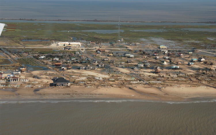
Along the Gulf Coast, national parks and wildlife refuges are vulnerable to coastal flooding and storms, which inundate low-lying buildings, roads, and other infrastructure, destroying property and in some cases leading to loss of lives. Coastal wetlands provide key habitat to support commercial and recreational fisheries, and in addition coastal wetlands provide \$23 billion annually in coastal protection services around the U.S. Coastal wetlands absorb floods and wave energy, which can decrease property damage by up to 20% and this protection is especially important during hurricanes and major storms. Additionally, wildlife refuges, many of which are coastal, get over 50 million visitors a year which has an economic impact on local economies of \$3.2 billion. Land Change Science Program scientists have developed wetland migration trajectories as a decision support tool that is providing information to 144 National wildlife refuges along the Gulf, Atlantic and Pacific coasts. These tools help refuges plan land use decisions today that will impact the future vitality of refuges. USGS data are informing infrastructure decisions including how best to manage or restore coastal wetlands which will ensure that coastal wetlands continue to provide key protective and recreation benefits to coastal communities into the future.


Wildland Fire and Debris Flows
The USGS provides timely information to fire and land managers to make decisions before, during and after wildfires and are widely used by private, state, and federal land managers across the nation.
Science from the Ecosystems Land Change Science Program informs local to national reduction of wildfire hazard, forest fuels, and post-fire flooding risks, which saves the government hundreds of millions to tens of billions of dollars in avoided losses associated with a single wildfire.
This is in addition to the fire suppression costs of millions of dollars, and the incalculable cost of human lives. For example, Ecosystems Land Change Science Program wildfire research in Santa Fe, New Mexico informed local management plans and actions related to wildfire hazard, fuels reduction, and post-fire flooding including: the Santa Fe National Forest and Fire and Forest Management Plans and City of Santa Fe Hazard Planning. As a result, the local managers were successful at stopping the 2020 En Medio fire from burning into Santa Fe, protecting public safety, and causing only minimal post-fire flooding which saved the community millions in avoided losses of property.


Avalanche Forecasting
In the west, avalanches cause more fatalities on an annual basis than earthquakes and landslides combined. Avalanche frequency has increased due to increasing temperatures and mid-winter rain events. Ecosystems Land Change Science Program science is used by land and transportation infrastructure managers to inform avalanche forecasting, hazard mitigation, and land-use planning in avalanche terrain, which saves human lives, avoids property loss, and minimizes economic losses due to transportation corridor closures.
For example, in Glacier National Park, park managers rely on USGS Land Change Science expertise to provide on-site avalanche forecasting for the Going-to-the-Sun Road – a major thoroughfare and tourist destination in the park. Since the USGS Glacier National Park Avalanche Program began forecasting efforts in 2003, there have been no avalanche related injuries or fatalities, despite there being 1168 avalanche days with 607 avalanches that impacted the road over the 22-year period. Further, in 2021, due to increased park visitation by tourists and access to higher stretches of road, USGS began providing weekend avalanche forecasts to the Visitor Protection Division at Glacier National Park, which uses those forecasts as the definitive measure of whether to close specific areas for public safety, saving lives and property.
USGS Land Change Science also partners with Colorado Department of Transportation and Colorado Avalanche Information Center to inform planning and disaster mitigation into the future. Critical transportation corridors run through the state of Colorado, including transcontinental Interstate 70 and many other highways that are at risk from snow avalanche hazards each winter. According to the American Road & Transportation Builders Association, the value of freight shipments to and from businesses in Colorado was \$232 billion in 2022 of which 77% was shipped by truck. Thus, road closures and damages by avalanches are extremely costly (millions can be lost for each day of closure), making accurate forecasting and mitigation activities essential for keeping the road open, avoiding both losses of life and property. Long term USGS avalanche frequency data has helped the Colorado Department of Transportation, Burlington National Santa Fe Railway, National Park Service, and Colorado Avalanche Information Center. USGS provided a 200-year avalanche chronology of destructive, large magnitude avalanches that helped them reassess their forecasts to improve public safety, saving lives and property.


Related

Impacts of changing climate and disturbance regimes on forest ecosystem resilience in the Southern Rocky Mountains

Understanding Ecosystem Response and Infrastructure Vulnerability to Sea-Level Rise for Several National Parks and Preserves in the South Atlantic-Gulf Region

USGS Snow and Avalanche Project

The Response of Coastal Wetlands to Sea-level Rise: Understanding how Macroscale Drivers Influence Local Processes and Feedbacks

Drivers and Impacts of North Pacific Climate Variability
Related
Impacts of changing climate and disturbance regimes on forest ecosystem resilience in the Southern Rocky Mountains
Understanding Ecosystem Response and Infrastructure Vulnerability to Sea-Level Rise for Several National Parks and Preserves in the South Atlantic-Gulf Region
USGS Snow and Avalanche Project
The Response of Coastal Wetlands to Sea-level Rise: Understanding how Macroscale Drivers Influence Local Processes and Feedbacks