
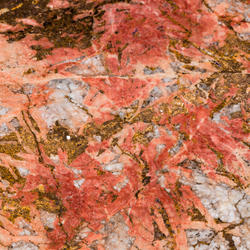
What are critical minerals?
We lead the government in developing the List of Critical Minerals.
We lead the government in developing the List of Critical Minerals.
Modernizing Mapping
The Earth Mapping Resources Initiative (Earth MRI) is modernizing mapping of the Nation's geology and critical mineral resources.
The Earth Mapping Resources Initiative (Earth MRI) is modernizing mapping of the Nation's geology and critical mineral resources.
Mineral Supply Chains
The National Mineral Information Center (NMIC) is the authoritative source of mineral resource information, including statistics on mineral production, trade and supply chain risks.
The National Mineral Information Center (NMIC) is the authoritative source of mineral resource information, including statistics on mineral production, trade and supply chain risks.
Educational Resources
Dive into lesson plans, activities, infographics, fact sheets and other materials related to Mineral Resources Program science.
Dive into lesson plans, activities, infographics, fact sheets and other materials related to Mineral Resources Program science.
Connect with Us
Mineral Resources Program
We are the Nation’s primary source of scientific information about the full life cycle and supply chains of mineral resources, including critical minerals. Our science is essential to responsibly managing natural resources and to procuring minerals needed to sustain and advance modern manufacturing, technology, infrastructure, and energy production.

Our Data
Our Data

Explore our featured geologic data, mineral assessments, life cycle research and mineral supply chain analyses.
Our Science
Our Science
Click each topic below to explore the impact of our science.
News
Lithium in Eastern States Could Replace Imports for a Century or More
Lithium in Eastern States Could Replace Imports for a Century or More
Media Alert: Low-level airplane and helicopter flights to scan geology over southern, central New Mexico
Media Alert: Low-level airplane and helicopter flights to scan geology over southern, central New Mexico
Value of U.S. mineral production rose last year, driven by precious metals prices
Value of U.S. mineral production rose last year, driven by precious metals prices
Publications
The United States Magnetotelluric Array and the National Impedance Map The United States Magnetotelluric Array and the National Impedance Map
The United States Magnetotelluric Array (USMTArray) data set, collected in the years 2006–2024, consists of more than 1,700 long-period magnetotelluric stations covering the entirety of the contiguous United States on a quasi-regular 70 km grid. Funding across multiple federal agencies was critical to sustaining this effort to its completion. Important components of the project included...
Geophysical architecture and geochronology of the Neoarchean Mentor anorthosite intrusive complex, northwestern Minnesota: Largest anorthosite complex of the Superior Province? Geophysical architecture and geochronology of the Neoarchean Mentor anorthosite intrusive complex, northwestern Minnesota: Largest anorthosite complex of the Superior Province?
The Neoarchean Mentor anorthosite intrusive complex (MAIC) lies within the Wawa subprovince in northwestern Minnesota, in a region where the Wawa, Quetico, and Wabigoon subprovinces are juxtaposed in close proximity. Archean rocks are entirely concealed, and interpretations are developed from aeromagnetic, gravity, and borehole samples. The MAIC includes both anorthosite (dense, weakly...
Quantitative mineral resource assessment of lithium pegmatite deposits in the northern Appalachian orogen, USA Quantitative mineral resource assessment of lithium pegmatite deposits in the northern Appalachian orogen, USA
Lithium demand is projected to increase more than 48 times by 2040 due to electric vehicle production and other energy storage needs. Most lithium production is outside of the USA, thereby increasing supply chain vulnerability. The combined end use importance and heightened supply risk of lithium make this lightest metallic element a critical commodity to the USA. To mitigate this supply...
Science
Controls on Critical Element Enrichment in Carbonatite-Alkaline Igneous Complexes
The project seeks to determine the processes responsible for critical element enrichment in carbonatites and to enhance our ability to identify and assess economic deposits. This project will work at various scales to meet this objective and will primarily focus on deposits within the US or our USGS collaborative Nations.

USMIN Mineral Deposit Database
The USMIN Mineral Deposit Database Project develops national-scale geospatial databases that provide authoritative information on the most significant mines, mineral deposits, and mining districts in the United States. These resources advance the understanding of domestic mineral resources and are available through the output of digital data products, journal articles, presentations, and other...

Alaska Databases and Information Analysis
We provide GIS and database support for Alaska-based research projects, including database design, data capture, and maintenance, GIS analysis and display, and production of datasets and metadata for publication and data releases.