
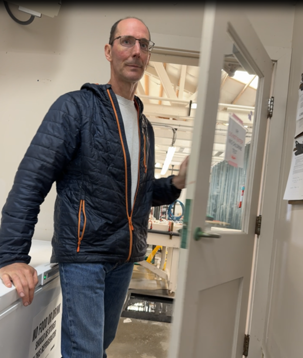
This is an image of Kenneth Tiffan out in the field. Ken works to conduct applied research to provide information that would increase our understanding of Snake River fall Chinook salmon, listed as “threatened” under the ESA in 1992. His career has focused on this unique stock and facilitating recovery efforts.
Images
Explore images.
Filter Total Items: 195

Kenneth Tiffan Out in the Field
This is an image of Kenneth Tiffan out in the field. Ken works to conduct applied research to provide information that would increase our understanding of Snake River fall Chinook salmon, listed as “threatened” under the ESA in 1992. His career has focused on this unique stock and facilitating recovery efforts.

Artificial Light At Night Boat
Artificial light at night (ALAN) can be a threat to aquatic ecosystems. Light in the sky penetrates through the water and brightens the water column. Even small increases in light at night can dramatically improve some predators’ ability to hunt and kill their prey.
Artificial light at night (ALAN) can be a threat to aquatic ecosystems. Light in the sky penetrates through the water and brightens the water column. Even small increases in light at night can dramatically improve some predators’ ability to hunt and kill their prey.

Light Sensor Attached to Boat for Artificial Light At Night Study
Light Sensor Attached to Boat for Artificial Light At Night StudyUSGS Western Fisheries Research Center scientists are investigating the relationship between ALAN, predators’ hunting ability, and juvenile salmon survival in Lake Washington. This includes using a new instrument that overcomes significant issues experienced when attempting to measure light at night underwater.

Snake River Chinook Abundance Over the Years
These are graphs detailing the number of natural origin age-0 Chinook salmon passing Lower Granite Dam over the years.
These are graphs detailing the number of natural origin age-0 Chinook salmon passing Lower Granite Dam over the years.

Artificial Light At Night Over Lake Washington, WA
Artificial Light At Night Over Lake Washington, WAArtificial light at night (ALAN) can be a threat to aquatic ecosystems. Light in the sky penetrates through the water and brightens the water column. Even small increases in light at night can dramatically improve some predators’ ability to hunt and kill their prey.

Artificial Light At Night Reflected into Lake Washington
Artificial Light At Night Reflected into Lake WashingtonArtificial light at night (ALAN) can be a threat to aquatic ecosystems. Light in the sky penetrates through the water and brightens the water column. Even small increases in light at night can dramatically improve some predators’ ability to hunt and kill their prey.

USGS Idaho Water Science Center hydrologists brief Northwest-Pacific Islands Regional Director Jill Rolland at Crystal Springs along the Snake River
USGS Idaho Water Science Center hydrologists brief Northwest-Pacific Islands Regional Director Jill Rolland at Crystal Springs along the Snake RiverDr. Jill Rolland, Director of the USGS Northwest- Pacific Islands Region, visited Idaho during the week of September 23, 2024. During her visit, Dr.

2024 American Fisheries Society (AFS) Meeting
USGS meets with four fisheries commissions at 2024 American Fisheries Society (AFS) meeting; Honolulu, Hawaii, HI; collaboration; fisheries; meeting; inter-regional; Greg McClenchy GLFC; Rachel Reagan USGS WFRC; Joshua Miller USGS GLSC; John Dettmers GLFC; Daniel Wieferich USGS CSS; Deborah Epperson USGS WARC; Marc Gaden GLFC; Tom O'Connell USGS EESC; Bob Beal ASMFC
USGS meets with four fisheries commissions at 2024 American Fisheries Society (AFS) meeting; Honolulu, Hawaii, HI; collaboration; fisheries; meeting; inter-regional; Greg McClenchy GLFC; Rachel Reagan USGS WFRC; Joshua Miller USGS GLSC; John Dettmers GLFC; Daniel Wieferich USGS CSS; Deborah Epperson USGS WARC; Marc Gaden GLFC; Tom O'Connell USGS EESC; Bob Beal ASMFC

Bob Beal Kicking off the 2024 American Fisheries Society (AFS) Symposium
Bob Beal Kicking off the 2024 American Fisheries Society (AFS) SymposiumThis is a photo of Bob Beal kicking off the 2024 American Fisheries Society (AFS) Symposium in Honolulu, Hawaii.
Bob Beal Kicking off the 2024 American Fisheries Society (AFS) Symposium
Bob Beal Kicking off the 2024 American Fisheries Society (AFS) SymposiumThis is a photo of Bob Beal kicking off the 2024 American Fisheries Society (AFS) Symposium in Honolulu, Hawaii.

Gael Kurath's Retirement Party
This is Gael Kurath at her retirement party. Viruses and infectious diseases are natural components of every ecosystem. In aquatic ecosystems of the Pacific Northwest infectious hematopoietic necrosis virus (IHNV) is a significant viral pathogen of many salmonid fish populations.
This is Gael Kurath at her retirement party. Viruses and infectious diseases are natural components of every ecosystem. In aquatic ecosystems of the Pacific Northwest infectious hematopoietic necrosis virus (IHNV) is a significant viral pathogen of many salmonid fish populations.

Scientists Working on Measuring Artificial Light at Night in Seattle, WA
Scientists Working on Measuring Artificial Light at Night in Seattle, WAPhoto shared by Dave Beauchamp from the first week of quantitative light measurements for the Artificial Light At Night (ALAN) project. This week was a big data collection push, with 2 boats out nightly Tuesday through Thursday, plus day activities and prep.

Boat Used to Study Artificial Light at Night in Seattle, WA
Boat Used to Study Artificial Light at Night in Seattle, WAPhotos shared by Dave Beauchamp from the first week of quantitative light measurements for the Artificial Light At Night (ALAN) project:
This week was a big data collection push, with 2 boats out nightly Tuesday through Thursday, plus day activities and prep.
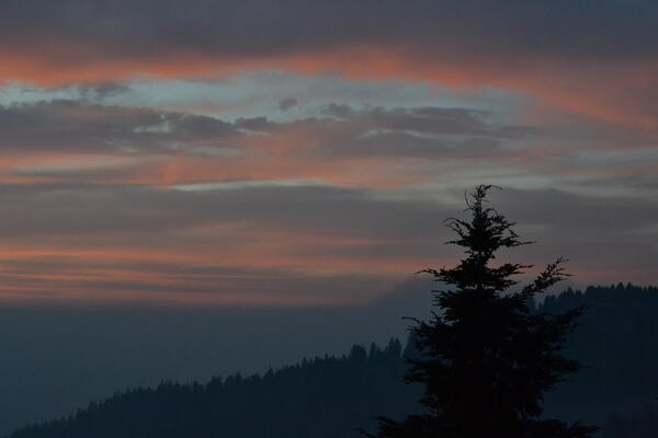
Sunset on Klamath Falls, OR
This is a photo of a sunset in August, 2024 in Klamath Falls, OR. The Western Fisheries Research Center (WFRC) conducts work on fish health and monitoring in this area.
This is a photo of a sunset in August, 2024 in Klamath Falls, OR. The Western Fisheries Research Center (WFRC) conducts work on fish health and monitoring in this area.

View of nose of Bell Jet Helicopter with a thermal infrared and true-color sensor co-mounted to the underside
View of nose of Bell Jet Helicopter with a thermal infrared and true-color sensor co-mounted to the undersideProfile view of a Bell Jet Helicopter with a thermal infrared and true-color sensor co-mounted to the underside of the nose. These sensors are used in airborne thermal infrared surveys for remotely sensing land/water surface temperature.
Scientist, Paul Hershberger, at the Marrowstone Marine Field Station in Washington
Scientist, Paul Hershberger, at the Marrowstone Marine Field Station in WashingtonThis is a photo of Paul Hershberger at Marrowstone Marine Field Station Lab. Dr. Hershberger studies diseases in fish.
Scientist, Paul Hershberger, at the Marrowstone Marine Field Station in Washington
Scientist, Paul Hershberger, at the Marrowstone Marine Field Station in WashingtonThis is a photo of Paul Hershberger at Marrowstone Marine Field Station Lab. Dr. Hershberger studies diseases in fish.

Eye Fluke Parasite in Klamath Sucker Eye
Fish health monitoring efforts in Upper Klamath Lake have revealed a high prevalence of warmwater pathogens. The fish health team is investigating parasites as a potential threat to the vulnerable sucker populations.
Fish health monitoring efforts in Upper Klamath Lake have revealed a high prevalence of warmwater pathogens. The fish health team is investigating parasites as a potential threat to the vulnerable sucker populations.

Pelicans in Upper Klamath Lake
This is a photo of pelicans on the Upper Klamath Lake in Klamath Falls, OR. The USGS Western Fisheries Research Center (WFRC) has a field station in Klamath Falls. Scientists at the WFRC monitor suckers in the Upper Klamath Lake.
This is a photo of pelicans on the Upper Klamath Lake in Klamath Falls, OR. The USGS Western Fisheries Research Center (WFRC) has a field station in Klamath Falls. Scientists at the WFRC monitor suckers in the Upper Klamath Lake.
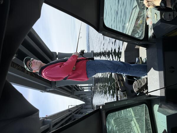
USGS Scientist, Paul Hershberger, Fishing for Salmon Predators on Lake Washington
USGS Scientist, Paul Hershberger, Fishing for Salmon Predators on Lake WashingtonThis is a photo of the fisheries scientist, Paul Hershberger, fishing for salmon predators in Lake Washington.
USGS Scientist, Paul Hershberger, Fishing for Salmon Predators on Lake Washington
USGS Scientist, Paul Hershberger, Fishing for Salmon Predators on Lake WashingtonThis is a photo of the fisheries scientist, Paul Hershberger, fishing for salmon predators in Lake Washington.

Field sampling in Montana
A landscape of sagebrush (Artemisia tridentada) and yellow sweet clover (Melilotus officinalis) on the Charles M. Russell National Wildlife Refuge in Montana.
A landscape of sagebrush (Artemisia tridentada) and yellow sweet clover (Melilotus officinalis) on the Charles M. Russell National Wildlife Refuge in Montana.

Snails in Laboratory
Snails collected from Upper Klamath Lake are being used in experiments in the Western Fisheries Research Center’s Seattle Laboratory to study the impacts of eye flukes on the health of endangered suckers.
Snails collected from Upper Klamath Lake are being used in experiments in the Western Fisheries Research Center’s Seattle Laboratory to study the impacts of eye flukes on the health of endangered suckers.

Underwater Views of Common Fish Inhabiting Eelgrass Meadows in Skagit Bay, Washington
Underwater Views of Common Fish Inhabiting Eelgrass Meadows in Skagit Bay, WashingtonExplore the underwater world of Skagit Bay eelgrass meadows where a diverse group of fish are visible, including the elegant Pacific Herring school , the unusual Snake Prickleback, the striking Pacific Spiny Dogfish, the graceful Shiner Perch, and the majestic juvenile Chinook Salmon.