
Maps and Mapping
How do I find, download, or order topographic maps?
What types of elevation datasets are available, what formats do they come in, and where can I download them?
What is a Digital Orthophoto Quadrangle (DOQ) or an orthoimage?
Where can I find land cover data for the U.S.?
The USGS provides the mapping and digital geospatial foundation for the Nation.

Why is the orthoimage (air photo) layer not available for some US Topo maps and OnDemand Topo maps? Why is the orthoimage (air photo) layer not available for some US Topo maps and OnDemand Topo maps?
In the lower 48 States, orthoimages (rectified air photographs) for US Topo maps and OnDemand Topo maps comes from the National Agriculture Imagery Program (NAIP). There are areas over some military installations where NAIP imagery is not available. In these locations, the OnDemand Topo maps will either not include imagery or contain partial imagery. US Topo maps are only produced for areas that...
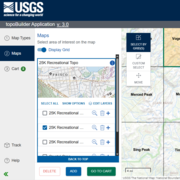
How do USGS OnDemand Topo maps differ from US Topo maps? How do USGS OnDemand Topo maps differ from US Topo maps?
USGS OnDemand Topo maps and USGS US Topo maps are built using similar datasets but can look different depending on what areas or options the user selects. OnDemand Topos--created using the topoBuilder application--offer customizations such as custom extents, a variety of scales, contour smoothing, and user-selected data layers. They include U.S. Territory coverage that is not available on US...
What criteria did the Derogatory Geographic Names Task Force apply to select replacement names under Secretary’s Order 3404? What criteria did the Derogatory Geographic Names Task Force apply to select replacement names under Secretary’s Order 3404?
A list of five candidate names for each geographic feature was developed by the U.S. Geological Survey as directed by Secretary's Order 3404. The candidate replacement names were derived through a search of nearby named geographic features until at least five nearby names were available. The candidate replacement name will replace the derogatory modifier. For example, “Castle Creek” is the nearest...

What is The National Map Structures Tint? What is The National Map Structures Tint?
The National Map’s Structures Tint dataset represents manmade structures using broad-area tints rather than defining the exact shape of individual buildings. The Structures Tint data was provided by Oak Ridge National Labs and the Federal Emergency Management Agency. This dataset was introduced in 2021 and is designed for use at the 1:24,000 scale (the standard scale for USGS topographic maps) or...

Can I donate a map that isn't already in the USGS Historical Topographic Map Collection? Can I donate a map that isn't already in the USGS Historical Topographic Map Collection?
The USGS will gladly accept donations of digital, scanned copies of historical topographic maps (published 1884-2006) that are not in our current Historical Topographic Map Collection (HTMC). We do not accept donations of paper maps. Donated products must be published USGS topographic maps, 1:250,000 scale or larger, with basic required metadata included. Before submitting map donations to the...

What happened to the Gridfloat, ArcGrid, and IMG formats for elevation data in The National Map? What happened to the Gridfloat, ArcGrid, and IMG formats for elevation data in The National Map?
USGS elevation data available through The National Map was converted to Cloud Optimized Geotiff (COG - GeoTIFF) format in mid-December, 2019. This change was made to improve product processing time, storage, and to support new and evolving cloud processing capabilities. GeoTIFF is a widely supported raster format and is directly useable by most commercial software that reads or processes Digital...

Where can I find a topographic map symbol sheet? Where can I find a topographic map symbol sheet?
Like topographic maps, topographic map symbols have evolved over time. There is no single document that describes all of the symbols used on all USGS topographic maps since they were first created. Maps published 2013-present: US Topo maps have a symbol sheet attached to the map file (PDF format only). Open the PDF file in Adobe Acrobat and click on the paperclip icon. Maps published 1947-2009...

Does the USGS have 1:50,000-scale maps, like the military uses, for the United States? Does the USGS have 1:50,000-scale maps, like the military uses, for the United States?
The USGS has a limited number of 1:50,000-scale maps available for the United States. Some of these are maps that the National Geospatial-Intelligence Agency (NGA) has released for sale to the public. To see which maps are available for sale (or free digital download), go to the online USGS Store: In the top navigation menu, select Products > Other Maps. In the "Filter by Country" box, select USA...

What are Cloud Optimized GeoTIFFs (COGs)? What are Cloud Optimized GeoTIFFs (COGs)?
A Cloud Optimized GeoTIFF (COG) is a GeoTIFF file with an internal organization that enables more efficient workflows in the cloud environment. It does this by leveraging the ability of clients issuing HTTP GET range requests to ask for just the parts of a file they need. Learn more: Landsat COG Data Format Control Book USGS Digital Elevation Models (DEM) Switching to New Distribution Format

How do I download layers in The National Map Viewer? How do I download layers in The National Map Viewer?
Base map data layers in The National Map Viewer are for viewing only. This application is designed for visualizing data, combining different data layers, and creating (and printing) your own maps. To download data from The National Map, see the link at the top of the Viewer for the Data Downloader. None of the base map layers in the Viewer are available for download, but some of them can be...

Where can I get global elevation data? Where can I get global elevation data?
Download free global elevation data products using AppEEARS or EarthExplorer. Free registration is required. In AppEEARS: Download Aster Global Digital Elevation Model (GDEM version 3) 1-arc-second (30m) resolution GeoTIFF format Acquired 2000-2013 In EarthExplorer, select “Digital Elevation” under the "Data Sets" tab and choose an option: Shuttle Radar Topography Mission (SRTM) 1-arc-second...

Where can I get Global Land Cover Data (GLCC)? Where can I get Global Land Cover Data (GLCC)?
In EarthExplorer, select "GLCC" under "Land Cover" in the "Data Sets" tab. Derived from 1-km Advanced Very High Resolution Radiometer ( AVHRR) data collected April 1992 to March 1993. Learn more: USGS EROS Archive - Land Cover Products - Global Land Cover Characterization (GLCC) Global Ecosystems Global Climate Data (NOAA) NOAAView Global Data (NOAA) Map of Worldwide Croplands (USGS news release)...