
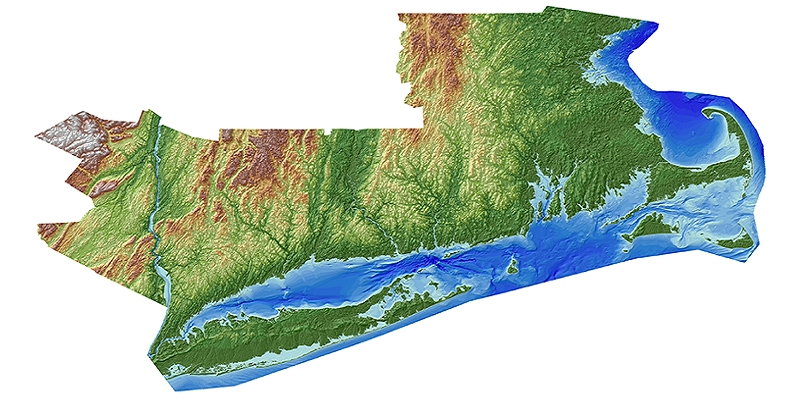
Hurricane Sandy Region - Topobathymetric Elevation Model of New England
Hurricane Sandy significantly impacted coastal New England from Connecticut to as far north as Maine altering the topography and ecosystems of this heavily populated region that includes both New York and Boston. In response to the storm, the U.S. Geological Survey (USGS) Coastal and Marine Geology Program in collaboration with USGS National Geospatial Program, and National Oceanic and Atmospheric Administration developed three-dimensional (3D) topobathymetric elevation models for the New England area. This comprehensive integrated topobathymetric baseline elevation data are essential for emergency planning, disaster response, and hazard mitigation policy development.
Additional information about topobathymetric elevation models is available online at USGS EROS Archive - Digital Elevation - Coastal National Elevation Database (CoNED) Project - Topobathymetric Digital Elevation Model (TBDEM).
To view or download the New England topobathymetric elevation model, visit the CoNED Project Viewer, USGS EarthExplorer or The National Map Viewer.
Below are other science projects associated with this project.

Coastal National Elevation Database (CoNED) Applications Project
Coastal National Elevation Database (CoNED) Applications Project

USGS EROS Archive - Products Overview
Hurricane Sandy significantly impacted coastal New England from Connecticut to as far north as Maine altering the topography and ecosystems of this heavily populated region that includes both New York and Boston. In response to the storm, the U.S. Geological Survey (USGS) Coastal and Marine Geology Program in collaboration with USGS National Geospatial Program, and National Oceanic and Atmospheric Administration developed three-dimensional (3D) topobathymetric elevation models for the New England area. This comprehensive integrated topobathymetric baseline elevation data are essential for emergency planning, disaster response, and hazard mitigation policy development.
Additional information about topobathymetric elevation models is available online at USGS EROS Archive - Digital Elevation - Coastal National Elevation Database (CoNED) Project - Topobathymetric Digital Elevation Model (TBDEM).
To view or download the New England topobathymetric elevation model, visit the CoNED Project Viewer, USGS EarthExplorer or The National Map Viewer.
Below are other science projects associated with this project.
Coastal National Elevation Database (CoNED) Applications Project
Coastal National Elevation Database (CoNED) Applications Project