Water Availability
Water Availability
Filter Total Items: 8
Impacts of changing climate and disturbance regimes on forest ecosystem resilience in the Southern Rocky Mountains
Climate-driven forest disturbances, particularly drought-induced tree mortality and large high-severity fires from increasingly warm and dry conditions, are altering forest ecosystems and the ecosystem services society depends on (e.g., water supplies) in the Southern Rockies and across the Western U.S. We will combine unique, long-term place-based ecological data, diverse methods (e.g., paleo...
Drought Resources of New Jersey
Conditions of moisture deficit sufficient to have an adverse effect on streamflow, groundwater levels, vegetation, animals, and man over a sizeable area.
Drought Prediction Science
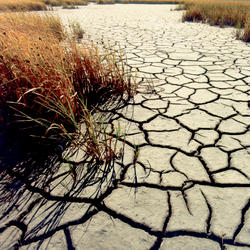
Drought is a prolonged and widespread deficit in available water supplies that creates multiple stressors across ecosystems and communities. The U.S. Geological Survey Water Mission Area conducts drought research and modeling to improve drought prediction capabilities. The research focus is on understanding the hydrological, ecological, and economic ramifications of drought. The modeling focus...
Drylands are highly vulnerable to climate and land use changes: what ecosystem changes are in store?
Improper land use during drought has been a major driver of land degradation in drylands globally, especially in the western U.S. Increasing aridity in western U.S. drylands under future climates will exacerbate risks associated with drought and land use decisions. This project provides critical observational, experimental, and modelling evidence to support our DOI partners with decision processes...
Dryland Ecosystems
Drylands are arid and semi-arid zones around the world where water resources are scarce. In the U.S., 40 percent of the land is considered dryland. USGS scientists are researching how predicted climate changes in dryland ecosystems--increases in temperature and declines in precipitation--will affect vegetation and wildlife in these areas as well as the ecosystem services they provide.
By
Stream Drying
Water in the western United States is disappearing, and several states are facing severe water shortages as drought conditions worsen. Many streams are drying up, and there is growing concern that this trend will only continue as climate change produces warmer and drier conditions. The loss of stream ecosystems has far reaching ecological, social, and economic implications. Species that depend on...
By
WaterSMART: Colorado River Basin
The Colorado River supplies water to more than 30 million people, irrigates nearly 4 million acres of cropland in the U.S. and Mexico, and supplies hydropower plants that generate more than 10 billion kilowatt-hours annually. Water from the river also provides for recreation and an array of environmental benefits, supporting a wide diversity of fish and wildlife and their habitats, and preserving...
By
Global Food Security-Support Analysis Data at 30 m (GFSAD30)
Using remote sensing data, especially Landsat data to map cropland extent, and crop types, to support managing water supplies for both energy and food production to ensure global food security.
By


