
Groundwater Flow
Groundwater Flow
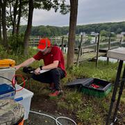
Filter Total Items: 6
Changes in Nitrogen Contributions from Groundwater to the Niantic River Before and After Sewering
Onsite residential septic systems can be a major nonpoint source of nitrogen contamination. The excess nitrogen entering Connecticut’s Niantic River estuary is associated with high nitrate concentrations in the groundwater of the river’s 28-square-mile watershed, creating unsuitable habitat for the growth and recovery of eelgrass (Zostera marina). In an attempt to improve the river’s water quality...

Estimating Nitrogen Loading from Groundwater and Potential Effects of Sea-Level Rise in Rhode Island's Salt Ponds Region
The U.S. Geological Survey (USGS), in cooperation with the Southeast New England Program of the U.S. Environmental Protection Agency, is estimating the magnitude, spatial distribution, and travel times of nitrogen-loading to ponds and streams in the Salt Ponds region of southern Rhode Island. This information can be used to guide conservation-management efforts aimed at reducing nitrogen inputs to...

Groundwater Sustainability of the Long Island Aquifer System
The U.S. Geological Survey (USGS) has partnered with the New York State Department of Environmental Conservation (NYSDEC) to conduct a comprehensive study of the Long Island aquifer system. The major findings of this investigation include: The location of the boundary between fresh and salty groundwater is much closer to the shoreline than previously thought. The historical onshore saltwater...

Development of a Regional-Scale Model to Simulate Groundwater Flow and Nitrogen Loading in Watersheds Along the Connecticut Coast of Long Island Sound
In 2018 USGS began work on the development of regional-scale groundwater flow and nitrogen transport models of areas along the Connecticut coast. The model will be used as a quantitative tool to evaluate groundwater flow and nitrogen loading to Long Island Sound.

U.S. Geological Survey Hydrologic Monitoring on Long Island, New York
The U.S. Geological Survey (USGS) is a science organization that provides impartial information on the health of our ecosystems and environment, the natural hazards that threaten us, the natural resources we rely on, the impacts of climate and land-use change, and the core science systems that help us provide timely, relevant, and usable information.

Comprehensive Delineation of Groundwater Source Areas and Times-of-travel to Long Island Streams and Estuaries
Problem The discharge of freshwater and associated loading of nutrients and other dissolved constituents from the Long Island aquifer system to surrounding estuaries and their tributaries are increasingly recognized as critical factors in the health of these ecosystems. However, further work is needed to scientifically characterize these factors and present them to the public in an...