
Geochemical Fingerprinting of Anthropogenic and Geologically Sourced Uranium at the Homestake Superfund Site, New Mexico
The U.S. Geological Survey (USGS), in cooperation with the U.S. Environmental Protection Agency, the Nuclear Regulatory Commission, and the New Mexico Environment Department, utilized a multiparameter geochemical-isotopic fingerprinting approach to differentiate anthropogenic and natural signatures of uranium contamination near the Homestake uranium mill Superfund site near Milan, New Mexico.
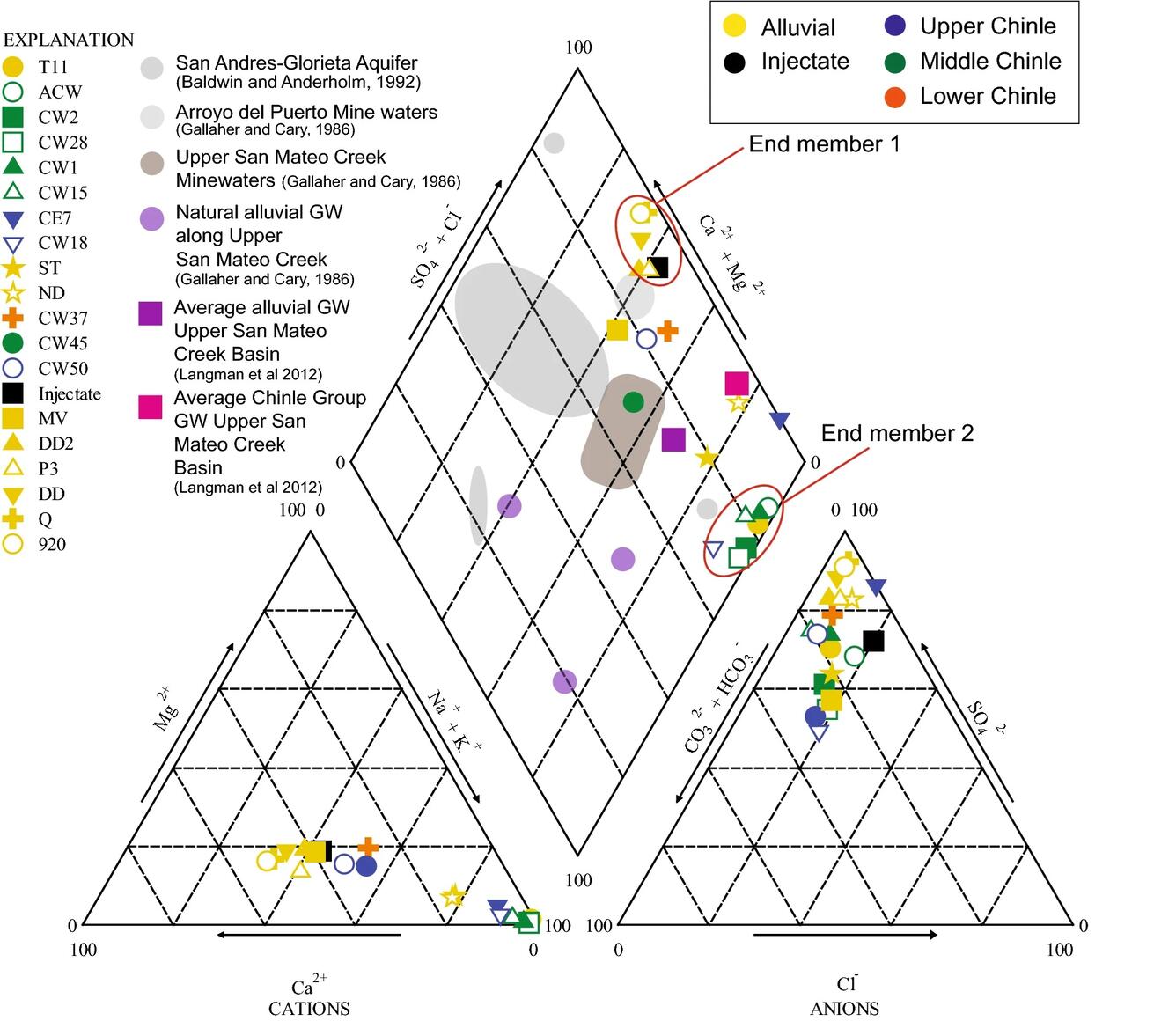
The Homestake Mining Company Superfund site includes a former uranium mill and groundwater contaminated by mine wastes and radon in neighboring residential subdivisions in Cibola County, New Mexico. The uranium mill operated between 1958 and 1990 and was decommissioned in 1993. Seepage from tailings impoundments at the mill site has contaminated waters in the San Mateo Creek Basin and the underlying alluvial and Upper, Middle, and Lower Chinle aquifers.
Geologically sourced uranium is ubiquitous in the Chinle Group, which underlies the site. In identifying flowpaths and site cleanup criteria, it is important to distinguish between natural and anthropogenic sources of radiogenic materials in groundwater. The milling processes used at a given facility may be unique to that facility and can uniquely alter the water’s geochemical and isotopic characteristics. Additionally, the time it takes for groundwater to travel from close and faraway sources, along with water age, can help us understand: (a) if groundwater has been exposed to milling activities, and (b) if water quality may be affected by the various geologic formations.
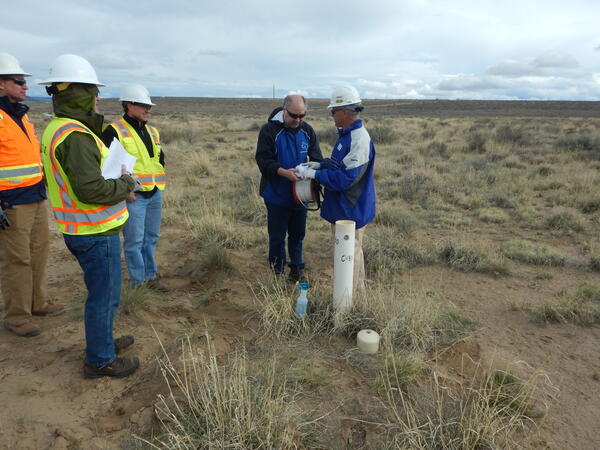
To inform sample collection procedures in wells, USGS collected borehole geophysical data including induction, fluid resistivity, natural gamma, spectral gamma, fluid temperature, caliper, casing collar locator, optical televiewer, and electromagnetic flow meter logs (ambient and stressed). Profiles of uranium concentrations helped assess the variability of uranium at the well scale. Following collection of groundwater samples, several statistical approaches, including principal component analysis, non-metric multidimensional scaling, and cluster analysis, were applied to help differentiate anthropogenic uranium signatures.
The study findings indicated that several alluvial wells north of the site had groundwater with anthropogenic fingerprints from regional sources related to upgradient mining. These same wells had elevated radon activities.
The U.S. Geological Survey (USGS), in cooperation with the U.S. Environmental Protection Agency, the Nuclear Regulatory Commission, and the New Mexico Environment Department, utilized a multiparameter geochemical-isotopic fingerprinting approach to differentiate anthropogenic and natural signatures of uranium contamination near the Homestake uranium mill Superfund site near Milan, New Mexico.
The Homestake Mining Company Superfund site includes a former uranium mill and groundwater contaminated by mine wastes and radon in neighboring residential subdivisions in Cibola County, New Mexico. The uranium mill operated between 1958 and 1990 and was decommissioned in 1993. Seepage from tailings impoundments at the mill site has contaminated waters in the San Mateo Creek Basin and the underlying alluvial and Upper, Middle, and Lower Chinle aquifers.
Geologically sourced uranium is ubiquitous in the Chinle Group, which underlies the site. In identifying flowpaths and site cleanup criteria, it is important to distinguish between natural and anthropogenic sources of radiogenic materials in groundwater. The milling processes used at a given facility may be unique to that facility and can uniquely alter the water’s geochemical and isotopic characteristics. Additionally, the time it takes for groundwater to travel from close and faraway sources, along with water age, can help us understand: (a) if groundwater has been exposed to milling activities, and (b) if water quality may be affected by the various geologic formations.
To inform sample collection procedures in wells, USGS collected borehole geophysical data including induction, fluid resistivity, natural gamma, spectral gamma, fluid temperature, caliper, casing collar locator, optical televiewer, and electromagnetic flow meter logs (ambient and stressed). Profiles of uranium concentrations helped assess the variability of uranium at the well scale. Following collection of groundwater samples, several statistical approaches, including principal component analysis, non-metric multidimensional scaling, and cluster analysis, were applied to help differentiate anthropogenic uranium signatures.
The study findings indicated that several alluvial wells north of the site had groundwater with anthropogenic fingerprints from regional sources related to upgradient mining. These same wells had elevated radon activities.