
Cory A Williams
Cory A. Williams is a Supervisory Hydrologist with the USGS Colorado Water Science Center in Western Colorado. His leadership roles include Upper Colorado Integrated Water Science (IWS) Basin Coordinator, Federal representative to the Colorado River Salinity Control Forum, and Western Colorado Hydrologic Investigations Section Supervisor.
He leads a team of multidisciplinary scientists that work with local and federal partners to study water-related issues throughout the Colorado Plateau. Cory has led numerous investigations evaluating trends in water quality and quantity throughout the Upper Colorado River Basin and is a Burn Area Emergency Response (BAER) Fluvial Geomorphologist. Cory has proudly studied the Upper Colorado River with USGS since 2001. He received his B.S. in Geology from Colorado Mesa University and his M.S. in Geoscience from Colorado State University, Fort Collins.
Science and Products
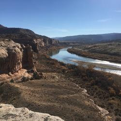
Integrated Water Science Basins: Upper Colorado River

Sediment Acoustics

Fountain Creek Watershed Flood and Sediment Transport Study

Reconfigured Channel Monitoring and Assessment Program (RCMAP)

RCMAP - Muddy Creek below Wolford Mountain Reservoir near Kremmling, Colorado

RCMAP - Lake Fork of the Gunnison near Lake City, Colorado

RCMAP - North Fork Gunnison River at Hotchkiss, Colorado

RCMAP - Gunnison River at the Hartland Dam near Delta, Colorado

Lower Yampa Streamflow and Sediment Modeling

Gunnison and Green River Basin Sediment Monitoring and Evaluation Program

RCMAP - Gunnison River at Spann Diversion at Gunnison, Colorado

RCMAP - Uncompahgre River at Ridgway, Colorado
Science and Products
Integrated Water Science Basins: Upper Colorado River
Sediment Acoustics
Fountain Creek Watershed Flood and Sediment Transport Study
Reconfigured Channel Monitoring and Assessment Program (RCMAP)
RCMAP - Muddy Creek below Wolford Mountain Reservoir near Kremmling, Colorado
RCMAP - Lake Fork of the Gunnison near Lake City, Colorado
RCMAP - North Fork Gunnison River at Hotchkiss, Colorado
RCMAP - Gunnison River at the Hartland Dam near Delta, Colorado
Lower Yampa Streamflow and Sediment Modeling
Gunnison and Green River Basin Sediment Monitoring and Evaluation Program
RCMAP - Gunnison River at Spann Diversion at Gunnison, Colorado