
Frederick Stumm
My projects have involved the application of hydrology, geology, and geophysics to environmental and engineering problems. They include delineating the extent of saltwater intrusion in coastal aquifers, mapping roadsalt plumes, detecting bridge scour, mapping hydrogeologic frameworks, delineating the fractured-rock groundwater system in Manhattan, and mapping depth to bedro
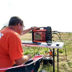
I hold a B.S. in Geology from Hofstra University, a M.S.. in Geology from California State University Fresno, and a Ph.D. in Earth and Environmental Science from the City University of New York Graduate Center. I take a multi-disciplinary approach applying Hydrology, Geology, and Geophysics with a focus on understanding the extent and mechanisms for saltwater intrusion on Long Island, the deposition of complex hydrogeologic frameworks, and quantifying fractured-rock groundwater flow. I recieved the Distinguished Scientific Achievement Award from the New York Federal Executive Board for my work on delineating the fractures, faults, foliation, and groundwater flow in Manhattan's bedrock using advanced borehole geophysical methods in support of the New York City Water Tunnel #3 Project. I have worked for the New York Water Science Center for over 20 years on studies that have helped coastal communities manage their water resources by delineating the extent of saltwater intrusion, improve construction safety and reduce cost overruns during construction of New York City Water Tunnel #3, the new Croton Water Filtration Tunnel, and the leakage in the Rondout West Branch Water Tunnel in Wawarsing NY, map the depth to bedrock in NYC, and delineated the extent of bridge scour at the Sloop Channel Bridge that lead to it's replacement. My ongoing projects include the delineation of the fractured-rock flow system in Wawarsing in support of the planned tunnel leakage repairs, the creation of the highest resolution bedrock maps for NYC in support of it's geothermal energy program, delineation of the saltwater-freshwater interface on Shelter Island NY, and remapping the hydrogeologic framework and delineation of saltwater intrusion throughout Long Island. My current research involves the application of radio signals transmitted between two wells to create two and three dimensional images of conductivity which can be used to map conductive plumes and possibly voids in bedrock.
Science and Products

Groundwater Sustainability of the Long Island Aquifer System
Hydrogeologic-Framework Mapping - Long Island, New York
Saltwater-Interface Mapping - Long Island, New York

Delineation of the Saltwater-Freshwater Interface at Selected Well Locations in the Town of Riverhead, NY

Hydrogeology and Water Quality of the North Shore Aquifer in Locust Valley, Town of Oyster Bay, New York

Delineation of the Freshwater-Saltwater Interface at Selected Public-Supply Wells Using Advanced Surface and Borehole Geophysical Techniques, in Eastern Suffolk County, New York

Delineation of Groundwater Flow, Lithology, Faults, and Fractures Along Existing and Proposed Water Tunnel

Delineation of Rock Fractures, Faults, and Groundwater Flow in the Vicinity of Proposed Water Tunnels, New York City and Southeastern New York
Science and Products
Groundwater Sustainability of the Long Island Aquifer System
Hydrogeologic-Framework Mapping - Long Island, New York
Saltwater-Interface Mapping - Long Island, New York
Delineation of the Saltwater-Freshwater Interface at Selected Well Locations in the Town of Riverhead, NY
Hydrogeology and Water Quality of the North Shore Aquifer in Locust Valley, Town of Oyster Bay, New York
Delineation of the Freshwater-Saltwater Interface at Selected Public-Supply Wells Using Advanced Surface and Borehole Geophysical Techniques, in Eastern Suffolk County, New York
Delineation of Groundwater Flow, Lithology, Faults, and Fractures Along Existing and Proposed Water Tunnel