Jason Kean
My research focuses on the processes controlling debris-flow initiation and growth, particularly after wildfire, but also in unburned areas.
This research includes a field component that obtains direct measurements of debris flows in natural settings, a modeling component that seeks to explain the observations, and an applied component that focuses on assessment of debris-flow hazards. My previous research at the USGS focused on river mechanics, including bank erosion and the development of model-based approaches to gage streams and rivers.
Education and Certifications
University of Colorado, Ph.D., 2003, Civil Engineering
University of Colorado, M.S., 1998, Civil Engineering
Cornell University, B.S., 1994, Civil Engineering
Science and Products
Postfire debris-flow hazard maps
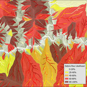
Wildfires can dramatically alter how water moves across the landscape. As a result, even modest rainstorms can trigger dangerous flash floods and debris flows in steep burned areas. In response, the USGS produces postfire debris-flow hazard assessments for recently burned areas. These hazard assessments estimate the likelihood, volume, and combined hazard of debris-flows in recently burned. This...
Improving Postfire Debris-Flow Hazard Assessments In The Pacific Northwest Through Application Of Debris-Flow Models
As part of the Post-fire Hazards and Impacts to Resources and Ecosystems (PHIRE): Support for Response, Recovery, and Mitigation Project, the PHIRE Debris Flow Hazard team is engaging in several studies to better understand the spatial and temporal drivers of postfire debris flows and improve postfire hazard assessments across northern California and the Pacific Northwest.
Calwood Fire "Heil Ranch" Landslide Monitoring Site near Boulder, CO
Wildfire can radically change a mountainous landscape such that even a modest rainstorm is capable of producing deadly and destructive flash flooding and debris flows.
Postfire Landslide Monitoring Station: "Chips" (2021 Dixie Fire) near Belden, CA
Wildfire can increase landslide susceptibility in mountainous terrain. The USGS maintains postfire landslide monitoring stations to track hillslope hydrologic conditions in the years following fire.
Postfire Landslide Monitoring Station: "Chambers" (2021 Dixie Fire) near Belden, CA
Wildfire can increase landslide susceptibility in mountainous terrain. The USGS maintains postfire landslide monitoring stations to track hillslope hydrologic conditions in the years following fire.
Advancing Post-Fire Debris Flow Hazard Science with a Field Deployable Mapping Tool
Mapping the occurrence of post-fire flooding and debris flow is crucial for 1) integrating observations into models used to define rainfall thresholds for early warning, 2) understanding patterns of inundation, and 3) improving models for predictive hazard assessment. Despite the critical role mapping plays in post-fire hazard assessment and early warning, there has not been a...
How Often Do Rainstorms Cause Debris Flows in Burned Areas of the Southwestern U.S.?
Debris flows, sometimes referred to as mudslides, mudflows, lahars, or debris avalanches, are common types of fast-moving landslides. They usually start on steep hillsides as a result of shallow landslides, or from runoff and erosion that liquefy and accelerate to speeds in excess of 35 mi/h. The consistency of debris flows ranges from thin, watery to thick, rocky mud that can carry large items...
Postfire debris-flow hazards
Wildfires can dramatically alter how water moves across the landscape. After a fire, vegetation is removed and soil properties change, reducing the ground’s ability to absorb rainfall. As a result, even modest rainstorms can trigger dangerous flash floods and debris flows in steep burned areas. Postfire debris flows are fast-moving mixtures of water, mud, rocks, and vegetation that can surge...
2009 Station Fire, Dunsmore Canyon, Glendale, California
In 2009, the Station Fire burned 160,000 acres in the San Gabriel Mountains. Vegetation has started to return, but it can take many years for a basin to fully recover from the effects of fire.
Reconstruction of an Avalanche: The West Salt Creek Rock Avalanche
Release Date: MAY 25, 2016 The West Salt Creek Rock Avalanche, Colorado, May 25, 2014
Rainfall and Landslides in Southern California
Southern California is well known to be susceptible to landslides, especially during periods of intense or prolonged rainfall, and these hazards can worsen during El Niño conditions. This page summarizes the causes and impacts of historical and recent rainfall-triggered landslides and debris flows in southern California, including several major winter storms that caused damaging and deadly events...
Filter Total Items: 33
No Result Found
Filter Total Items: 104
Landslide movement in southwest Colorado triggered by atmospheric tides Landslide movement in southwest Colorado triggered by atmospheric tides
Landslides are among the most hazardous of geological processes, causing thousands of casualties and damage on the order of billions of dollars annually. The movement of most landslides occurs along a discrete shear surface, and is triggered by a reduction in the frictional strength of the surface. Infiltration of water into the landslide from rainfall and snowmelt and ground motion from
Authors
W.H. Schulz, J. W. Kean, G. Wang
Test of a method to calculate near-bank velocity and boundary shear stress Test of a method to calculate near-bank velocity and boundary shear stress
No abstract available.
Authors
Jason W. Kean, Roger A. Kuhnle, J. Dungan Smith, Carlos V. Alonso, Eddy J. Langendoen
Modeling the evolution of channel shape: Balancing computational efficiency with hydraulic fidelity Modeling the evolution of channel shape: Balancing computational efficiency with hydraulic fidelity
The cross-sectional shape of a natural river channel controls the capacity of the system to carry water off a landscape, to convey sediment derived from hillslopes, and to erode its bed and banks. Numerical models that describe the response of a landscape to changes in climate or tectonics therefore require formulations that can accommodate evolution of channel cross-sectional geometry...
Authors
C.W. Wobus, J. W. Kean, G.E. Tucker, R. Scott Anderson
Field Reconnaissance of Debris Flows Triggered by a July 21, 2007, Thunderstorm in Alpine, Colorado, and Vicinity Field Reconnaissance of Debris Flows Triggered by a July 21, 2007, Thunderstorm in Alpine, Colorado, and Vicinity
On the evening of July 21, 2007, a slow-moving thunderstorm triggered about 45 debris flows on steep mountainsides near the community of Alpine, Colorado. Most of the debris flows were initiated by surface-water runoff that eroded and entrained loose sediment in previously existing channels. About 12 of the debris-flow channels were located in the lower half of Weldon Gulch upslope from...
Authors
Jeffrey A. Coe, Jonathan W. Godt, T.C. Wait, Jason W. Kean
Form drag in rivers due to small-scale natural topographic features: 1. Regular sequences Form drag in rivers due to small-scale natural topographic features: 1. Regular sequences
Small-scale topographic features are commonly found on the boundaries of natural rivers, streams, and floodplains. A simple method for determining the form drag on these features is presented, and the results of this model are compared to laboratory measurements. The roughness elements are modeled as Gaussian-shaped features defined in terms of three parameters: a protrusion height, H; a
Authors
J. W. Kean, J.D. Smith
Form drag in rivers due to small-scale natural topographic features: 2. Irregular sequences Form drag in rivers due to small-scale natural topographic features: 2. Irregular sequences
The size, shape, and spacing of small-scale topographic features found on the boundaries of natural streams, rivers, and floodplains can be quite variable. Consequently, a procedure for determining the form drag on irregular sequences of different-sized topographic features is essential for calculating near-boundary flows and sediment transport. A method for carrying out such...
Authors
J. W. Kean, J.D. Smith
Modeling effects of bank friction and woody bank vegetation on channel flow and boundary shear stress in the Rio Puerco, New Mexico Modeling effects of bank friction and woody bank vegetation on channel flow and boundary shear stress in the Rio Puerco, New Mexico
[1] We have applied a physically based model for steady, horizontally uniform flow to calculate reach-averaged velocity and boundary shear-stress distributions in a natural stream with woody vegetation on the channel banks. The model calculates explicitly the form drag on woody plant stems and includes the effects of vegetation on the boundary shear stress, velocity, and turbulence...
Authors
E.R. Griffin, J. W. Kean, K.R. Vincent, J.D. Smith, Jonathan M. Friedman
Generation and verification of theoretical rating curves in the Whitewater River basin, Kansas Generation and verification of theoretical rating curves in the Whitewater River basin, Kansas
[1] A new method for generating stage-discharge relations (rating curves) for geomorphically stable channels is presented and applied to two streams in the Whitewater River basin, Kansas. The approach converts measurements of stage into discharge using a fluid mechanically based model. The model does not use empirical roughness coefficients, such as Manning coefficients, but rather...
Authors
J. W. Kean, J.D. Smith
Science and Products
Postfire debris-flow hazard maps
Wildfires can dramatically alter how water moves across the landscape. As a result, even modest rainstorms can trigger dangerous flash floods and debris flows in steep burned areas. In response, the USGS produces postfire debris-flow hazard assessments for recently burned areas. These hazard assessments estimate the likelihood, volume, and combined hazard of debris-flows in recently burned. This...
Improving Postfire Debris-Flow Hazard Assessments In The Pacific Northwest Through Application Of Debris-Flow Models
As part of the Post-fire Hazards and Impacts to Resources and Ecosystems (PHIRE): Support for Response, Recovery, and Mitigation Project, the PHIRE Debris Flow Hazard team is engaging in several studies to better understand the spatial and temporal drivers of postfire debris flows and improve postfire hazard assessments across northern California and the Pacific Northwest.
Calwood Fire "Heil Ranch" Landslide Monitoring Site near Boulder, CO
Wildfire can radically change a mountainous landscape such that even a modest rainstorm is capable of producing deadly and destructive flash flooding and debris flows.
Postfire Landslide Monitoring Station: "Chips" (2021 Dixie Fire) near Belden, CA
Wildfire can increase landslide susceptibility in mountainous terrain. The USGS maintains postfire landslide monitoring stations to track hillslope hydrologic conditions in the years following fire.
Postfire Landslide Monitoring Station: "Chambers" (2021 Dixie Fire) near Belden, CA
Wildfire can increase landslide susceptibility in mountainous terrain. The USGS maintains postfire landslide monitoring stations to track hillslope hydrologic conditions in the years following fire.
Advancing Post-Fire Debris Flow Hazard Science with a Field Deployable Mapping Tool
Mapping the occurrence of post-fire flooding and debris flow is crucial for 1) integrating observations into models used to define rainfall thresholds for early warning, 2) understanding patterns of inundation, and 3) improving models for predictive hazard assessment. Despite the critical role mapping plays in post-fire hazard assessment and early warning, there has not been a...
How Often Do Rainstorms Cause Debris Flows in Burned Areas of the Southwestern U.S.?
Debris flows, sometimes referred to as mudslides, mudflows, lahars, or debris avalanches, are common types of fast-moving landslides. They usually start on steep hillsides as a result of shallow landslides, or from runoff and erosion that liquefy and accelerate to speeds in excess of 35 mi/h. The consistency of debris flows ranges from thin, watery to thick, rocky mud that can carry large items...
Postfire debris-flow hazards
Wildfires can dramatically alter how water moves across the landscape. After a fire, vegetation is removed and soil properties change, reducing the ground’s ability to absorb rainfall. As a result, even modest rainstorms can trigger dangerous flash floods and debris flows in steep burned areas. Postfire debris flows are fast-moving mixtures of water, mud, rocks, and vegetation that can surge...
2009 Station Fire, Dunsmore Canyon, Glendale, California
In 2009, the Station Fire burned 160,000 acres in the San Gabriel Mountains. Vegetation has started to return, but it can take many years for a basin to fully recover from the effects of fire.
Reconstruction of an Avalanche: The West Salt Creek Rock Avalanche
Release Date: MAY 25, 2016 The West Salt Creek Rock Avalanche, Colorado, May 25, 2014
Rainfall and Landslides in Southern California
Southern California is well known to be susceptible to landslides, especially during periods of intense or prolonged rainfall, and these hazards can worsen during El Niño conditions. This page summarizes the causes and impacts of historical and recent rainfall-triggered landslides and debris flows in southern California, including several major winter storms that caused damaging and deadly events...
Filter Total Items: 33
No Result Found
Filter Total Items: 104
Landslide movement in southwest Colorado triggered by atmospheric tides Landslide movement in southwest Colorado triggered by atmospheric tides
Landslides are among the most hazardous of geological processes, causing thousands of casualties and damage on the order of billions of dollars annually. The movement of most landslides occurs along a discrete shear surface, and is triggered by a reduction in the frictional strength of the surface. Infiltration of water into the landslide from rainfall and snowmelt and ground motion from
Authors
W.H. Schulz, J. W. Kean, G. Wang
Test of a method to calculate near-bank velocity and boundary shear stress Test of a method to calculate near-bank velocity and boundary shear stress
No abstract available.
Authors
Jason W. Kean, Roger A. Kuhnle, J. Dungan Smith, Carlos V. Alonso, Eddy J. Langendoen
Modeling the evolution of channel shape: Balancing computational efficiency with hydraulic fidelity Modeling the evolution of channel shape: Balancing computational efficiency with hydraulic fidelity
The cross-sectional shape of a natural river channel controls the capacity of the system to carry water off a landscape, to convey sediment derived from hillslopes, and to erode its bed and banks. Numerical models that describe the response of a landscape to changes in climate or tectonics therefore require formulations that can accommodate evolution of channel cross-sectional geometry...
Authors
C.W. Wobus, J. W. Kean, G.E. Tucker, R. Scott Anderson
Field Reconnaissance of Debris Flows Triggered by a July 21, 2007, Thunderstorm in Alpine, Colorado, and Vicinity Field Reconnaissance of Debris Flows Triggered by a July 21, 2007, Thunderstorm in Alpine, Colorado, and Vicinity
On the evening of July 21, 2007, a slow-moving thunderstorm triggered about 45 debris flows on steep mountainsides near the community of Alpine, Colorado. Most of the debris flows were initiated by surface-water runoff that eroded and entrained loose sediment in previously existing channels. About 12 of the debris-flow channels were located in the lower half of Weldon Gulch upslope from...
Authors
Jeffrey A. Coe, Jonathan W. Godt, T.C. Wait, Jason W. Kean
Form drag in rivers due to small-scale natural topographic features: 1. Regular sequences Form drag in rivers due to small-scale natural topographic features: 1. Regular sequences
Small-scale topographic features are commonly found on the boundaries of natural rivers, streams, and floodplains. A simple method for determining the form drag on these features is presented, and the results of this model are compared to laboratory measurements. The roughness elements are modeled as Gaussian-shaped features defined in terms of three parameters: a protrusion height, H; a
Authors
J. W. Kean, J.D. Smith
Form drag in rivers due to small-scale natural topographic features: 2. Irregular sequences Form drag in rivers due to small-scale natural topographic features: 2. Irregular sequences
The size, shape, and spacing of small-scale topographic features found on the boundaries of natural streams, rivers, and floodplains can be quite variable. Consequently, a procedure for determining the form drag on irregular sequences of different-sized topographic features is essential for calculating near-boundary flows and sediment transport. A method for carrying out such...
Authors
J. W. Kean, J.D. Smith
Modeling effects of bank friction and woody bank vegetation on channel flow and boundary shear stress in the Rio Puerco, New Mexico Modeling effects of bank friction and woody bank vegetation on channel flow and boundary shear stress in the Rio Puerco, New Mexico
[1] We have applied a physically based model for steady, horizontally uniform flow to calculate reach-averaged velocity and boundary shear-stress distributions in a natural stream with woody vegetation on the channel banks. The model calculates explicitly the form drag on woody plant stems and includes the effects of vegetation on the boundary shear stress, velocity, and turbulence...
Authors
E.R. Griffin, J. W. Kean, K.R. Vincent, J.D. Smith, Jonathan M. Friedman
Generation and verification of theoretical rating curves in the Whitewater River basin, Kansas Generation and verification of theoretical rating curves in the Whitewater River basin, Kansas
[1] A new method for generating stage-discharge relations (rating curves) for geomorphically stable channels is presented and applied to two streams in the Whitewater River basin, Kansas. The approach converts measurements of stage into discharge using a fluid mechanically based model. The model does not use empirical roughness coefficients, such as Manning coefficients, but rather...
Authors
J. W. Kean, J.D. Smith