U.S. flag

An official website of the United States government

Images

Images intro.
Filter Total Items: 64
Color photograph of island with part of airplane visible in top of photo
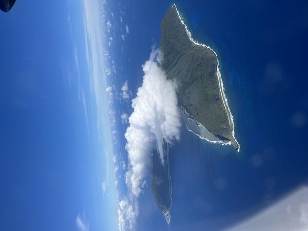
September 9, 2026 — Aerial view of Aunu‘u Island, American Samoa

This photo, taken from an airplane, shows Aunu‘u Island from the south looking north; Tutuila Island is visible on the left. Aunu‘u Island is a tuff cone less than 1 mile southeast of Tutuila Island and is considered part of Tutuila volcano. A tuff cone can form when magma and water interact at shallow depths, causing localized explosions.
This photo, taken from an airplane, shows Aunu‘u Island from the south looking north; Tutuila Island is visible on the left. Aunu‘u Island is a tuff cone less than 1 mile southeast of Tutuila Island and is considered part of Tutuila volcano. A tuff cone can form when magma and water interact at shallow depths, causing localized explosions.
Color photograph of island in ocean
September 9, 2026 — Aerial view of Ofu-Olosega, American Samoa

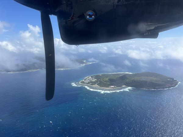
This photo, taken from an airplane, shows Ofu-Olosega from the southeast looking northwest. Olosega Island is in the right foreground, while Ofu Island is in the middle left background. Ocean waves are breaking at some distance from shore where there is a coral reef. According to the 2020 US Census, less than 300 people live on Ofu-Olosega. USGS photo by N.

This photo, taken from an airplane, shows Ofu-Olosega from the southeast looking northwest. Olosega Island is in the right foreground, while Ofu Island is in the middle left background. Ocean waves are breaking at some distance from shore where there is a coral reef. According to the 2020 US Census, less than 300 people live on Ofu-Olosega. USGS photo by N.

Color photograph of scientists working on monitoring equipment
September 9, 2026 — Tutuila seismic station maintenance

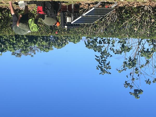
Two USGS scientists service a seismic station on Tutuila island in American Samoa. The Hawaiian Volcano Observatory uses this site and three others to monitor volcanic activity in American Samoa. These stations are also used by the NOAA Pacific Tsunami Warning Center and the USGS National Earthquake Information Center. USGS photo by N. Deligne.

Two USGS scientists service a seismic station on Tutuila island in American Samoa. The Hawaiian Volcano Observatory uses this site and three others to monitor volcanic activity in American Samoa. These stations are also used by the NOAA Pacific Tsunami Warning Center and the USGS National Earthquake Information Center. USGS photo by N. Deligne.

Color photograph of vegetated shoreline and ocean
September 9, 2026 — Aerial view of the coast of eastern Ta‘ū Island, American Samoa

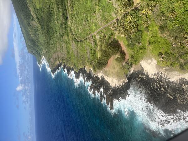
This photo, taken from an airplane, shows the eastern Ta‘ū Island coastline south of Fitiuta village; the view is from the north looking south. The black rock on the coast are lava flows of an unknown age. USGS photo by N. Deligne.

This photo, taken from an airplane, shows the eastern Ta‘ū Island coastline south of Fitiuta village; the view is from the north looking south. The black rock on the coast are lava flows of an unknown age. USGS photo by N. Deligne.

Color photograph of island in ocean
September 9, 2026 — Aerial view of Ofu Island, American Samoa

This photo, taken from an airplane, shows Ofu Island from the south looking north. Nuʻutele Island is visible to the left (west) of Ofu Island. The tallest point of Ofu Island is the peak of Tumutumu Mountain at 1,611 feet (491 meters). The westernmost edge of Olosega Island is visible to the right of Ofu Island; the two islands are connected by the Asaga bridge.

This photo, taken from an airplane, shows Ofu Island from the south looking north. Nuʻutele Island is visible to the left (west) of Ofu Island. The tallest point of Ofu Island is the peak of Tumutumu Mountain at 1,611 feet (491 meters). The westernmost edge of Olosega Island is visible to the right of Ofu Island; the two islands are connected by the Asaga bridge.

Color photograph of vegetated crater
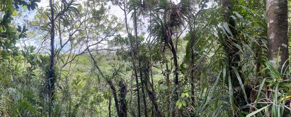
September 8, 2026 — Panorama of Judds Crater on Ta‘ū Island, American Samoa

This panorama photo shows the heavily vegetated Judds Crater from the north looking south on eastern Ta‘ū Island in American Samoa.

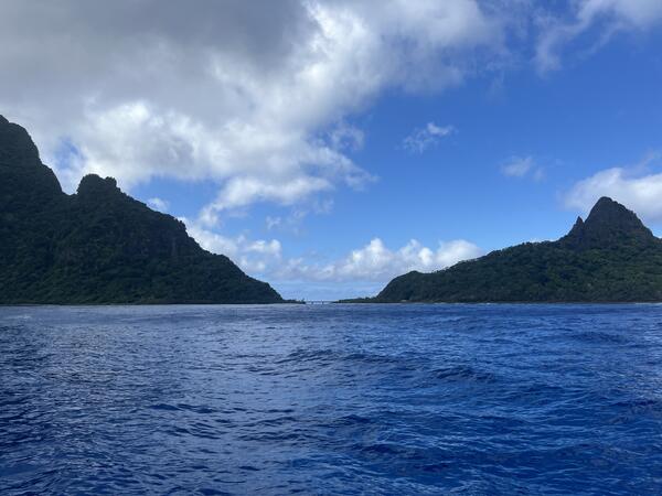
Color photograph of vegetated islnd rising from ocean
September 4, 2026 — View of Ofu-Olosega Islands, American Samoa

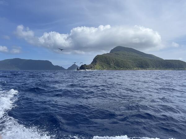
This photo, taken from a boat looking to the northwest, shows Olosega Island on the right and Ofu Island on the left in the distance. Together, they make up the top of Ofu-Olosega volcano, most of which is underwater. USGS photo by N. Deligne.

This photo, taken from a boat looking to the northwest, shows Olosega Island on the right and Ofu Island on the left in the distance. Together, they make up the top of Ofu-Olosega volcano, most of which is underwater. USGS photo by N. Deligne.

Color photograph of scientists at monitoring station surrounded by vegetation
September 4, 2026 – Servicing seismic station on Taʻū Island, American Samoa

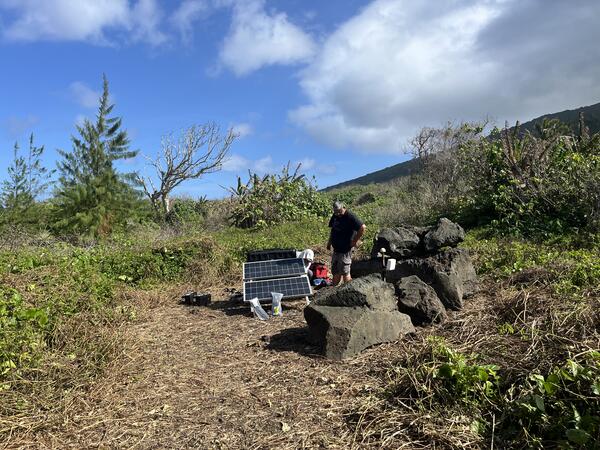
A USGS Hawaiian Volcano Observatory seismologist services the FAGA seismic station on eastern Taʻū Island, American Samoa. This station is part of the volcano monitoring network of American Samoa, and is also used by the USGS National Earthquake Information Center (NEIC) and by the NOAA Pacific Tsunami Warning Center (PTWC). USGS photo by N. Deligne.

A USGS Hawaiian Volcano Observatory seismologist services the FAGA seismic station on eastern Taʻū Island, American Samoa. This station is part of the volcano monitoring network of American Samoa, and is also used by the USGS National Earthquake Information Center (NEIC) and by the NOAA Pacific Tsunami Warning Center (PTWC). USGS photo by N. Deligne.

Color photograph of island rising from ocean
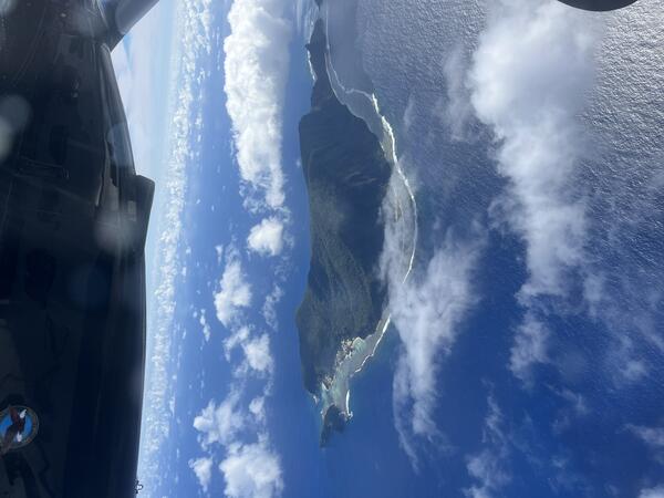
September 4, 2026 — Nuʻutele Island of Ofu-Olosega volcano, American Samoa

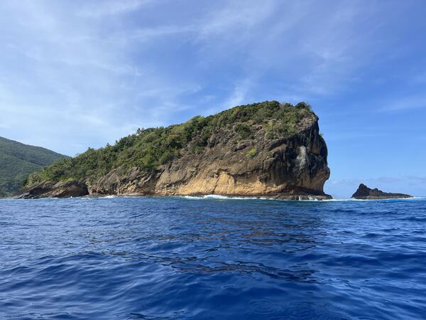
This photo, taken from a boat, shows the northwest side of Nuʻutele Island, off the west coast of Ofu Island in the Manuʻa Islands, American Samoa. Nuʻutele Island, which may be known by other names locally, is an eroded tuff cone of Ofu-Olosega volcano. A tuff cone can form when magma and water interact at shallow depths, causing localized explosions.
This photo, taken from a boat, shows the northwest side of Nuʻutele Island, off the west coast of Ofu Island in the Manuʻa Islands, American Samoa. Nuʻutele Island, which may be known by other names locally, is an eroded tuff cone of Ofu-Olosega volcano. A tuff cone can form when magma and water interact at shallow depths, causing localized explosions.
maps showing geology of the US, including Alaska and Hawaii
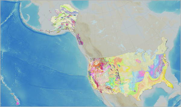
Cooperative National Geologic Map now includes Alaska and Hawaii

A unique cartographic layout highlights the global scope of the US and the associated reach of version 2 of the Cooperative National Geologic Map, which now depicts the history and distribution of geologic units and structures across all states and most territories.

Color photograph of vegetated island rising from ocean
September 2, 2026 — View of eastern Olosega Island

This photo, taken from a boat, shows the eastern side of Olosega Island in the Manuʻa Islands of American Samoa. This volcanic island is part of Ofu-Olosega volcano, which is estimated to be 440,000 years old. USGS photo by N. Deligne.

This photo, taken from a boat, shows the eastern side of Olosega Island in the Manuʻa Islands of American Samoa. This volcanic island is part of Ofu-Olosega volcano, which is estimated to be 440,000 years old. USGS photo by N. Deligne.

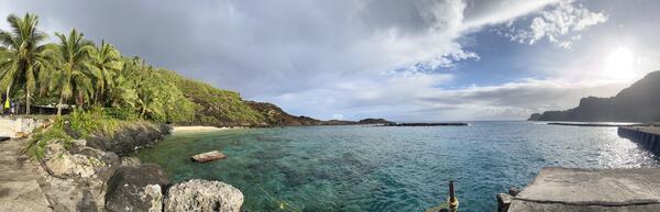
Color photograph of harbor
September 2, 2026 — Panorama of Faleāsao harbor on Ta‘ū Island

Panorama of Faleāsao village harbor on northwest Ta‘ū island, looking primarily north. This harbor is situated within a tuff cone that is thousands of years old, formed when hot magma interacted with either shallow groundwater or sea water. There are several tuff cones located within the northwest corner of Ta‘ū island. USGS photo by N. Deligne.

Panorama of Faleāsao village harbor on northwest Ta‘ū island, looking primarily north. This harbor is situated within a tuff cone that is thousands of years old, formed when hot magma interacted with either shallow groundwater or sea water. There are several tuff cones located within the northwest corner of Ta‘ū island. USGS photo by N. Deligne.

Color photograph of ocean in foreground, island in background
September 2, 2026 — Ofu and Olosega Islands and the Asaga bridge

This photo, taken from a boat looking south, shows Olosega Island to the left, Ofu Island to the right, and the Asaga bridge connecting the two islands. The Asaga bridge was built in 1970; this single-lane bridge connects the two islands that form Ofu-Olosega volcano. USGS photo by N. Deligne.

This photo, taken from a boat looking south, shows Olosega Island to the left, Ofu Island to the right, and the Asaga bridge connecting the two islands. The Asaga bridge was built in 1970; this single-lane bridge connects the two islands that form Ofu-Olosega volcano. USGS photo by N. Deligne.

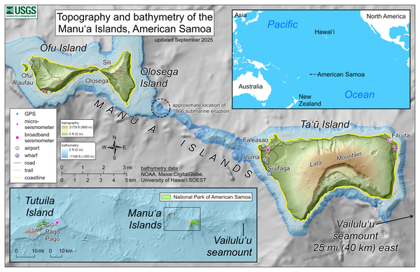
Color map of the Manuʻa Islands, American Samoa
September 2025—Topography and bathymetry of the Manuʻa Islands, American Samoa

This reference map depicts the volcanoes of the Manuʻa Islands, American Samoa, which are monitored by the USGS Hawaiian Volcano Observatory.

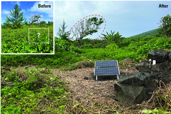
Color photo of before and after images of a solar panel covered and then cleared of plants growing over it.
Broadband seismometer site on eastern Taʻū, American Samoa, before and after it was cleared of vegetation.

Broadband seismometer site on eastern Taʻū, American Samoa, before (inset) and after a work party cleared rapidly growing vegetation which had covered the solar panels along with the boulders to the right of the main photo. Due to lack of power from the solar panels being unable to charge during the day, the station was offline for many months.

Broadband seismometer site on eastern Taʻū, American Samoa, before (inset) and after a work party cleared rapidly growing vegetation which had covered the solar panels along with the boulders to the right of the main photo. Due to lack of power from the solar panels being unable to charge during the day, the station was offline for many months.

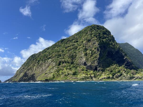
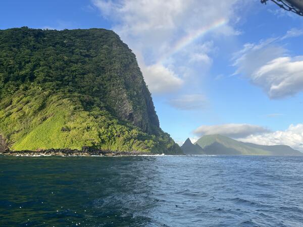
Color photo of a large green cliff on an island towering over the blue ocean.
September 3, 2025 – View of Ofu-Olosega Islands, American Samoa

This photo, taken from a boat, shows Olosega Island on the left, and Ofu Island further away on the right, in the Manuʻs Islands of American Samoa. These islands, connected by a one-lane bridge (out of sight), are the top of Ofu-Olosega volcano. USGS photo by N. Deligne.

This photo, taken from a boat, shows Olosega Island on the left, and Ofu Island further away on the right, in the Manuʻs Islands of American Samoa. These islands, connected by a one-lane bridge (out of sight), are the top of Ofu-Olosega volcano. USGS photo by N. Deligne.

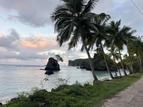
Color photo of a tropical looking island with palm trees and rock coast and calm seas.
September 3, 2025 – Small islands west of Ofu Island, American Samoa

This photo shows part of the western Ofu coastline and several small islands west of Ofu Island, American Samoa. These islands are considered part of Ofu-Olosega volcano in the Manuʻa Islands.

This photo shows part of the western Ofu coastline and several small islands west of Ofu Island, American Samoa. These islands are considered part of Ofu-Olosega volcano in the Manuʻa Islands.

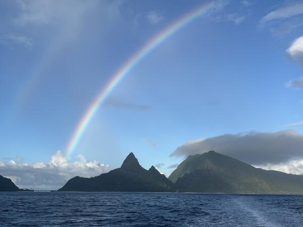
Color photo of a rainbow over the ocean.
September 3, 2025 – View of the north side of Ofu Island, American Samoa

USGS Hawaiian Volcano Observatory scientists and NOAA National Weather Service Weather Service Office Pago Pago meteorologists travelled by boat between the Manuʻa Islands, American Samoa, during an outreach and monitoring network maintenance trip in early September 2025. This view is from the boat looking south towards the north side of Ofu Island.

USGS Hawaiian Volcano Observatory scientists and NOAA National Weather Service Weather Service Office Pago Pago meteorologists travelled by boat between the Manuʻa Islands, American Samoa, during an outreach and monitoring network maintenance trip in early September 2025. This view is from the boat looking south towards the north side of Ofu Island.

Color photo of a GPS station and solar panel in grass in a tropical setting.
September 3, 2025 – Volcano monitoring GPS station on TAU Island, American Samoa

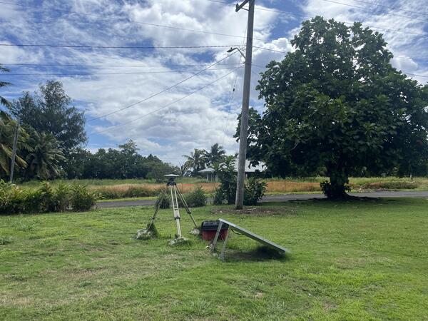
Photo of the USGS Global Positioning System (GPS) monitoring station on western Ta‘ū Island in the Manuʻa Islands of American Samoa. The station consists of a GPS unit, which can measure very slight movements of the ground, placed on a tripod that is leveled and centered over a benchmark.

Photo of the USGS Global Positioning System (GPS) monitoring station on western Ta‘ū Island in the Manuʻa Islands of American Samoa. The station consists of a GPS unit, which can measure very slight movements of the ground, placed on a tripod that is leveled and centered over a benchmark.

Color photo looking down at Aunu‘u Island from the air during a flight.
September 2, 2025 – Photo of Aunu‘u Island while on a flight from Tutuila to Ofu Island in American Samoa.

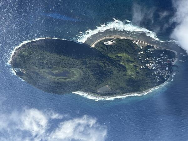
USGS Hawaiian Volcano Observatory scientists took this photo of Aunu‘u Island while on a flight from Tutuila to Ofu Island in American Samoa on September 2, 2025. The view is from the south looking north. Aunu‘u Island is a tuff cone less than 1 mile southeast of Tutuila Island and is considered part of Tutuila volcano.

USGS Hawaiian Volcano Observatory scientists took this photo of Aunu‘u Island while on a flight from Tutuila to Ofu Island in American Samoa on September 2, 2025. The view is from the south looking north. Aunu‘u Island is a tuff cone less than 1 mile southeast of Tutuila Island and is considered part of Tutuila volcano.

Scientist in field
USGS Hawaiian Volcano Observatory chief field engineer

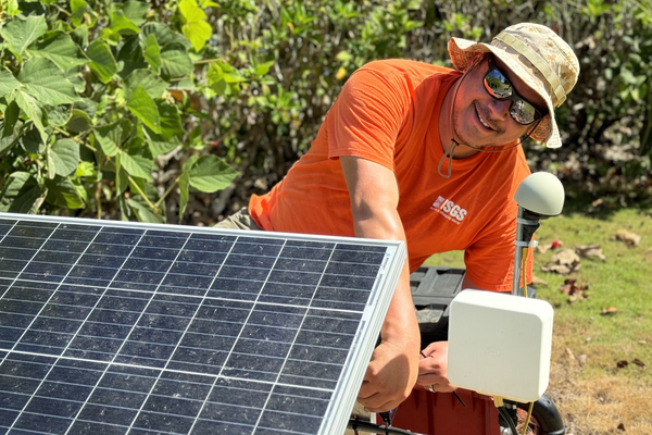
USGS Hawaiian Volcano Observatory chief field engineer Kevan Kamibayashi conducts maintenance on a volcano-monitoring station located in American Samoa. USGS photo by J. Chang. 

USGS Hawaiian Volcano Observatory chief field engineer Kevan Kamibayashi conducts maintenance on a volcano-monitoring station located in American Samoa. USGS photo by J. Chang. 

Was this page helpful?