
This red spruce forest and understory vegetation are part of a larger patchwork of red spruce forest stands across the central and southern Appalachians, separated from each other by miles of hardwood such as maple, oak, and beech.
Images
Images intro.
Filter Total Items: 51
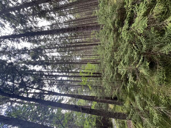
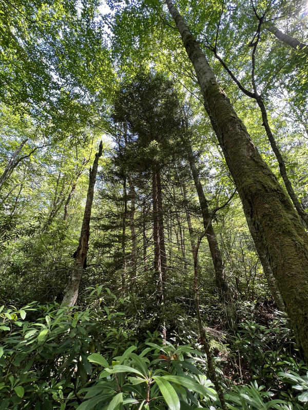
Red spruce forest stand and understory vegetation
This red spruce forest and understory vegetation are part of a larger patchwork of red spruce forest stands across the central and southern Appalachians, separated from each other by miles of hardwood such as maple, oak, and beech.
Red spruce in the Central Appalachian Mountains
Red spruce forests, once widespread across the central and southern Appalachians, now persist only in scattered fragments on mountaintops.
Red spruce forests, once widespread across the central and southern Appalachians, now persist only in scattered fragments on mountaintops.
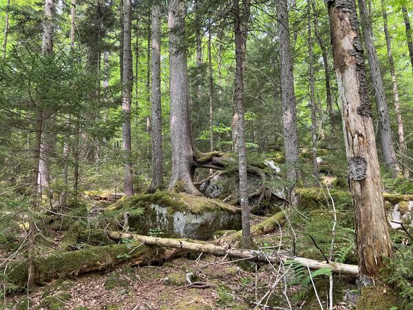
Gaudineer Knob in eastern West Virginia
Gaudineer Knob in eastern West Virginia is home to one of the few remaining old-growth red spruce forests in the region, sitting as a unique reminder of what red spruce forests once looked like across the central and southern Appalachians.
Gaudineer Knob in eastern West Virginia is home to one of the few remaining old-growth red spruce forests in the region, sitting as a unique reminder of what red spruce forests once looked like across the central and southern Appalachians.
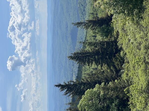
Spruce Knob, the highest point in West Virginia
Spruce Knob is the highest point in West Virginia, which offers incredible views of misty ridgelines and the unmistakable scent of spruce on cool mountain air.
Spruce Knob is the highest point in West Virginia, which offers incredible views of misty ridgelines and the unmistakable scent of spruce on cool mountain air.
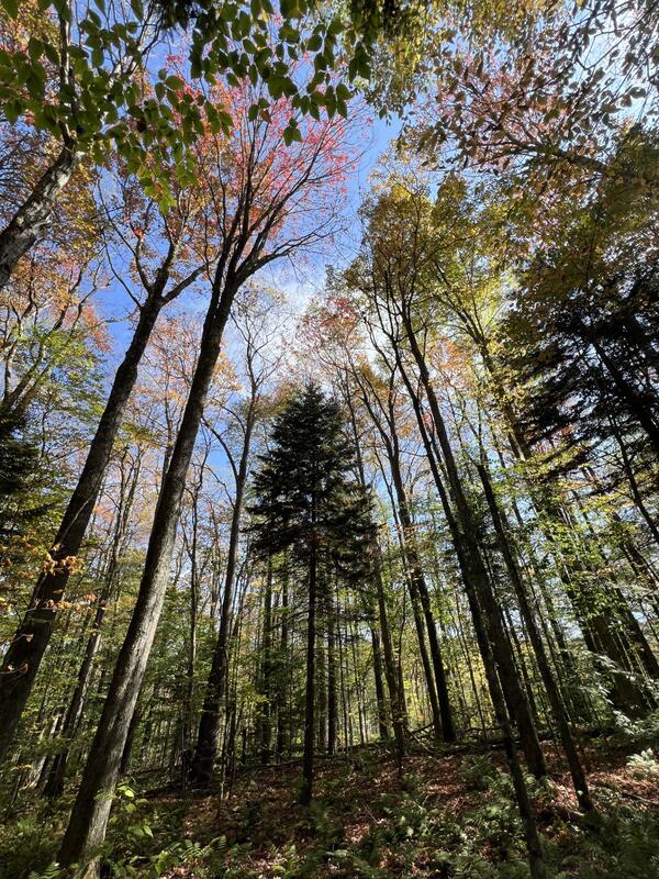
Hardwood canopy dominating above the red spruce in West Virginia
Hardwood canopy dominating above the red spruce in West VirginiaRed spruce forests, once widespread across the central and southern Appalachians, now persist only in scattered fragments on mountaintops.
Hardwood canopy dominating above the red spruce in West Virginia
Hardwood canopy dominating above the red spruce in West VirginiaRed spruce forests, once widespread across the central and southern Appalachians, now persist only in scattered fragments on mountaintops.

USGS water expert measures floodwaters at Piney Creek near Raleigh, WV.
USGS water expert measures floodwaters at Piney Creek near Raleigh, WV.USGS water expert Jeremy White measures how high and fast floodwaters are moving at Piney Creek near Raleigh, WV. He's using special water measurement equipment (a hydroacoustic doppler profiler) to collect this data.

High Flow being measured at Hurricane Creek
USGS hydrologic technician Fred Brogan holds an acoustic doppler current profiler (ADCP) while measuring the highest flow measured to-date on Hurricane Creek at Hurricane, WV. Photo by Logan Jarrell, USGS Hydrologic Technician
USGS hydrologic technician Fred Brogan holds an acoustic doppler current profiler (ADCP) while measuring the highest flow measured to-date on Hurricane Creek at Hurricane, WV. Photo by Logan Jarrell, USGS Hydrologic Technician

Fred D. Brogan (pictured) and Logan C. Jarrell collect the two highest discharge measurements made at Hurricane Creek at Hurricane, WV, using an acoustic doppler current profiler (ADCP) during period of record flooding on 02/06/2025.
Fred D. Brogan (pictured) and Logan C. Jarrell collect the two highest discharge measurements made at Hurricane Creek at Hurricane, WV, using an acoustic doppler current profiler (ADCP) during period of record flooding on 02/06/2025.Fred D. Brogan (pictured) and Logan C. Jarrell collect the two highest discharge measurements made at Hurricane Creek at Hurricane, WV, using an acoustic doppler current profiler (ADCP) during period of record flooding on 02/06/2025.
Winter 2025 Photo Contest Winner: Logan Jarrell, Where We Work category
Fred D. Brogan (pictured) and Logan C. Jarrell collect the two highest discharge measurements made at Hurricane Creek at Hurricane, WV, using an acoustic doppler current profiler (ADCP) during period of record flooding on 02/06/2025.
Fred D. Brogan (pictured) and Logan C. Jarrell collect the two highest discharge measurements made at Hurricane Creek at Hurricane, WV, using an acoustic doppler current profiler (ADCP) during period of record flooding on 02/06/2025.Fred D. Brogan (pictured) and Logan C. Jarrell collect the two highest discharge measurements made at Hurricane Creek at Hurricane, WV, using an acoustic doppler current profiler (ADCP) during period of record flooding on 02/06/2025.
Fred D. Brogan (pictured) and Logan C. Jarrell collect the two highest discharge measurements made at Hurricane Creek at Hurricane, WV, using an acoustic doppler current profiler (ADCP) during period of record flooding on 02/06/2025.Fred D. Brogan (pictured) and Logan C. Jarrell collect the two highest discharge measurements made at Hurricane Creek at Hurricane, WV, using an acoustic doppler current profiler (ADCP) during period of record flooding on 02/06/2025.
Winter 2025 Photo Contest Winner: Logan Jarrell, Where We Work category

A Salamander found near the New River Gorge
A salamander found in Short Creek, West Virginia during a synoptic habitat survey as a part of the New River Gorge Abandoned Coal Mine Restoration Effects Study.
A salamander found in Short Creek, West Virginia during a synoptic habitat survey as a part of the New River Gorge Abandoned Coal Mine Restoration Effects Study.

Salamander found near the New River Gorge
A salamander found in Short Creek, West Virginia during a synoptic habitat survey as a part of the New River Gorge Abandoned Coal Mine Restoration Effects Study.
A salamander found in Short Creek, West Virginia during a synoptic habitat survey as a part of the New River Gorge Abandoned Coal Mine Restoration Effects Study.

Water Quality Sonde in Keeney Creek
Taking water quality measurements in Keeney Creek, Fayetteville, West Virginia using a water quality sonde.
Taking water quality measurements in Keeney Creek, Fayetteville, West Virginia using a water quality sonde.

Stonefly Nymph
A stonefly nymph found during a survey of benthic macroinvertebrates in Keeney Creek, West Virginia.
A stonefly nymph found during a survey of benthic macroinvertebrates in Keeney Creek, West Virginia.

Collecting Water Quality samples in the New River gorge
Collecting Water Quality samples in the New River gorgeTwo USGS hydrologists collect water quality samples at Contrary Creek near the New River Gorge as a part of the New River Gorge Abandoned Coal Mine Restoration Effects Study.
Collecting Water Quality samples in the New River gorge
Collecting Water Quality samples in the New River gorgeTwo USGS hydrologists collect water quality samples at Contrary Creek near the New River Gorge as a part of the New River Gorge Abandoned Coal Mine Restoration Effects Study.

Keeney Creek, West Virginia
Keeney Creek is one of the tributaries of the New River in West Virginia, and is potentially impacted by mine drainage from nearby abandonned coal mines.
Keeney Creek is one of the tributaries of the New River in West Virginia, and is potentially impacted by mine drainage from nearby abandonned coal mines.

A Coal Seam Outcrop
A geologic outcrop in the New River Gorge with a visible coal seam. Coal mining is a large part of the history of the New River Gorge, and its effects can still be seen on the landscape today.
A geologic outcrop in the New River Gorge with a visible coal seam. Coal mining is a large part of the history of the New River Gorge, and its effects can still be seen on the landscape today.

Juvenile Salamander
A juvenile salamander found during a habitat survey in the New River Gorge.
This image is a part of the New River Gorge Abandoned Coal Mine Restoration Effects Study.
A juvenile salamander found during a habitat survey in the New River Gorge.
This image is a part of the New River Gorge Abandoned Coal Mine Restoration Effects Study.

Principal aquifers and wells assessed in nationwide NAWQA/GAMA groundwater quality study
Principal aquifers and wells assessed in nationwide NAWQA/GAMA groundwater quality studyMap showing principal aquifers (PAs) and wells that were sampled as part of a Nationwide assessment of the quality of groundwater used for public supply.

View of the inside of a groundwater well
What does the inside of a groundwater well look like? This can be an important question for groundwater scientists! In this photo, we see the view from a video camera inside a groundwater well. USGS scientists can use cameras to inspect the inside of a well to identify any changes in the well that might affect groundwater level measurements over time.
What does the inside of a groundwater well look like? This can be an important question for groundwater scientists! In this photo, we see the view from a video camera inside a groundwater well. USGS scientists can use cameras to inspect the inside of a well to identify any changes in the well that might affect groundwater level measurements over time.

Collecting water quality samples from the New River Gorge
Collecting water quality samples from the New River GorgeCollecting water quality samples from the New River Gorge in support of USGS-NPS partnership.
Fall 2022 Photo Contest Winner: Matt Kearns, USGS at Work category
Collecting water quality samples from the New River Gorge
Collecting water quality samples from the New River GorgeCollecting water quality samples from the New River Gorge in support of USGS-NPS partnership.
Fall 2022 Photo Contest Winner: Matt Kearns, USGS at Work category

Assessment of Per- and Polyfluoroalkyl Substances (PFAS) in West Virginia Public Source-Water Supplies
Assessment of Per- and Polyfluoroalkyl Substances (PFAS) in West Virginia Public Source-Water SuppliesWhat are PFAS?

Drone flight at Leetown
A USGS researcher pilots a drone over the Leetown Research Laboratory ponds as part of an effort to explore how remote sensing may be able to inform efforts to identify and track the extent of Harmful Algal Blooms.
A USGS researcher pilots a drone over the Leetown Research Laboratory ponds as part of an effort to explore how remote sensing may be able to inform efforts to identify and track the extent of Harmful Algal Blooms.