U.S. flag

An official website of the United States government

Images

Images intro.
Filter Total Items: 734
Muddy thermal discharge near Congress Pool in Norris Geyser Basin following the 1975 Yellowstone National Park earthquake

Muddy thermal discharge (foreground) near Congress Pool (middle ground) in Norris Geyser Basin following the June 30, 1975, magnitude-6 Yellowstone National Park earthquake,  NPS photo by Rick Hutchinson.

1975 earthquake damage just south of Mammoth Hot Springs on the Mammoth-Norris highway

Photo of damage to the Mammoth-Norris highway, just south of Mammoth Hot Springs, caused by the June 30, 1975, magnitude-6 earthquake.  Haynes Inc. photo for the Deseret News.

Gibbon River in Gibbon Meadows immediate following the 1975 Yellowstone National Park earthquake

Gibbon River in Gibbon Meadows immediate following the June 30, 1975, magnitude-6 Yellowstone National Park earthquake.  The muddy color is due to increased sediment load.  NPS photo by Rick Hutchinson.

A geyser sprays water into the air. Foreground is barren with dead trees. Background is a tree-covered hill under blue sky.
Seismic geyser in Yellowstone’s Upper Geyser Basin during an eruption in 1969

Seismic geyser in Yellowstone’s Upper Geyser Basin during an eruption. Based on the study of George Marler and USGS scientist Donald E.

Eruptions from drill rods during research drilling in Yellowstone National Park, 1967–1968

Eruptions from drill rods during research drilling in Yellowstone National Park, 1967–1968. Left panel shows initial explosive eruption of water-steam mixture from open drill pipe in drill hole Y-5 (Rabbit Creek) on August 20, 1967.

Bob Fournier (left) and Don White (right) at the Y3 drilling site in Yellowstone National Park

Bob Fournier (left) and Don White (right) at the Y3 drilling site in Pocket Basin adjacent to Ojo Caliente, Lower Geyser Basin, Yellowstone National Park, in 1967.  USGS Photo.

Pocket Basin orthophoto

This orthophoto of Pocket Basin, a hydrothermal explosion crater in Yellowstone National Park's Lower Geyser Basin, was created from aerial photos taken in 1965 that were corrected to have uniform scale for use in geologic mapping.

This orthophoto of Pocket Basin, a hydrothermal explosion crater in Yellowstone National Park's Lower Geyser Basin, was created from aerial photos taken in 1965 that were corrected to have uniform scale for use in geologic mapping.

Early aerial thermal infrared images from Yellowstone National Park

Top: the first thermal infrared images of Yellowstone (1961).  Warm areas are brighter; cold areas are darker.  These images were published in: McLerran, J.H. and Morgan, J.O. (1965) Thermal mapping of Yellowstone National Park.

Top: the first thermal infrared images of Yellowstone (1961).  Warm areas are brighter; cold areas are darker.  These images were published in: McLerran, J.H. and Morgan, J.O. (1965) Thermal mapping of Yellowstone National Park.

Lower Geyser Basin from Great Fountain Geyser

View of Lower Geyser Basin. Note active thermal pools (Great Fountain Geyser) in the foreground with thermal grasslands—kept treeless by hot soils—and lodgepole pine forest in the distance. Photo by George Marler, 1959.

View of Lower Geyser Basin. Note active thermal pools (Great Fountain Geyser) in the foreground with thermal grasslands—kept treeless by hot soils—and lodgepole pine forest in the distance. Photo by George Marler, 1959.

Aerial view of Black Opal Pool, Black Diamond Pool, and part of Wall Pool, all in Biscuit Basin, Yellowstone National Park, taken in 1959

Aerial view of Black Opal Pool, Black Diamond Pool, and part of Wall Pool, all in Biscuit Basin, Yellowstone National Park, taken in 1959 sometime after the Hebgen Lake earthquake (which occurred on August 17 of that year).

rockslide
Rockslide damage to the Golden Gate area near Mammoth Hot Springs

Rockslide damage to the Golden Gate area near Mammoth Hot Springs, Yellowstone National Park, as a result of the 1959 Hebgen Lake earthquake.

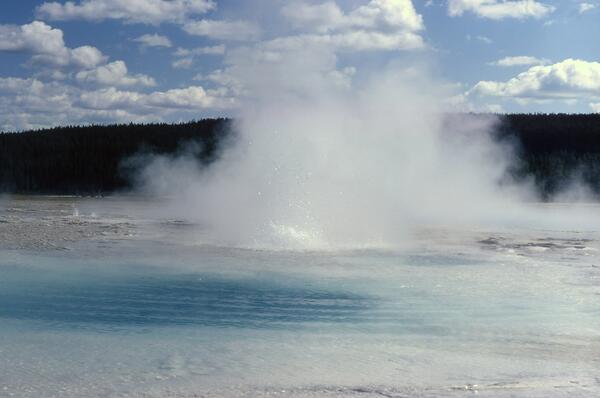
Sapphire Pool erupting
Sapphire Pool, in the Upper Geyser Basin, erupting after the 1959 Hebg
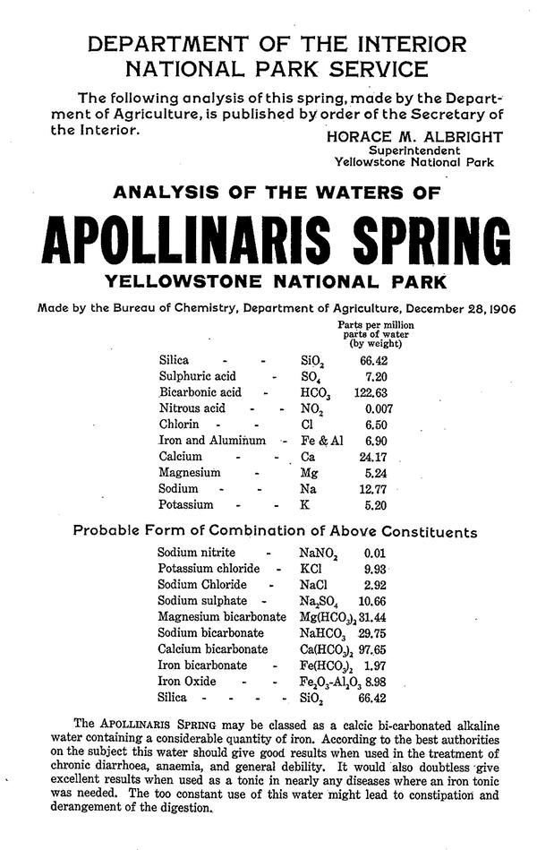
Reproduction of a poster showing chemical contents of water from Apollinaris Spring
Poster with chemical composition of water from Apollinaris Spring

Poster containing information about the chemical composition of water from Apollinaris Spring. Analysis is from 1906, but this poster is from the 1920s, when Horace Albright was the park’s Superintendent. Posters like this were posted in hotels and at the spring itself. 

Poster containing information about the chemical composition of water from Apollinaris Spring. Analysis is from 1906, but this poster is from the 1920s, when Horace Albright was the park’s Superintendent. Posters like this were posted in hotels and at the spring itself. 

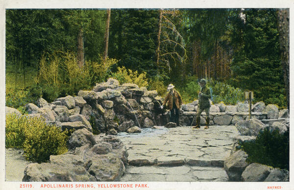
Colored 1920s postcard with two people on a stone platform hosting a cold water spring within a forested area
Haynes postcard showing Apollinaris Spring sometime after its 1925 renovation
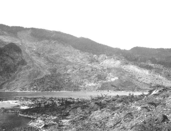
Black and white photo of a hillside that has been devastated by a landslide, with rock debris in the foreground and a lake
Gros Ventre landslide as seen shortly after it occurred in 1925

Photograph taken several months after the Gros Ventre Slide, Wyoming, showing the slide path (background), debris at the toe (foreground), and the waters of Lower Slide Lake.  Photo by William C. Alden, U.S. Geological Survey, 1925.

Photograph taken several months after the Gros Ventre Slide, Wyoming, showing the slide path (background), debris at the toe (foreground), and the waters of Lower Slide Lake.  Photo by William C. Alden, U.S. Geological Survey, 1925.

Was this page helpful?