
Sampling the Greybull River for pesticides
Images
Images intro.
Filter Total Items: 709

Sampling the Greybull River for pesticides

Water-quality sampling for pesticides, Shoshone River near Lovell
Water-quality sampling for pesticides, Shoshone River near LovellWater-quality sampling for pesticides, Shoshone River near Lovell
Water-quality sampling for pesticides, Shoshone River near Lovell
Water-quality sampling for pesticides, Shoshone River near LovellWater-quality sampling for pesticides, Shoshone River near Lovell

Lowering pump down monitoring well to sample for pesticides
Lowering pump down monitoring well to sample for pesticidesLowering pump down monitoring well to sample for pesticides
Lowering pump down monitoring well to sample for pesticides
Lowering pump down monitoring well to sample for pesticidesLowering pump down monitoring well to sample for pesticides

Water-quality sampling from Salt River cableway
Water-quality sampling from Salt River cableway

Digging trench to bury cable transmitting GW data to streamgage
Digging trench to bury cable transmitting GW data to streamgageDigging trench in which to bury cable transmitting groundwater data from well to streamgage
Digging trench to bury cable transmitting GW data to streamgage
Digging trench to bury cable transmitting GW data to streamgageDigging trench in which to bury cable transmitting groundwater data from well to streamgage

Setting up Groundwater Streamgage on Green River nr LaBarge
Setting up Groundwater Streamgage on Green River nr LaBargeSetting up Groundwater Streamgage on Green River nr LaBarge
Setting up Groundwater Streamgage on Green River nr LaBarge
Setting up Groundwater Streamgage on Green River nr LaBargeSetting up Groundwater Streamgage on Green River nr LaBarge

A mangy wolf in Yellowstone National Park.

Lava Mountain, Wyoming
Lava Mountain, Wyoming. (A) View from Dubois, WY, in the Wind River basin looking northwest ~30 km toward Lava Mountain.
Lava Mountain, Wyoming. (A) View from Dubois, WY, in the Wind River basin looking northwest ~30 km toward Lava Mountain.

Sampling for aquatic invasive species in the Greater Yellowstone Area.
Sampling for aquatic invasive species in the Greater Yellowstone Area.Sampling for aquatic invasive species in the Greater Yellowstone Area.
Sampling for aquatic invasive species in the Greater Yellowstone Area.
Sampling for aquatic invasive species in the Greater Yellowstone Area.Sampling for aquatic invasive species in the Greater Yellowstone Area.

Wind Turbines During Approaching Storm
A field of wind turbines in Wyoming with a storm rolling in.
A field of wind turbines in Wyoming with a storm rolling in.

Red spotted toad.
Red spotted toad.

Sampling for aquatic invasive species in the Greater Yellowstone Area.
Sampling for aquatic invasive species in the Greater Yellowstone Area.Sampling for aquatic invasive species in the Greater Yellowstone Area.
Sampling for aquatic invasive species in the Greater Yellowstone Area.
Sampling for aquatic invasive species in the Greater Yellowstone Area.Sampling for aquatic invasive species in the Greater Yellowstone Area.

Wheat Field Wind Turbines in Wyoming
Wheat field wind turbines in Wyoming.
Wheat field wind turbines in Wyoming.

Frosted trees in the Fairy Falls area of Yellowstone National Park near the Firehole River
Frosted trees in the Fairy Falls area of Yellowstone National Park near the Firehole RiverFrosted trees in the Fairy Falls area of Yellowstone National Park near the Firehole River. National Park Service photo by Annie Carlson, 2014.

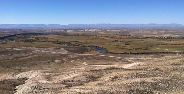
View into Green River Basin from Wyoming Range, Dry Piney Basin
View into Green River Basin from Wyoming Range, Dry Piney BasinView into Green River Basin from Wyoming Range, Dry Piney Basin
View into Green River Basin from Wyoming Range, Dry Piney Basin
View into Green River Basin from Wyoming Range, Dry Piney BasinView into Green River Basin from Wyoming Range, Dry Piney Basin

Installing piezometer on the bank of the New Fork River
Installing piezometer on the bank of the New Fork RiverInstalling piezometer on the bank of the New Fork River
Installing piezometer on the bank of the New Fork River
Installing piezometer on the bank of the New Fork RiverInstalling piezometer on the bank of the New Fork River

Installing stream thermistor at New Fork Groundwater Streamgage
Installing stream thermistor at New Fork Groundwater StreamgageInstalling stream thermistor at New Fork Groundwater Streamgage
Installing stream thermistor at New Fork Groundwater Streamgage
Installing stream thermistor at New Fork Groundwater StreamgageInstalling stream thermistor at New Fork Groundwater Streamgage
Confluence of New Fork (foreground) and Green Rivers
Confluence of New Fork (foreground) and Green RiversConfluence of New Fork (foreground) and Green Rivers
Confluence of New Fork (foreground) and Green Rivers
Confluence of New Fork (foreground) and Green RiversConfluence of New Fork (foreground) and Green Rivers

Bull elk in Grand Teton National Park, Wyoming.
Bull elk in Grand Teton National Park, Wyoming.
Bull elk in Grand Teton National Park, Wyoming.

Mud Pot within the Mud Volcano thermal area of Yellowstone National Park
Mud Pot within the Mud Volcano thermal area of Yellowstone National ParkA mud pot in the Obsidian Pool Thermal Area, near Mud Volcano. The large amounts of suspended sediment make the thermal water much more viscous than pure water. Photo by Shaul Hurwitz, September 2014.

Little Powder River above Dry Week, near Weston, Wyoming
Little Powder River above Dry Week, near Weston, WyomingLittle Powder River above Dry Week, near Weston, Wyoming
Little Powder River above Dry Week, near Weston, Wyoming
Little Powder River above Dry Week, near Weston, WyomingLittle Powder River above Dry Week, near Weston, Wyoming