
Geographic Names FAQs
Find answers to some of the most frequently asked questions about the U.S. Board on Geographic Names (BGN) Domestic Names Committee processes and names data.

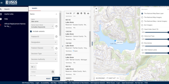
What is GNIS?
Frequently asked questions regarding the Geographic Names Information System (GNIS).
Related FAQs
-

Why are there no entries for caves in the Geographic Names Information System database? Why are there no entries for caves in the Geographic Names Information System database?
Geographic Names Information System (GNIS) does include caves but the entries are not publicly available. In response to the 1988 National Cave Management Resources Act, Department of the Interior Regulation 43 (CFR Subtitle A, Part 37) forbids the release of information regarding the location of all caves on Federal lands. Currently, GNIS does not distinguish between features on Federal versus...

Does the Geographic Names Information System database contain entries for obsolete names and geographic features that no longer exist? Does the Geographic Names Information System database contain entries for obsolete names and geographic features that no longer exist?
Yes, the Geographic Names Information System (GNIS) includes features that no longer exist and names that are no longer used. If a feature no longer exists on the landscape, or the name has fallen out of use, the entry is marked “historical”. The designation “historical” has no reference to age, size, condition, extent of habitation, type of use, or any other factor. Examples of historical...

How do I report an error in the Geographic Names Information System database? How do I report an error in the Geographic Names Information System database?
Please report possible errors in the Geographic Names Information System (GNIS) database to the GNIS Manager at tnm_help@usgs.gov. The Names data experts will investigate and validate the data, enter appropriate corrections where needed, and advise you of the results. Learn more: Geographic Names FAQs

How can I acquire or download Geographic Names Information System (GNIS) data? How can I acquire or download Geographic Names Information System (GNIS) data?
Geographic Names Information System (GNIS) data is available for download via the U.S. Board on Geographic Names website. You can also download names using a query in Search Domestic Names. GNIS includes official names, their location attributes, variant names, and other data, which can be displayed, printed, and downloaded (in csv format) up to a maximum of 2,000 records. GNIS data can also be...

Why are there no ZIP Codes in the Geographic Names Information System database? Why are there no ZIP Codes in the Geographic Names Information System database?
The Geographic Names Information System (GNIS) contains named communities, both incorporated and unincorporated, but these communities do not necessarily correspond to ZIP Code areas. ZIP Codes are developed and maintained by the U.S. Postal Service solely for the purpose of delivering mail. It is not within the mission, purpose, or resources of the GNIS to maintain ZIP Code information. You can...

What is the Geographic Names Information System (GNIS)? What is the Geographic Names Information System (GNIS)?
The Geographic Names Information System (GNIS) was developed by the U.S. Geological Survey (USGS) in cooperation with the U.S. Board on Geographic Names (BGN), which maintains cooperative working relationships with State Names Authorities to standardize geographic names for Federal use. GNIS contains information about the official names for places, features, and areas in the 50 states, the...

How often is the Geographic Names Information System database updated? How often is the Geographic Names Information System database updated?
Federal, tribal, state, local, and non-governmental data partners continuously submit new features and edits to existing features in the Geographic Names Information System (GNIS). Additions and changes are validated by the staff and made available on the Search Domestic Names application. The downloadable files are revised bi-monthly and available via The National Map Downloader. and the GNIS...

What is the difference between "mountain", "hill", and "peak"; "lake" and "pond"; or "river" and "creek?" What is the difference between "mountain", "hill", and "peak"; "lake" and "pond"; or "river" and "creek?"
There are no official definitions for generic terms as applied to geographic features. The Geographic Names Information System (GNIS) utilizes 43 broad categories of feature classes defined solely to facilitate retrieval of entries with similar characteristics. Go to GNIS Domestic Names Feature Classes to see the full list. These categories generally match dictionary definitions, but not always...

How do I find the average elevation of a city, town, county, or other civil division? How do I find the average elevation of a city, town, county, or other civil division?
Average (or mean) elevations for civil divisions are not available from the USGS. You can, however, find the elevation at the center of a civil division using the Geographic Names Information System (GNIS): Go to the GNIS Search Domestic Names. Select "Search Domestic Names" In the Name box, type the city, town, county, etc. name (for example, “Stanley,” “Richmond,” "Madison County") In the...

How can I propose a name change for a natural feature? How can I propose a name change for a natural feature?
Proposals to change the name of a feature within the United States and its territories may be submitted to the U.S. Board on Geographic Names (BGN). However, proposals must include a compelling reason the feature’s name needs to be changed for federal use. Changing an existing name merely to correct or re-establish historical usage should not be a primary reason to change a name. The BGN is...

What constitutes the United States? What are the official definitions? What constitutes the United States? What are the official definitions?
Geographically (and as a general reference), the United States of America includes all areas considered to be under the sovereignty of the United States, but does not include leased areas. On May 14, 1959, the U.S. Board on Geographic Names issued the following definitions, which defined the Continental United States as "the 49 States on the North American Continent and the District of Columbia...

How can I name an unnamed natural feature? How can I name an unnamed natural feature?
Proposals to name an unnamed feature within the United States and its territories may be submitted to the U.S. Board on Geographic Names (BGN). However, proposals must include a compelling reason the feature needs to be named for federal use. The BGN is responsible by law ( 43 USC Ch. 11A) for standardizing geographic names throughout the Federal Government and has developed policies governing...

Is the federal government responsible for updating geographic names on non-federal map products? Is the federal government responsible for updating geographic names on non-federal map products?
The U.S. Board on Geographic Names (BGN) is the official source for geographic names for federal use within the United States. The Geographic Names Information System (GNIS) contains geographic names for official use. The BGN, USGS, and GNIS are not responsible for how this information is used, updated, released, or otherwise is managed by end users. Questions about the use, update, or release of...