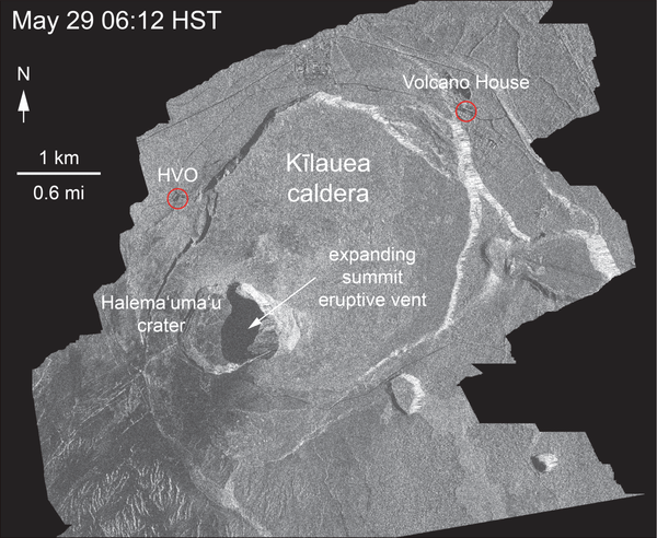
Halema‘uma‘u at the summit of Kīlauea Volcano captured from an Unmanne
Halema‘uma‘u at the summit of Kīlauea Volcano captured from an UnmanneAn aerial view of Halema‘uma‘u at the summit of Kīlauea Volcano captured from an Unmanned Aircraft Systems (UAS) overflight video on May 31, 2018. Limited UAS flights into this hazardous area are conducted with permission and coordination with Hawai‘i Volcanoes National Park to collect visual information on this changing eruption site.