Lesson plans
Check out our latest lesson plan - Water in Our World!
Where is the water?
The Water Science School likes to make life easier for teachers. Here we offer teacher guides with lesson plans and students worksheets complete with answers that can aid teachers in helping their students learn about water.
The Edible Aquifer
The Edible Aquifer activity is a hands‑on, food‑based model that helps students visualize how groundwater is stored and moves through different types of aquifers. Using layered ingredients to represent rock, sand, soil, and water, students explore concepts like the water table, recharge, confined vs. unconfined aquifers, and how pollution can spread through groundwater systems. This interactive activity supports NGSS standards and provides an engaging way to understand real-world hydrogeology.
All about Streamflow - Web Application
How Changing Snowmelt affects Water in the Western U.S.
Understanding Streamflow Drought: Impacts on Water, Land, and Communities
Water Insights: Short Education Activities to Explore the NWAA Report
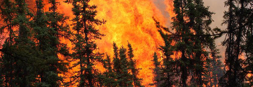
How Do Wildfires Affect Our Water?
In this activity students will learn how wildfires impact watersheds and water quality and think critically about how people and communities can adapt to these changes.
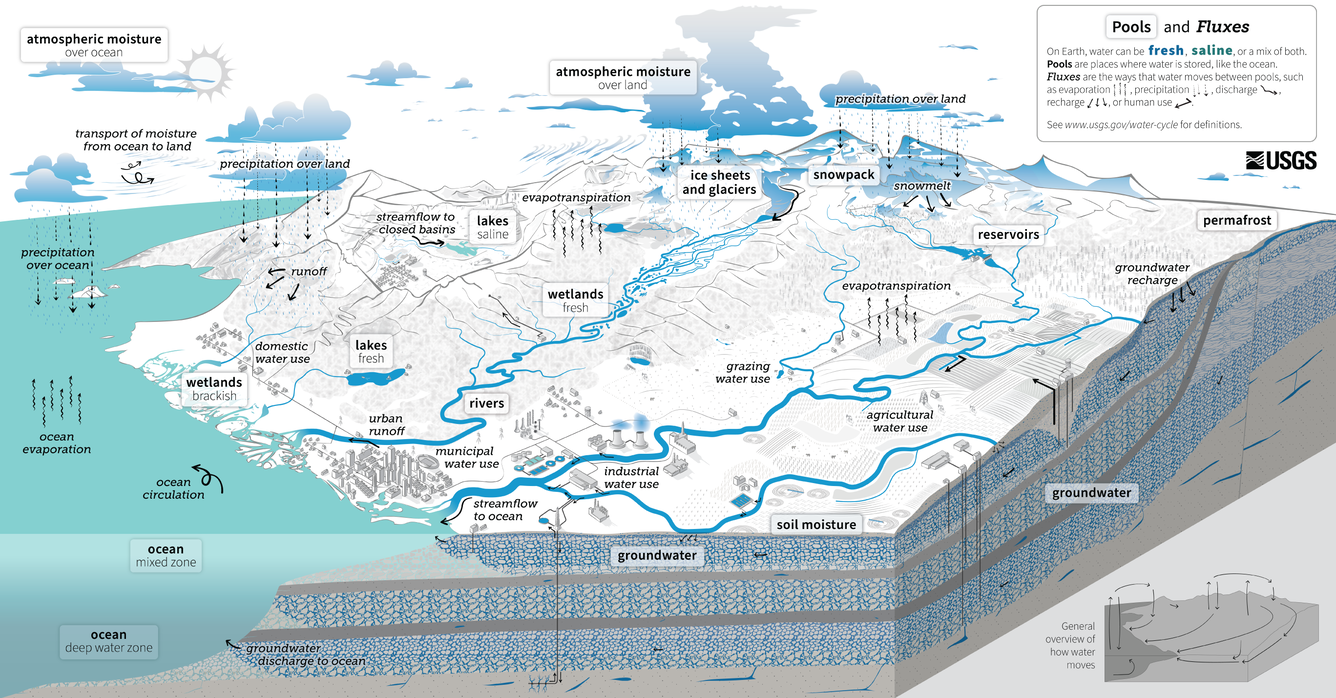
Building the Water Cycle Diagram
This lesson will help activate and assess students' prior knowledge about the water cycle and eventually progress to help build their knowledge. The final portion of this lesson plan includes an online interactive activity that can help keep students engaged throughout the entire lesson.
Water in Our World: Exploring Storage and Movement in Different Environments
In this lesson plan students will investigate and compare where water is stored and how it moves in six different environments: deserts, forests, urban areas, suburban areas, coastlines, and agricultural regions.

Our Water, Our Lives: A Series of Water Units for Intermediate Elementary
The goal of Our Water, Our Lives is to help students realize that they can contribute solutions to water-related challenges with their unique experience and knowledge. As students learn about the science of water, its uses for human and ecological systems, and its role in the development of culture, they begin thinking of themselves as future leaders that will solve these STEM-centered problems. For more information about the Our Water, Our Lives series, visit Our Water, Our Lives: A Series of Water Units for Intermediate Elementary.
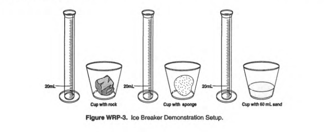
Water Resources Professional's Outreach Notebook - Groundwater (Grades 6-8)
This notebook provides five lesson plans developed to help educators and Water Resources Professionals discuss the subject of ground water with students in grades 6-8.