
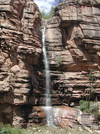
The Upper Gunnison River Watershed, located in the Rocky Mountains 150 miles southwest of Denver, Colorado, drains approximately 3,965 square miles. Forest and rangeland comprise 89 percent of land within the watershed, but the traditional western ranching economy is increasingly supplemented through a tourism economy centered around Crested Butte Mountain Resort and the Curecanti National Recreation area. Recreational development and population growth in recent years have the potential to affect both the quantity and quality of water.
In 1995, the U.S. Geological Survey (USGS) established a water-quality monitoring program in the upper Gunnison River Basin in Colorado as part of a local water-quality effort and as part of the Upper Colorado River Basin National Water-Quality Assessment (UCOL NAWQA) Program.

The monitoring program was established to characterize existing water quality and to assess effects of increasing urbanization/recreation on water quality and aquatic life. As a result of this effort and the water-quality concerns identified in the basin, local entities have expressed a need for a compilation and analysis of existing water-resources data and studies, as well as the coordination of further water-resources monitoring in the upper Gunnison River Basin.
- The population in Gunnison County has increased by approximately 200 percent between 1970 and 1990.
- Urban growth in the area and the associated recreational uses could result in reduced well capacities and contamination of the ground water and surface water.
- Metal mining upstream from Crested Butte and Lake City also could affect stream quality and stream biota.
To make informed land-use decisions, local entities need up-to-date information on the historical and current (1999) status of water quantity, water quality, stream biota, and land use in the upper Gunnison River Basin.
To provide this up-to-date information, a retrospective analysis is needed to establish a historical perspective on the quality of the water resources, to assess the strengths and weaknesses of available information, and to evaluate the implications for water-quality management and future water-quality sampling networks and data analysis.
OBJECTIVES:
- To characterize existing water-resources and stream-biota data for the upper Gunnison River Basin.
- To analyze historical data and assess the broad-scale geographic and seasonal distribution of current (1999) water-quality and stream-biota conditions of the upper Gunnison River Basin.
- To summarize the current knowledge of the environmental setting and identify, describe, and explain, where possible, the primary natural and human factors that affect observed water-quality conditions.
- To develop a water-quality and stream-biota data base.
- To redesign a water-quality sampling scheme to address water-quality and water-resource management concerns, based on the retrospective analysis.
- To implement a monitoring program to describe current water-quality and stream-biota conditions in the upper Gunnison River Basin.
Below are other science projects associated with the Colorado Water-Quality Data Repository.

Upper Yampa Watershed Water-Quality Data

Eagle River Water-Quality Data

Piceance Basin Water-Quality Data

Southwest Study Area Water-Quality Data

Roaring Fork Watershed Water-Quality Data

Arkansas River Water-Quality Data

Blue River Water-Quality Data
The Upper Gunnison River Watershed, located in the Rocky Mountains 150 miles southwest of Denver, Colorado, drains approximately 3,965 square miles. Forest and rangeland comprise 89 percent of land within the watershed, but the traditional western ranching economy is increasingly supplemented through a tourism economy centered around Crested Butte Mountain Resort and the Curecanti National Recreation area. Recreational development and population growth in recent years have the potential to affect both the quantity and quality of water.
In 1995, the U.S. Geological Survey (USGS) established a water-quality monitoring program in the upper Gunnison River Basin in Colorado as part of a local water-quality effort and as part of the Upper Colorado River Basin National Water-Quality Assessment (UCOL NAWQA) Program.
The monitoring program was established to characterize existing water quality and to assess effects of increasing urbanization/recreation on water quality and aquatic life. As a result of this effort and the water-quality concerns identified in the basin, local entities have expressed a need for a compilation and analysis of existing water-resources data and studies, as well as the coordination of further water-resources monitoring in the upper Gunnison River Basin.
- The population in Gunnison County has increased by approximately 200 percent between 1970 and 1990.
- Urban growth in the area and the associated recreational uses could result in reduced well capacities and contamination of the ground water and surface water.
- Metal mining upstream from Crested Butte and Lake City also could affect stream quality and stream biota.
To make informed land-use decisions, local entities need up-to-date information on the historical and current (1999) status of water quantity, water quality, stream biota, and land use in the upper Gunnison River Basin.
To provide this up-to-date information, a retrospective analysis is needed to establish a historical perspective on the quality of the water resources, to assess the strengths and weaknesses of available information, and to evaluate the implications for water-quality management and future water-quality sampling networks and data analysis.
OBJECTIVES:
- To characterize existing water-resources and stream-biota data for the upper Gunnison River Basin.
- To analyze historical data and assess the broad-scale geographic and seasonal distribution of current (1999) water-quality and stream-biota conditions of the upper Gunnison River Basin.
- To summarize the current knowledge of the environmental setting and identify, describe, and explain, where possible, the primary natural and human factors that affect observed water-quality conditions.
- To develop a water-quality and stream-biota data base.
- To redesign a water-quality sampling scheme to address water-quality and water-resource management concerns, based on the retrospective analysis.
- To implement a monitoring program to describe current water-quality and stream-biota conditions in the upper Gunnison River Basin.
Below are other science projects associated with the Colorado Water-Quality Data Repository.
Upper Yampa Watershed Water-Quality Data
Eagle River Water-Quality Data
Piceance Basin Water-Quality Data
Southwest Study Area Water-Quality Data
Roaring Fork Watershed Water-Quality Data
Arkansas River Water-Quality Data