
Data
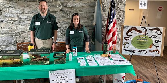
At the Eastern Ecological Science Center (EESC), we strive to provide world-class science to inform natural resource decisions that preserve and enhance our quality of life.
Connect with Us
Connect with Us
Find locations, staff profiles and contact information for our team.
EESC's Latest Findings
EESC's Latest Findings
Search for EESC publications by location, author, year or keyword.
Filter Total Items: 310
Laboratory study investigating the effects of seasonal temperature and photoperiod manipulation on Eastern elliptio reproduction Laboratory study investigating the effects of seasonal temperature and photoperiod manipulation on Eastern elliptio reproduction
A laboratory study was conducted at the Northern Appalachian Research Laboratory (Wellsboro, PA) on the ability to manipulate photoperiod and water temperatures to determine its effects on Eastern elliptio freshwater mussel glochidia production. Brooding mussels were collected from Pine Creek, Tioga County, PA in late December and were housed in the laboratory in groups subjected to one...
Tunicate survey on eelgrass in 2017 northwest Atlantic coast New Jersey to Newfoundland Tunicate survey on eelgrass in 2017 northwest Atlantic coast New Jersey to Newfoundland
This dataset consists of one data file (Carman_Et_al_Tunicate_2017_survey_on_eelgrass_quad_data_final) and one definitions file (Carman_Et_al_Tunicate_2017_survey_on_eelgrass_quad_data_final_definitions). The data file consists of species and abundance of tunicates found growing on eelgrass (Zostera marina L.) in a survey of 33 northwest Atlantic eelgrass meadows in summer 2017. Eelgrass...
Chesapeake Bay Watershed historical and future projected land use and climate data summarized for NHDPlusV2 catchments Chesapeake Bay Watershed historical and future projected land use and climate data summarized for NHDPlusV2 catchments
This dataset consists of historical estimates and future projections of land use and climate data summarized within the 1:100,000 National Hydrography Dataset Version 2 (NHDPlusV2) framework for catchments and upstream accumulated watersheds. Historical land use data are for the year 2005 and future land use projections are for the years 2030, 2060, and 2090. The projections offer a...
Population genetics metrics for wild brook trout populations in North Carolina (1998-2016) Population genetics metrics for wild brook trout populations in North Carolina (1998-2016)
This data set includes information on 406 wild brook trout populations from across the State of North Carolina. Key genetics metrics on diversity and the extent of hatchery introgression are presented. These data accompany the following article: Kazyak, D.C., Rash, Jacob, Lubinski, B.A., and King, T.L., 2018, Assessing the impact of stocking northern-origin hatchery brook trout on the...
Brook trout movement data related to cover and forage in an experimental stream system with associated water quality parameters Brook trout movement data related to cover and forage in an experimental stream system with associated water quality parameters
Brook trout is a species of conservation concern in the eastern US. In 2016, we evaluated brook trout movement patterns in response to food and cover treatments in an experimental stream system using RFID monitoring techniques at the USGS Leetown Science Center in Kearneysville, WV. Brook trout were tagged with 12mm HDX Passive Integrated Transponder (PIT) tags and monitored with Multi...
Promoting Change in Common Tern (Sterna hirundo) Nest Site Selection to Minimize Construction Related Disturbance Promoting Change in Common Tern (Sterna hirundo) Nest Site Selection to Minimize Construction Related Disturbance
These data describe the status of eggs in nests which had a foster egg added to them as part of an effort to relocate a common tern colony on Poplar Island. One data file (McGowanEtAl2018_FosterNestData_Data.csv) contains the data regarding the observations, while one definitions file (McGowanEtAl2018_FosterNestData_Definitions.csv) details the data.
Spatio-temporal distribution models for dabbling duck species across the continental United States Spatio-temporal distribution models for dabbling duck species across the continental United States
These data describe the spatio-temporal distribution of dabbling duck species across the continental United States during four biologically relevant seasons. This dataset contains two types of distribution models: (1) probability of presence, and (2) abundance. The model type, species, and season depicted in a raster are defined in the file name. File names begin with either abun...
In ovo exposure to brominated flame retardants Part II: Assessment of effects of TBBPA-BDBPE and BTBPE on hatching success, morphometric and physiological endpoints in American kestrels In ovo exposure to brominated flame retardants Part II: Assessment of effects of TBBPA-BDBPE and BTBPE on hatching success, morphometric and physiological endpoints in American kestrels
- Observations of test subjects and hatching data - Body weight, organ/tissue weights - Biomarker data (oxidative stress indicators, oxidative DNA damage, thyroid hormones, histological findings) in various tissues - Chemical residues in tissues
Spatial Integration of Biological and Social Objectives to Identify Priority Landscapes for Waterfowl Habitat Conservation Spatial Integration of Biological and Social Objectives to Identify Priority Landscapes for Waterfowl Habitat Conservation
The information and data presented herein serve as the supplement to the report, Spatial Integration of Biological and Social Objectives to Identify Priority Landscapes for Waterfowl Habitat Conservation. The purpose of this supplemental material is to encourage exploration of the methods used to develop the spatially explicit products presented in the report. The in depth step-by-step...
Toxicokinetics of imidacloprid-coated wheat seeds in Japanese quail (Coturnix coturnix) and an assessment of risk Toxicokinetics of imidacloprid-coated wheat seeds in Japanese quail (Coturnix coturnix) and an assessment of risk
- Observations of test subjects, - Body weight, organ/tissue weights - Biomarker data (oxidative DNA damage, thyroid hormones, corticosterone, gene expression) in various tissues - Residues as percent of administered dose - Tissues to plasma rations - Metabolites and ratios - Elimination half-lives
Toxicity of potassium chloride, active compound in the molluscicide potash, on salmonid fishes and their forage base (Leetown Science Center, 2018). Toxicity of potassium chloride, active compound in the molluscicide potash, on salmonid fishes and their forage base (Leetown Science Center, 2018).
The data is supplemental to the 2018 USGS Open File Report, "An evaluation of the acute and chronic toxicity of potassium chloride, active compound in the molluscicide potash, on salmonid fishes and their forage base". This research was performed as a Science Support Partnership (SSP) study with USFWS in order to evaluate potential lethal and sublethal impacts of potassium chloride on...
Molecular detection of avian influenza virus from sediment samples in waterfowl habitats on the Delmarva Peninsula, USA Molecular detection of avian influenza virus from sediment samples in waterfowl habitats on the Delmarva Peninsula, USA
Data were collected as part of an investigation developed by Leetown Science Center to investigate the comparative detection of avian influenza viruses from waterfowl and potential environmental reservoirs such as aquatic sediment from waterfowl habitat. This dataset identifies positive or negative test results for qRT-PCR (quantitative reverse transcriptase polymerase chain reaction)...