
Data
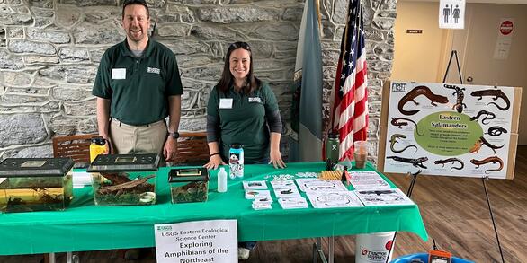
At the Eastern Ecological Science Center (EESC), we strive to provide world-class science to inform natural resource decisions that preserve and enhance our quality of life.
Connect with Us
Connect with Us
Find locations, staff profiles and contact information for our team.
EESC's Latest Findings
EESC's Latest Findings
Search for EESC publications by location, author, year or keyword.
Filter Total Items: 310
Morphometric, Age, Visible Abnormalities, Skin and Liver Neoplasms, and Stable Isotopes in White Sucker Collected in the St. Louis River and Estuary, Minnesota/Wisconsin, 2011-2015 Morphometric, Age, Visible Abnormalities, Skin and Liver Neoplasms, and Stable Isotopes in White Sucker Collected in the St. Louis River and Estuary, Minnesota/Wisconsin, 2011-2015
The dataset provides length, weight, age, observations of visible external abnormalities, liver and skin histopathology and stable isotopes of white sucker captured within the St. Louis river and associated bays.
Slow recovery of headwater-stream fishes following a catastrophic poisoning event Slow recovery of headwater-stream fishes following a catastrophic poisoning event
Fish collection data for surveys made at 5 localities in Flat Creek, Dawson County GA, on 6 dates that spanned a 4 to 18.5-month period following a catastrophic fish kill caused by a chemical spill near the headwater origin on Flat Creek. The data are: locality descriptions, water depth and velocity measurements made during fish sampling, and tabulated numbers and range in body length of
The North American Breeding Bird Survey in Mexico, 2008-2018 - unprocessed data The North American Breeding Bird Survey in Mexico, 2008-2018 - unprocessed data
This dataset includes all North American Breeding Bird Survey data collected in Mexico between 2008-2018. These data were used as the basis for all analyses discussed in an associated publication: The North American Breeding Bird Survey in Mexico, 2008-2018 - A Status Report; https:doi.org/10.3133/cir1479. The records include avian point count data for all reported taxa (species, races...
North American Bird Banding Program Dataset 1960-2020 retrieved 2020-06-26 North American Bird Banding Program Dataset 1960-2020 retrieved 2020-06-26
The North American Bird Banding Program is directed in the United States by the U.S. Geological Survey (USGS) Bird Banding Laboratory (BBL), Eastern Ecological Science Center at the Patuxent Research Refuge (EESC) and in Canada by the Bird Banding Office (BBO), Environment and Climate Change Canada (ECCC). The respective banding offices have similar functions and policies and use the...
Morphometric, Age and Concentrations of Perfluoroalkyl Substances in Smallmouth Bass Plasma from Four Sites in the Chesapeake Bay Watershed Morphometric, Age and Concentrations of Perfluoroalkyl Substances in Smallmouth Bass Plasma from Four Sites in the Chesapeake Bay Watershed
Archived plasma from fish health monitoring sites within the Chesapeake Bay watershed was analyzed for 13 perfluoroalkyl compounds. Smallmouth bass were collected from two sites in the Potomac River drainage (Antietam Creek, Maryland and South Branch Potomac, West Virginia) and two in the Susquehanna River drainage (West Branch Mahantango Creek, Pennsylvania and Pine Creek, Pennsylvania)...
Water levels (November 11 2016 through November 11 2017) for four wells and Light intensity data (October 1 2015 through September 2019): from marsh to upland forest, for Moneystump Marsh, Blackwater National Wildlife Refuge, Maryland Water levels (November 11 2016 through November 11 2017) for four wells and Light intensity data (October 1 2015 through September 2019): from marsh to upland forest, for Moneystump Marsh, Blackwater National Wildlife Refuge, Maryland
Water levels in meters from four wells in Moneystump marsh at Blackwater National Wildlife Refuge, MD. Two wells are located in the upland forest; one well is located in the marsh-forest transition zone (ecotone); and one well is located in the marsh. Water depth of the adjacent creek is reported in meters. Data covers the time span from November 11 2016 - November 11 2017. Pressure...
Presence and prevalence of pathogens among amphibians of Catoctin Mountain Park, 2014 Presence and prevalence of pathogens among amphibians of Catoctin Mountain Park, 2014
Data described herein was collected by USGS personnel and the project funded by USGS and the National Park Service (Catoctin Mountain Park) through a FY14 NRPP project involving both agencies and developed to detect the presence and prevalence of ranavirus and chytrid pathogens among amphibians of Catoctin Mountain Park (CATO). Supplemental molecular analyses were performed on behalf of...
Spatial patterns of dewatering within watersheds of Shenandoah National Park, Virginia 2016 - 2021 (ver. 2.0, December 2021) Spatial patterns of dewatering within watersheds of Shenandoah National Park, Virginia 2016 - 2021 (ver. 2.0, December 2021)
These data describe longitudinal (upstream to downstream) patterns of dewatering during summer baseflow (July-September) conditions in nine watersheds in Shenandoah National park. In July-August of 2016 all nine watersheds (Jeremy's Run, Hazel River, Piney River, Hughes River, Staunton River, Whiteoak Canyon Run, Paine Run, Meadow Run, and Big Run) were evaluated for dewatering. In...
USGS Chesapeake Bay Study Locations Related to Theme 1 and Theme 2 Activities (ver. 3.0, October 2024) USGS Chesapeake Bay Study Locations Related to Theme 1 and Theme 2 Activities (ver. 3.0, October 2024)
This data includes point and polygon layers that are a compilation of study sites, watersheds, and areas of interest associated with the USGS Chesapeake Bay Theme 1 (factors affecting stream health, fish habitat, and aquatic conditions) and Theme 2 (coastal Habitats and Implications for Waterbirds) activities. Locations in this dataset were compiled from various USGS Chesapeake Bay...
Shoreline delineations for 21 Subestuaries in the Chesapeake Bay 2010-2014. Shoreline delineations for 21 Subestuaries in the Chesapeake Bay 2010-2014.
In many coastal regions throughout the world, there is increasing pressure to harden shorelines to protect human infrastructures against sea level rise, storm surge, and erosion. These data reflect the digitization of the shorelines of 21 sub-estuaries throughout the Chesapeake Bay (USA) as observed from 2010 through 2014. Shoreline segments are classified into one of seven shoreline...
Land Cover, Climate, and Geological conditions summarized within Maryland DNR Biological Stream Survery (MBSS) Catchments Land Cover, Climate, and Geological conditions summarized within Maryland DNR Biological Stream Survery (MBSS) Catchments
This dataset consists of several measures of landscape characteristics, each of which is summarized from raster data within spatial polygons. These spatial polygons represent the land area upstream of sampled stream reaches. These stream reaches were sampled by the Maryland Department of Natural Resources for the Maryland Biological Stream Survey program during survey rounds one, two...
Rusty Patched Bumble Bee Pollen Metagenome Rusty Patched Bumble Bee Pollen Metagenome
The rusty-patched bumble bee (Bombus affinis) is a listed species under the Endangered Species Act of the United States. While understood to be a highly generalist forager, little is known on the role that limited floral resources or shifting floral community composition could have played in B. affinis decline. Determining which floral species provide suitable B. affinis forage could...