U.S. flag

An official website of the United States government

Hierarchical Modeling

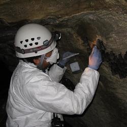
Filter Total Items: 14

EESC Makes an Impact: Reducing Management Costs and Increasing Efficiency

Decision analysis is widely used in business applications to improve cost saving and increase efficiency under uncertainty. Scientists at the U.S. Geological Survey Eastern Ecological Science Center (EESC) include world-renowned experts who use data, mathematics, statistics, and computer science to help frame and solve decision problems to support U.S. national security, public health, wildlife...
EESC Makes an Impact: Reducing Management Costs and Increasing Efficiency

EESC Makes an Impact: Reducing Management Costs and Increasing Efficiency

Decision analysis is widely used in business applications to improve cost saving and increase efficiency under uncertainty. Scientists at the U.S. Geological Survey Eastern Ecological Science Center (EESC) include world-renowned experts who use data, mathematics, statistics, and computer science to help frame and solve decision problems to support U.S. national security, public health, wildlife...
Learn More

Supporting Interstate Conservation of Atlantic Sturgeon (Acipenser o. oxyrinchus) Using Genetics, Telemetry, and Side-scan Sonar

USGS scientists are using innovative combinations of telemetry, genetics, and side-scan Sonar to support conservation of endangered Atlantic sturgeon ( Acipenser o. oxyrinchus).
Supporting Interstate Conservation of Atlantic Sturgeon (Acipenser o. oxyrinchus) Using Genetics, Telemetry, and Side-scan Sonar

Supporting Interstate Conservation of Atlantic Sturgeon (Acipenser o. oxyrinchus) Using Genetics, Telemetry, and Side-scan Sonar

USGS scientists are using innovative combinations of telemetry, genetics, and side-scan Sonar to support conservation of endangered Atlantic sturgeon ( Acipenser o. oxyrinchus).
Learn More

Using Multiple Indicators to Assess Stream Condition in the Chesapeake Bay

USGS is working with federal, state and local partners to develop multiple assessments of stream and river conditions in non-tidal areas of the Chesapeake Bay watershed. These assessments will help managers preserve stream health and improve biological conditions in impaired streams as the human population and climate continue to change in this region.
Using Multiple Indicators to Assess Stream Condition in the Chesapeake Bay

Using Multiple Indicators to Assess Stream Condition in the Chesapeake Bay

USGS is working with federal, state and local partners to develop multiple assessments of stream and river conditions in non-tidal areas of the Chesapeake Bay watershed. These assessments will help managers preserve stream health and improve biological conditions in impaired streams as the human population and climate continue to change in this region.
Learn More

Sustaining Horseshoe Crabs and Supporting Migratory Shorebirds in the Delaware Bay

USGS is developing predictive models to inform sustainable harvest of horseshoe crabs ( Limulus polyphemus) in Delaware Bay to help managers make decisions to support needs of people and shorebirds including rufa red knot ( Calidris canutus rufa).
Sustaining Horseshoe Crabs and Supporting Migratory Shorebirds in the Delaware Bay

Sustaining Horseshoe Crabs and Supporting Migratory Shorebirds in the Delaware Bay

USGS is developing predictive models to inform sustainable harvest of horseshoe crabs ( Limulus polyphemus) in Delaware Bay to help managers make decisions to support needs of people and shorebirds including rufa red knot ( Calidris canutus rufa).
Learn More

Northeast Amphibian Research and Monitoring Initiative

The U.S. Geological Survey’s Eastern Ecological Science Center is home to the Northeast Amphibian Research and Monitoring Initiative (NEARMI), one of 7 ARMI regions across the United States. NEARMI works on public lands in thirteen states from Maine to Virginia, including many National Parks and National Wildlife Refuges.
Northeast Amphibian Research and Monitoring Initiative

Northeast Amphibian Research and Monitoring Initiative

The U.S. Geological Survey’s Eastern Ecological Science Center is home to the Northeast Amphibian Research and Monitoring Initiative (NEARMI), one of 7 ARMI regions across the United States. NEARMI works on public lands in thirteen states from Maine to Virginia, including many National Parks and National Wildlife Refuges.
Learn More

Evaluating the Design of the Waterfowl Breeding Population and Habitat Survey

The Waterfowl Breeding Population and Habitat Survey (WBPHS) is a primary source of waterfowl population status and trend information for management of ducks in North America. The survey has not been reviewed in several decades, and since the last review new analysis approaches and information needs have created a need to reassess the design, scope of inference, and analysis of the survey to...
Evaluating the Design of the Waterfowl Breeding Population and Habitat Survey

Evaluating the Design of the Waterfowl Breeding Population and Habitat Survey

The Waterfowl Breeding Population and Habitat Survey (WBPHS) is a primary source of waterfowl population status and trend information for management of ducks in North America. The survey has not been reviewed in several decades, and since the last review new analysis approaches and information needs have created a need to reassess the design, scope of inference, and analysis of the survey to...
Learn More

Pre-listing Science Support in the Northeast

We are working closely with multiple partners to provide updated information, model potential outcomes, and identify key uncertainties relevant to amphibian and reptile species proposed for listing in the northeast US. We also provide timely science to partners to assist in recovery of listed species, which may involve field research, data analysis, or decision support.
Pre-listing Science Support in the Northeast

Pre-listing Science Support in the Northeast

We are working closely with multiple partners to provide updated information, model potential outcomes, and identify key uncertainties relevant to amphibian and reptile species proposed for listing in the northeast US. We also provide timely science to partners to assist in recovery of listed species, which may involve field research, data analysis, or decision support.
Learn More

Post-Hurricane Sandy Vegetation Recovery in the Presence of a Hyper-abundant Deer Population

The Challenge: The primary dune along barrier island beaches protects leeward vegetation from tidal fluctuation, salt spray and storm surge. However, storm surges like those experienced during Hurricane Sandy can obliterate the primary dune, transporting sand inland and burying existing vegetation. The dune rebuilds naturally as recovering vegetation traps wind-blown and waterborne sand. The rate...
Post-Hurricane Sandy Vegetation Recovery in the Presence of a Hyper-abundant Deer Population

Post-Hurricane Sandy Vegetation Recovery in the Presence of a Hyper-abundant Deer Population

The Challenge: The primary dune along barrier island beaches protects leeward vegetation from tidal fluctuation, salt spray and storm surge. However, storm surges like those experienced during Hurricane Sandy can obliterate the primary dune, transporting sand inland and burying existing vegetation. The dune rebuilds naturally as recovering vegetation traps wind-blown and waterborne sand. The rate...
Learn More

Implementing Cross Validation Approaches for Model Selection and Evaluating Goodness of Fit in Complex Hierarchical Models

It is (relatively) easy to construct complex hierarchical models for analysis of the North American Breeding Bird Survey (BBS), but deciding which model best describes population change is difficult. We are developing methods for model selection for BBS and other important survey data sets, and using them to refine our estimates of population change from this important survey.
Implementing Cross Validation Approaches for Model Selection and Evaluating Goodness of Fit in Complex Hierarchical Models

Implementing Cross Validation Approaches for Model Selection and Evaluating Goodness of Fit in Complex Hierarchical Models

It is (relatively) easy to construct complex hierarchical models for analysis of the North American Breeding Bird Survey (BBS), but deciding which model best describes population change is difficult. We are developing methods for model selection for BBS and other important survey data sets, and using them to refine our estimates of population change from this important survey.
Learn More

Design and Analysis of Surveys for Estimation of Temporal and Spatial Change in Animal Populations

Designing and analyzing large-scale animal surveys is an important focus of our research. Although we conduct research into analysis methods for many surveys, the primary focus of this project is to conduct analyses and develop web-based summaries of data from the North American Breeding Bird Survey (BBS).
Design and Analysis of Surveys for Estimation of Temporal and Spatial Change in Animal Populations

Design and Analysis of Surveys for Estimation of Temporal and Spatial Change in Animal Populations

Designing and analyzing large-scale animal surveys is an important focus of our research. Although we conduct research into analysis methods for many surveys, the primary focus of this project is to conduct analyses and develop web-based summaries of data from the North American Breeding Bird Survey (BBS).
Learn More

Hierarchical Models of Animal Abundance and Occurrence

The Challenge: Research goals of this project are to develop models, statistical methods, sampling strategies and tools for inference about animal population status from survey data. Survey data are always subject to a number of observation processes that induce bias and error. In particular, inferences are based on spatial sampling – we can only ever sample a subset of locations where species...
Hierarchical Models of Animal Abundance and Occurrence

Hierarchical Models of Animal Abundance and Occurrence

The Challenge: Research goals of this project are to develop models, statistical methods, sampling strategies and tools for inference about animal population status from survey data. Survey data are always subject to a number of observation processes that induce bias and error. In particular, inferences are based on spatial sampling – we can only ever sample a subset of locations where species...
Learn More

Spatial Capture-Recapture Models to Estimate Abundance and Density of Animal Populations

The Challenge: For decades, capture-recapture methods have been the cornerstone of ecological statistics as applied to population biology. While capture-recapture has become the standard sampling and analytical framework for the study of population processes (Williams, Nichols & Conroy 2002) it has advanced independent of and remained unconnected to the spatial structure of the population or the...
Spatial Capture-Recapture Models to Estimate Abundance and Density of Animal Populations

Spatial Capture-Recapture Models to Estimate Abundance and Density of Animal Populations

The Challenge: For decades, capture-recapture methods have been the cornerstone of ecological statistics as applied to population biology. While capture-recapture has become the standard sampling and analytical framework for the study of population processes (Williams, Nichols & Conroy 2002) it has advanced independent of and remained unconnected to the spatial structure of the population or the...
Learn More
Was this page helpful?