

In this episode of Eyes on Earth, we talk about the latest release of the National Land Cover Database (NLCD). More than just a map, NLCD is a stack of maps—a database. It has long been the foundational land cover source for scientists, resource managers, and decision-makers across the United States, and now the next generation of USGS land cover mapping is here.
By Earth Resources Observation and Science (EROS) Center
December 5, 2024
With research in land change, land cover, water, fire and climate, the USGS Earth Resources Observation and Science (EROS) Center always sends a diverse group of researchers to the annual meeting of the American Geophysical Union (AGU).
This year, almost half of EROS staff at AGU will focus on a major milestone: The first release of the Annual National Land Cover Database (NLCD).
“I’m very excited to present the recent release of Annual NLCD at AGU this year,” said USGS Project Manager Jesslyn Brown. “AGU is a fabulous meeting for this because it’s such a huge gathering of scientists.”
The weeklong conference starting December 9, 2024, will bring more than 25,000 attendees to Washington, D.C., including scientists from the U.S. Geological Survey (USGS). Along with land cover, the 20 or so EROS participants will present research on evapotranspiration, flooding, drought, climate, fire and data access and management.
Multiple Aspects of Annual NLCD
Media

Sources/Usage: Public Domain. View Media Details
“Our team is hitting it hard and making a lot of presentations (both oral and poster form) about our methods, validation and demonstration of use of the Annual NLCD data,” Brown said. Her own presentation about the development and cloud implementation of Annual NLCD will be part of a session about land change chaired by George Xian of EROS. In the same session, Rylie Fleckenstein, a KBR contractor, will talk about the deep learning method Land Cover Artificial Mapping System (LCAMS), which was developed to support Annual NLCD.
Like Brown, Josephine Horton, a KBR contractor, is enthused about telling the story of Annual NLCD. “This is a very big deal. NLCD has been the standard for land cover mapping in the United States for decades at this point,” she said.
Horton’s poster describes the effort under way to validate Annual NLCD. Scientists are collecting 10,000 plots across the country for ground truthing, or verifying the accuracy of the satellite data. An interpreter will review each plot from 1984-2023, and 5,000 plots will be chosen for review by a second interpreter. “With the annual time series, we really want to make sure that people understand how accurate it is, how consistent it is, and have the confidence they’ve always had in NLCD continue,” she said.
Several other EROS posters and presentations focus on Annual NLCD and land cover in general:
- Jesslyn Brown, “Development and Cloud Implementation of the New Annual National Land Cover Database for the United States”
- Heather Tollerud, “Future Directions and Updating Capabilities for Annual NLCD”
- Suming Jin, “A New Method for Producing Annual Cloud-Free Composite Images of 1984-2023 from Landsat Collection 2 for NLCD 2023 Production”
- Josephine Horton, "Creation of a Land Cover and Land Change Reference Dataset for Validation of Annual NLCD Collection 1"
- Rylie Fleckenstein, “Spatiotemporal Deep Learning for Land Cover Mapping with Landsat: Annual NLCD”
- Congcong Li, “Aligning NLCD Historical Land Cover Maps Based on Landsat Collection 1 to Collection 2”
- Francis Dwomoh, “Analyses of Interannual Climate Variability and Patterns of Land Cover Change in the Mississippi River Basin”
- Terry Sohl, “Multi-scale Scenario-based Modeling of Feedbacks among Land Use, Water Use, and Water Availability”
- George Xian, Townhall, USGCRP Coordination of Urban Climate Research in the Federal Agencies
Water, Flooding and Drought
Tracking water availability for agricultural purposes is another major focus of the research EROS scientists are presenting at AGU. The key measurement from a remote sensing perspective is evapotranspiration, or ET, which is the amount of water that evaporates and transpires and can be estimated by satellite data.
Several presentations spotlight water conditions for agriculture in Africa. EROS has worked with the Famine Early Warning Systems Network (FEWS NET) since the mid-1980s to help predict crop failure. Knowing the potential for drought or flooding beforehand allows food aid to be sent in a timely manner.
Gabriel Parrish, a contractor with Innovate! Inc., is sharing a poster about a new Landscape Water Requirement Satisfaction Index (L-WSRI). “L-WSRI essentially takes the landscape phenology into account, which is the seasonal pattern of vegetation,” he said, making it easier to track ET when seasonal onset fluctuates.
The index can peer back in time, too, to see when rainfall was insufficient for crops. “If you go to 1984, which was a major drought year in the Horn of Africa and the Sahel, you can see how in that marginal area next to the Sahara Desert, the L-WSRI is much lower than normal,” Parrish said.
One of Parrish’s coauthors, Gabriel Senay, USGS, will chair an AGU session on evapotranspiration as well as present two more posters, “Water Budgets of the Nile River Basin: Sources and Sinks” and “Integrating Remote Sensing and Global Weather Datasets through Agro-hydrologic Modeling for Drought Monitoring and Assessment Applications with FEWS NET.”
Other presentations about water and agriculture include:
- Shahriar Pervez, “Development of an Integrated Geospatial and Statistical Modeling Framework to Monitor and Forecast Floods for the Famine Early Warning Systems Network (FEWS NET)”
- Gabriel Senay, “Integrating Remote Sensing and Global Weather Datasets through Agro-hydrologic Modeling for Drought Monitoring and Assessment Applications with FEWS NET”
- Gabriel Senay, “Water Budgets of the Nile River Basin: Sources and Sinks”
- Gabriel Parrish, “A New Landscape Water Requirement Satisfaction Index for Drought Monitoring and Early Warning in Africa”
- Kul Khand, “Water Balance Equivalence (WABE) Method for Improving Accuracy of Remote Sensing-derived Evapotranspiration Products”
- Lei Ji, “Mapping Agricultural Irrigation Water Consumption across the Conterminous United States Using Remote Sensing-based Evapotranspiration Data”
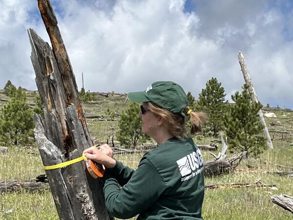
Lidar Applications for Fire
Media
Sources/Usage: Public Domain. View Media Details
Birgit Peterson, a USGS scientist, spent the last two summers with a team gathering observations from the Jasper Fire scar in South Dakota and the KNP Complex Fire in California using terrestrial lidar. “Lidar” stands for “light detection and ranging,” a remote sensing method that bounces light off the ground to capture 3-D imagery.
Peterson’s AGU presentation compares that land-based data with lidar data from the Global Ecosystem Dynamics Investigation (GEDI) sensor on the International Space Station (ISS). “We are collecting field data to help demonstrate how lidar observations can scale from point, to landscape, to regional scales,” she said. The object is to learn about fuel load estimation, fuel treatment planning, burn severity assessment and post-fire recovery monitoring for fire management purposes.
One of Peterson’s USGS coauthors, Kurtis Nelson, will be talking about a related topic: Evaluating new fire behavior models with data from a wide variety of remote sensing methods and sensors, from lidar to well-established satellites like Landsat. The presentation appraises the fire behavior models but also will explain which remote sensing data is most useful in evaluating the models.
- Birgit Peterson, “Leveraging Cross-Scale Lidar: Scaling Vegetation Structure Metrics Between Terrestrial Lidar and GEDI Observations for Wildfire Applications”
- Kurtis Nelson, “Evaluation of Next Generation Wildland Fire Behavior Models Using Multi-Scale Lidar and Satellite Imagery”
LP DAAC Talks Data
The EROS group also includes several representatives from NASA’s Land Processes Distributed Active Archive Center (LP DAAC), which is based at EROS. All three LP DAAC presenters aim to help make it easier for users to access data.
“As the USGS LP DAAC Project Scientist, it is my job to interact with the user community in order to learn about user wants, needs and gaps in support of NASA’s Land Remote Sensing Missions,” said Cole Krehbiel. He will be talking about LP DAAC’s key data access tool, Application for Extracting and Exploring Analysis Ready Samples (AppEEARS). “AppEEARS allows entry-level users from diverse user communities to begin working with NASA Earthdata (and select data from additional federal archives),” he said.
Mahsa Jami, a KBR contractor, will inform users about using AppEEARS and other resources to access data to research topics in biodiversity. His fellow KBR contractor Erik Bolch will emphasize a new repository of tutorials available to help manage datasets from ISS sensors like EMIT (Earth Surface Mineral Dust Source Investigation) and ECOSTRESS (Ecosystem Spaceborne Thermal Radiometer Experiment on Space Station).
- Cole Krehbiel, “Making Geospatial Data Easier to Access: NASA Earthdata’s Application for Extracting and Exploring Analysis Ready Samples”
- Mahsa Jami, “Simplifying Data Access: AppEEARS and Python Resources for Working with Biodiversity-relevant Remote Sensing Data”
- Erik Bolch, “The VITALS GitHub Repository: Python Resources for Working with EMIT and ECOSTRESS Data”
See the webpage highlighting Landsat contributions at AGU here. To learn more about any of the EROS research, go to the AGU 2024 website and use the Search feature at the top to find authors by name.
Related
In this episode of Eyes on Earth, we talk about the latest release of the National Land Cover Database (NLCD). More than just a map, NLCD is a stack of maps—a database. It has long been the foundational land cover source for scientists, resource managers, and decision-makers across the United States, and now the next generation of USGS land cover mapping is here.

Eyes on Earth Episode 122 – EROS Interns, 2024
In this episode of Eyes on Earth, we talked with some of the interns who worked at EROS this summer. They shared their experiences learning about the cloud, AI, wildland fire research, terrestrial lidar scanning, and more. The common theme among them was recognizing the value of the EROS mission and noticing the passion their co-workers demonstrated in their work.
In this episode of Eyes on Earth, we talked with some of the interns who worked at EROS this summer. They shared their experiences learning about the cloud, AI, wildland fire research, terrestrial lidar scanning, and more. The common theme among them was recognizing the value of the EROS mission and noticing the passion their co-workers demonstrated in their work.
Related
Eyes on Earth Episode 126 – Annual NLCD
In this episode of Eyes on Earth, we talk about the latest release of the National Land Cover Database (NLCD). More than just a map, NLCD is a stack of maps—a database. It has long been the foundational land cover source for scientists, resource managers, and decision-makers across the United States, and now the next generation of USGS land cover mapping is here.
In this episode of Eyes on Earth, we talk about the latest release of the National Land Cover Database (NLCD). More than just a map, NLCD is a stack of maps—a database. It has long been the foundational land cover source for scientists, resource managers, and decision-makers across the United States, and now the next generation of USGS land cover mapping is here.
Eyes on Earth Episode 122 – EROS Interns, 2024
In this episode of Eyes on Earth, we talked with some of the interns who worked at EROS this summer. They shared their experiences learning about the cloud, AI, wildland fire research, terrestrial lidar scanning, and more. The common theme among them was recognizing the value of the EROS mission and noticing the passion their co-workers demonstrated in their work.
In this episode of Eyes on Earth, we talked with some of the interns who worked at EROS this summer. They shared their experiences learning about the cloud, AI, wildland fire research, terrestrial lidar scanning, and more. The common theme among them was recognizing the value of the EROS mission and noticing the passion their co-workers demonstrated in their work.