
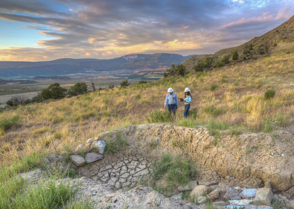
Land management research in support of streamlined energy development, economic growth, and wildfire management
FORT researchers provide sound science to support the Department of the Interior in its efforts to streamline reliable energy development, enhance cost efficiency in public lands management, and manage fire-prone habitats for public safety.
This research is developed in partnership with resource managers from local, State, Federal and Tribal governments, industry, and nongovernmental organizations, empowering local and rural communities to make decisions for themselves using high-quality data and smart tools.
Facilitating reliable energy development
All FORT scientists produce research products in support of efficient decision making on public lands, including decisions related to the acceleration of coal, oil, and gas development in America. Here are a few ongoing projects at FORT that can support streamlining of reliable energy development.
Expedited permitting on public lands
FORT computer scientists and biologists with the North American Bat Monitoring Program (NABat) are working with the Permitting Council to build a web portal for expedited delivery, review, exchange, and preservation of information related to permitting on Federal lands. With this portal, the interagency team aims to streamline environmental review across the federal government, and improve timeliness and transparency of decision-making for federal and non-federal users. Leveraging an open source and customizable tech-stack, the portal will deliver a unified environmental review data system that facilitates intuitive user flows using:
- High volume data streams
- An inventory of geospatial analytical products
- Dynamic data queries
- Informative analytics
- Automated report generation
- Connections to relevant applications and data stores through Application Programming Interfaces
This system will reduce time, labor, hosting and computing costs by implementing technology and data standards that address the number one reported need to improve existing workflows – rapid discovery and access to relevant data and information.
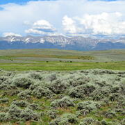
Science for energy development in southwestern Wyoming
Southwestern Wyoming is an area rich in natural resources, including large energy reserves and critical minerals. In 2007, the Wyoming Landscape Conservation Initiative (WLCI) – a coalition of local, State and Federal governments, private companies, and public citizens – formed with the mission to facilitate reliable energy development, mining, outdoor recreation and agriculture in the region, while enhancing aquatic and terrestrial habitats across southwestern Wyoming. Since 2007, USGS has provided much needed research and mapping capabilities as a main partner in this initiative.
Over the last 18 years, scientists at FORT and ten other USGS centers have published over 200 science products related to the mapping of Southwest Wyoming’s natural resources, the efficacy of habitat management projects, and the economics of land management. They have also developed protocols for monitoring of wildlife movement, vegetation change, and water quality trends, and aid managers by modeling future resource conditions under varying scenarios (such as, increased drought or potential vegetation treatments). Together, these tools inform managers on where energy development is feasible in southwest Wyoming, while offsetting its impacts to other land uses in the region.

Streamlined decision making on public lands
Many FORT research projects are coproduced with land managers, to ensure products are relevant to land management issues and useful for managers. For example, FORT scientists have worked closely with the Bureau of Land Management (BLM) to determine the agency’s priority science needs, including assessment of science-related legal challenges to BLM’s decisions.
Recently, FORT scientists created a new suite of products known as structured science syntheses, which synthesize science about priority management issues on public lands. These products are coproduced with resource managers, structured to align with relevant decision-making processes, and designed for ease of use. Ultimately, their aim is to assist managers in making speedy and defensible decisions on public lands. Published structured science syntheses include science that can streamline management of oil and gas development, nonmotorized recreation, and culvert construction. Upcoming syntheses will provide science information for management of wildfire, artificial intelligence data centers, invasive grasses, and other issues relevant to public lands managers.

Ensuring cost efficiency in public lands management
FORT economists research numerous topics related to the economics of public lands management, including studies of the economic impacts of wildfire, the costs of invasive grass treatments, and the value gained from outdoor recreation. This research promotes cost-effective decision making, while ensuring managers meet their goals for public safety, national security, and economic growth.
Economics of Wildland Fire
Economic Impacts of Public Lands Management
Economics of Outdoor Recreation
Environmental and Natural Resource Economics
Managing fire-prone habitats for public safety
Restoring native habitats to reduce invasive fine fuels
Invasive annual grasses like cheatgrass are fueling more frequent and intense wildfires across the Western United States, putting communities at higher risk. Multiple FORT research groups study the efficacy of common restoration practices, invasive species biology, and invasive species control measures, to help invasive species and wildland fire managers reduce the abundance of these fine fuels and ensure public safety. Recent and ongoing projects include:
- Evaluating the success of sagebrush restoration approaches in burned landscapes
- Estimating restoration treatment efficacy in fire-prone habitats
- Testing how fires influence new invasions to produce maps of post-fire invasion risk
- Understanding the timing of cheatgrass and red brome life cycles to better map and manage these invaders
- Investigating the causes and consequences of invading annual grasses to better predict and prevent future spread
- Exploring potential vectors of invasive annual grasses
- Synthesizing research on the effectiveness of popular herbicides in invasive grass treatment
Managing forests to reduce fire-related risks
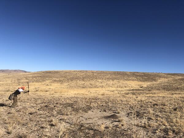
FORT scientists work closely with resource managers in the Sante Fe watershed to inform forest and fire management within this critical watershed. Currently, biologists in the New Mexico Landscapes Field Station are developing fire history records to inform local forest managers on the ways that drought and human management practices have influenced fires across time. This historical information can help forest managers develop best practices for reducing harms from future forest fires in the region.

Additional Land Management Science at FORT
Many FORT research projects are interdisciplinary. On the pages below, you can learn more about additional land management research from FORT, including science for invasive species and wildlife management, science on parcel-level wildfire risk mitigation, science investigating efficiency of agricultural practices, and science supporting outdoor recreation.
All Land Management Research Projects at FORT
FORT Science for Fish and Wildlife Management
FORT Science for Invasive Species Management
Shrubland, Alpine and Grassland Ecology (SAGE) Wildlife Research Group

Developing structured science syntheses for use in NEPA analyses and decision making in the Bureau of Land Management

Economics of Wildland Fire

Prioritizing Restoration of Sagebrush Ecosystems Tool (PReSET): A USGS-facilitated Decision-support Tool for Sagebrush Ecosystem Conservation and Restoration Actions

Human Dimensions of Resource Management

Fish and wildlife science in support of heritage preservation, efficient decision making, wild ungulate management, and outdoor recreation

Invasive species science in support of public safety, America’s natural resources, and economic growth

USGS Ecosystems Science in Support of Economic Growth

Economics of Outdoor Recreation

Economic Impacts of Public Lands Management

Economic assessment of addressing annual invasive grasses across the sagebrush biome

Identifying priority science needs for strengthening decision making on public lands
FORT researchers provide sound science to support the Department of the Interior in its efforts to streamline reliable energy development, enhance cost efficiency in public lands management, and manage fire-prone habitats for public safety.
This research is developed in partnership with resource managers from local, State, Federal and Tribal governments, industry, and nongovernmental organizations, empowering local and rural communities to make decisions for themselves using high-quality data and smart tools.
Facilitating reliable energy development
All FORT scientists produce research products in support of efficient decision making on public lands, including decisions related to the acceleration of coal, oil, and gas development in America. Here are a few ongoing projects at FORT that can support streamlining of reliable energy development.
Expedited permitting on public lands
FORT computer scientists and biologists with the North American Bat Monitoring Program (NABat) are working with the Permitting Council to build a web portal for expedited delivery, review, exchange, and preservation of information related to permitting on Federal lands. With this portal, the interagency team aims to streamline environmental review across the federal government, and improve timeliness and transparency of decision-making for federal and non-federal users. Leveraging an open source and customizable tech-stack, the portal will deliver a unified environmental review data system that facilitates intuitive user flows using:
- High volume data streams
- An inventory of geospatial analytical products
- Dynamic data queries
- Informative analytics
- Automated report generation
- Connections to relevant applications and data stores through Application Programming Interfaces
This system will reduce time, labor, hosting and computing costs by implementing technology and data standards that address the number one reported need to improve existing workflows – rapid discovery and access to relevant data and information.
Science for energy development in southwestern Wyoming
Southwestern Wyoming is an area rich in natural resources, including large energy reserves and critical minerals. In 2007, the Wyoming Landscape Conservation Initiative (WLCI) – a coalition of local, State and Federal governments, private companies, and public citizens – formed with the mission to facilitate reliable energy development, mining, outdoor recreation and agriculture in the region, while enhancing aquatic and terrestrial habitats across southwestern Wyoming. Since 2007, USGS has provided much needed research and mapping capabilities as a main partner in this initiative.
Over the last 18 years, scientists at FORT and ten other USGS centers have published over 200 science products related to the mapping of Southwest Wyoming’s natural resources, the efficacy of habitat management projects, and the economics of land management. They have also developed protocols for monitoring of wildlife movement, vegetation change, and water quality trends, and aid managers by modeling future resource conditions under varying scenarios (such as, increased drought or potential vegetation treatments). Together, these tools inform managers on where energy development is feasible in southwest Wyoming, while offsetting its impacts to other land uses in the region.
Streamlined decision making on public lands
Many FORT research projects are coproduced with land managers, to ensure products are relevant to land management issues and useful for managers. For example, FORT scientists have worked closely with the Bureau of Land Management (BLM) to determine the agency’s priority science needs, including assessment of science-related legal challenges to BLM’s decisions.
Recently, FORT scientists created a new suite of products known as structured science syntheses, which synthesize science about priority management issues on public lands. These products are coproduced with resource managers, structured to align with relevant decision-making processes, and designed for ease of use. Ultimately, their aim is to assist managers in making speedy and defensible decisions on public lands. Published structured science syntheses include science that can streamline management of oil and gas development, nonmotorized recreation, and culvert construction. Upcoming syntheses will provide science information for management of wildfire, artificial intelligence data centers, invasive grasses, and other issues relevant to public lands managers.
Ensuring cost efficiency in public lands management
FORT economists research numerous topics related to the economics of public lands management, including studies of the economic impacts of wildfire, the costs of invasive grass treatments, and the value gained from outdoor recreation. This research promotes cost-effective decision making, while ensuring managers meet their goals for public safety, national security, and economic growth.
Economics of Wildland Fire
Economic Impacts of Public Lands Management
Economics of Outdoor Recreation
Environmental and Natural Resource Economics
Managing fire-prone habitats for public safety
Restoring native habitats to reduce invasive fine fuels
Invasive annual grasses like cheatgrass are fueling more frequent and intense wildfires across the Western United States, putting communities at higher risk. Multiple FORT research groups study the efficacy of common restoration practices, invasive species biology, and invasive species control measures, to help invasive species and wildland fire managers reduce the abundance of these fine fuels and ensure public safety. Recent and ongoing projects include:
- Evaluating the success of sagebrush restoration approaches in burned landscapes
- Estimating restoration treatment efficacy in fire-prone habitats
- Testing how fires influence new invasions to produce maps of post-fire invasion risk
- Understanding the timing of cheatgrass and red brome life cycles to better map and manage these invaders
- Investigating the causes and consequences of invading annual grasses to better predict and prevent future spread
- Exploring potential vectors of invasive annual grasses
- Synthesizing research on the effectiveness of popular herbicides in invasive grass treatment
Managing forests to reduce fire-related risks
FORT scientists work closely with resource managers in the Sante Fe watershed to inform forest and fire management within this critical watershed. Currently, biologists in the New Mexico Landscapes Field Station are developing fire history records to inform local forest managers on the ways that drought and human management practices have influenced fires across time. This historical information can help forest managers develop best practices for reducing harms from future forest fires in the region.
Additional Land Management Science at FORT
Many FORT research projects are interdisciplinary. On the pages below, you can learn more about additional land management research from FORT, including science for invasive species and wildlife management, science on parcel-level wildfire risk mitigation, science investigating efficiency of agricultural practices, and science supporting outdoor recreation.
All Land Management Research Projects at FORT
FORT Science for Fish and Wildlife Management
FORT Science for Invasive Species Management
Shrubland, Alpine and Grassland Ecology (SAGE) Wildlife Research Group
Developing structured science syntheses for use in NEPA analyses and decision making in the Bureau of Land Management
Economics of Wildland Fire
Prioritizing Restoration of Sagebrush Ecosystems Tool (PReSET): A USGS-facilitated Decision-support Tool for Sagebrush Ecosystem Conservation and Restoration Actions
Human Dimensions of Resource Management
Fish and wildlife science in support of heritage preservation, efficient decision making, wild ungulate management, and outdoor recreation
Invasive species science in support of public safety, America’s natural resources, and economic growth
USGS Ecosystems Science in Support of Economic Growth
Economics of Outdoor Recreation
Economic Impacts of Public Lands Management
Economic assessment of addressing annual invasive grasses across the sagebrush biome