U.S. flag

An official website of the United States government

Nevada Water Science Center

The Nevada Water Science Center (NVWSC) is committed to providing reliable, unbiased scientific information about Nevada's water resources to the public, cooperators, and stakeholders. To provide this information, we operate widespread data collection networks as well as conduct water-science research covering a wide range of scientific issues throughout Nevada and adjacent states.

News

Saline Lake Ecosystems IWAA Fall 2024 Webinar Series

Saline Lake Ecosystems IWAA Fall 2024 Webinar Series

USGS Water Science Centers Join Forces at 2024 Lake Tahoe Summit

USGS Water Science Centers Join Forces at 2024 Lake Tahoe Summit

USGS releases Carson River Basin Hydro Mapper

USGS releases Carson River Basin Hydro Mapper

Publications

Assessment of water levels, nitrate, and arsenic in the Carson Valley Alluvial Aquifer and the development of a data visualization tool for the Carson River Basin, Nevada

Residents of Carson Valley, Douglas County, Nevada, rely on the basin-fill alluvial aquifer underlying the valley for drinking water. Since the 1980s, groundwater levels and water-quality data have been collected to monitor the status of the aquifer system and to assist in planning efforts to address current (2024) and future demand. The U.S. Geological Survey (USGS), in cooperation with Douglas C
Authors
Ramon C. Naranjo, Anjela Bubiy

A conceptual framework to assess post-wildfire water quality: State of the science and knowledge gaps

Wildfire substantially alters aquatic ecosystems by inducing moderate to catastrophic physical and chemical changes. However, the relations of environmental and watershed variables that drive those effects are complex. We present a Driver-Factor-Stressor-Effect (DFSE) conceptual framework to assess the current state of the science related to post-wildfire water-quality. We reviewed 64 peer-reviewe
Authors
Sarah M. Elliott, Michelle I. Hornberger, Donald O. Rosenberry, Rebecca Frus, Richard M. Webb

Remote sensing evapotranspiration in ensemble-based framework to enhance cascade routing and re-infiltration concept in integrated hydrological model applied to support decision making

Integrated hydrological models (IHMs) help characterize the complexity of surface–groundwater interactions. The cascade routing and re-infiltration (CRR) concept, recently applied to a MODFLOW 6 IHM, improved conceptualization and simulation of overland flow processes. The CRR controls the transfer of rejected infiltration and groundwater exfiltration from upslope areas to adjacent downslope areas
Authors
Mostafa Gomaa Daoud, Jeremy T. White, Eric D. Morway, Christiaan van der Tol, Maciek W. Lubczynski

Science

Arsenic in Nevada Groundwater

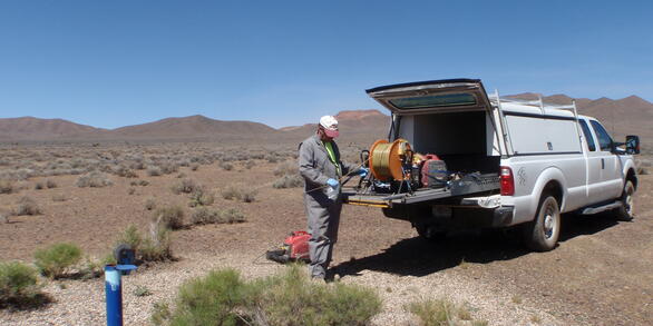
From 2007 to 2021, the U.S. Geological Survey (USGS) collaborated with the Nevada Bureau of Mines and Geology on evaluating the forms of arsenic in Nevada groundwater resources. A total of 190 groundwater samples were collected from wells and springs throughout Nevada. Concentrations of arsenic ranged from <1.6 to 2,408 micrograms per liter (µg/L); in most cases, arsenate was the dominant species...
link

Arsenic in Nevada Groundwater

From 2007 to 2021, the U.S. Geological Survey (USGS) collaborated with the Nevada Bureau of Mines and Geology on evaluating the forms of arsenic in Nevada groundwater resources. A total of 190 groundwater samples were collected from wells and springs throughout Nevada. Concentrations of arsenic ranged from <1.6 to 2,408 micrograms per liter (µg/L); in most cases, arsenate was the dominant species...
Learn More

Actionable Science

The Colorado River Basin Pilot Project is exploring new approaches for the USGS to answer complex earth systems questions identified in partnership with stakeholders, which cannot be answered through a single discipline approach. Science coproduction is a method where scientists, managers, policy makers, and other stakeholders first identify specific decisions to be informed by science, and then...
link

Actionable Science

The Colorado River Basin Pilot Project is exploring new approaches for the USGS to answer complex earth systems questions identified in partnership with stakeholders, which cannot be answered through a single discipline approach. Science coproduction is a method where scientists, managers, policy makers, and other stakeholders first identify specific decisions to be informed by science, and then...
Learn More

Integrated Science Approach

The USGS has a long history of delivering science and tools to help decision-makers manage and mitigate effects of drought. The timing is critical for the USGS to consolidate its diverse expertise into a single landscape-scale effort to rapidly provide integrated transdisciplinary, targeted data, tools, and models required by decision makers in the Basin. This initiative unifies USGS expertise...
link

Integrated Science Approach

The USGS has a long history of delivering science and tools to help decision-makers manage and mitigate effects of drought. The timing is critical for the USGS to consolidate its diverse expertise into a single landscape-scale effort to rapidly provide integrated transdisciplinary, targeted data, tools, and models required by decision makers in the Basin. This initiative unifies USGS expertise...
Learn More
Was this page helpful?