Hurricane Sandy flooding damages Connecticut sidewalk
Hurricane Sandy flooding damages Connecticut sidewalkFlooding from Hurricane Sandy breaks up a sidewalk at Seaside Park in Bridgeport, Connecticut.

Official websites use .gov
A .gov website belongs to an official government organization in the United States.
Secure .gov websites use HTTPS
A lock () or https:// means you’ve safely connected to the .gov website. Share sensitive information only on official, secure websites.
Click through our gallery of photographs showcasing New England Water Science Center research projects and monitoring work throughout the region.

Flooding from Hurricane Sandy breaks up a sidewalk at Seaside Park in Bridgeport, Connecticut.
Flooding from Hurricane Sandy breaks up a sidewalk at Seaside Park in Bridgeport, Connecticut.

USGS New England Water Science Center hydrologist measures a high-water level mark along the garage door of a coastal Connecticut home after Hurricane Sandy.
USGS New England Water Science Center hydrologist measures a high-water level mark along the garage door of a coastal Connecticut home after Hurricane Sandy.

A Hurricane Sandy high-water mark measured by USGS in Fairfield County, Connecticut. The Sandy high-water mark is marked above the high-water mark for the Great Hurricane of 1938 and below the area's 100-year flood measurement.
A Hurricane Sandy high-water mark measured by USGS in Fairfield County, Connecticut. The Sandy high-water mark is marked above the high-water mark for the Great Hurricane of 1938 and below the area's 100-year flood measurement.

Hurricane Sandy flooding remains days after the storm passes in Fairfield County, Connecticut.
Hurricane Sandy flooding remains days after the storm passes in Fairfield County, Connecticut.

Sand carried by Hurricane Sandy flood waters covers picnic tables at Short Beach in Stratford, Connecticut days after the storm.
Sand carried by Hurricane Sandy flood waters covers picnic tables at Short Beach in Stratford, Connecticut days after the storm.

Days after Hurricane Sandy passed through the northeastern Atlantic seaboard, this sailboat remained wrecked on a dock in Connecticut.
Days after Hurricane Sandy passed through the northeastern Atlantic seaboard, this sailboat remained wrecked on a dock in Connecticut.

Hurricane Sandy sent sand from Sound Beach in Old Lyme, Connecticut up the street to cover nearby benches.
Hurricane Sandy sent sand from Sound Beach in Old Lyme, Connecticut up the street to cover nearby benches.

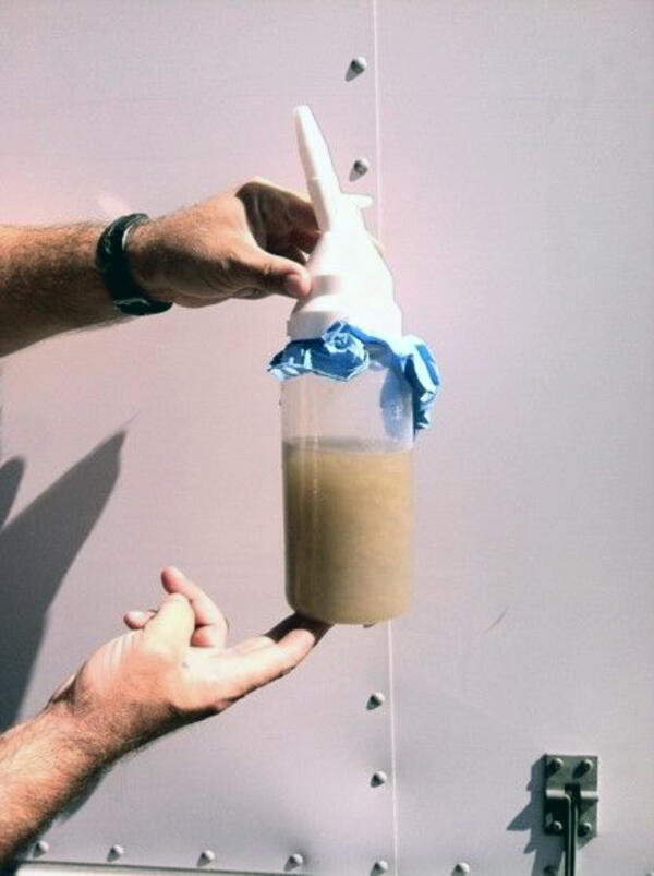
Hydrologic technician installs a storm-tide sensor ahead of Hurricane Sandy in Milford Harbor, Connecticut.
Hydrologic technician installs a storm-tide sensor ahead of Hurricane Sandy in Milford Harbor, Connecticut.

Two storm tide sensors installed on a piling attached to a boardwalk on Short Beach in Stratford, Connecticut ahead of Hurricane Sandy.
Two storm tide sensors installed on a piling attached to a boardwalk on Short Beach in Stratford, Connecticut ahead of Hurricane Sandy.

The impacts of Tropical Storm Irene lingered on long after the storm. This photo shows the Green River in Great Barrington, Massachusetts (USGS station ID 01198000) and was taken on May 14, 2012, almost a year after Irene. This tree was lodged under the Hurlburt Rd.
The impacts of Tropical Storm Irene lingered on long after the storm. This photo shows the Green River in Great Barrington, Massachusetts (USGS station ID 01198000) and was taken on May 14, 2012, almost a year after Irene. This tree was lodged under the Hurlburt Rd.

Photograph showing a bedrock outcrop near the intersection of Post Road and Daniel Webster Highway (New Hampshire State Route 3) in Hooksett, New Hampshire. During the summer, groundwater stains the exposed bedrock with precipitated iron oxides.
Photograph showing a bedrock outcrop near the intersection of Post Road and Daniel Webster Highway (New Hampshire State Route 3) in Hooksett, New Hampshire. During the summer, groundwater stains the exposed bedrock with precipitated iron oxides.

Sunrise on the shore of Spednic Lake before heading out on the lake to collect data for a study.
Sunrise on the shore of Spednic Lake before heading out on the lake to collect data for a study.

A rainbow over the USGS streamflow station gage house at the outlet of Bass Harbor Marsh in Maine (monitoring location 010228955).
A rainbow over the USGS streamflow station gage house at the outlet of Bass Harbor Marsh in Maine (monitoring location 010228955).

On October 6, 2011 USGS staff were visiting their streamflow station at the outlet of Bass Harbor Marsh and snapped this photo of a rainbow over the gage house.
On October 6, 2011 USGS staff were visiting their streamflow station at the outlet of Bass Harbor Marsh and snapped this photo of a rainbow over the gage house.

Flood damage from tropical storm Irene, August 28, 2011, washed out Maxam Road bridge on the West Branch North River in Colrain, Massachusetts.
Flood damage from tropical storm Irene, August 28, 2011, washed out Maxam Road bridge on the West Branch North River in Colrain, Massachusetts.

A debris line was left on the ground where the river reached its peak at USGS station ID 010642505 Saco River at Bartlett, New Hampshire. This is a type of High-Water Mark that was flagged for an indirect measurement of discharge.
A debris line was left on the ground where the river reached its peak at USGS station ID 010642505 Saco River at Bartlett, New Hampshire. This is a type of High-Water Mark that was flagged for an indirect measurement of discharge.
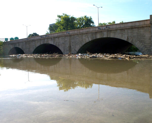
Debris jam from flooding after Tropical Strom Irene on the upstream side of the Bulkeley Bridge in Hartford, CT.
Debris jam from flooding after Tropical Strom Irene on the upstream side of the Bulkeley Bridge in Hartford, CT.
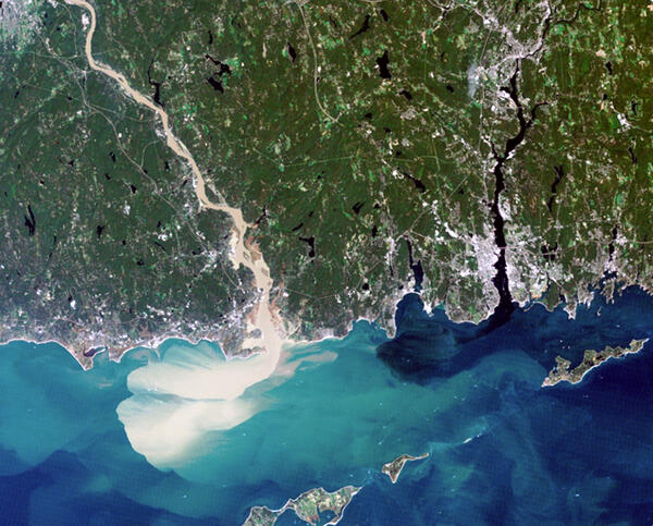
Satellite imagery of southern Connecticut showing the Connecticut River and the Thames River, with the Connecticut River a muddy color due to heavy sediment transport.
Satellite imagery of southern Connecticut showing the Connecticut River and the Thames River, with the Connecticut River a muddy color due to heavy sediment transport.

The channel at Roaring Brook needed reconstruction after Irene devastated the river system due to the immense rainfall. This image was taken looking upstream from Route 7 (North St) crossing in Bennington, Vermont.
The channel at Roaring Brook needed reconstruction after Irene devastated the river system due to the immense rainfall. This image was taken looking upstream from Route 7 (North St) crossing in Bennington, Vermont.