
Floods, Droughts, and Hazards
Floods, Droughts, and Hazards
Filter Total Items: 13

Assessing stormwater reduction through green infrastructure: RecoveryPark (Detroit, Mich.)
The effectiveness of green infrastructure (including urban land conversion and bioswales) at reducing stormwater runoff is being assessed at RecoveryPark, a redeveloped urban farm in Detroit, Michigan. This study will monitor pre- and post-construction storm-sewer flow, groundwater levels, precipitation, and potential evapotranspiration (ET) to evaluate stormwater-volume reduction in response to...
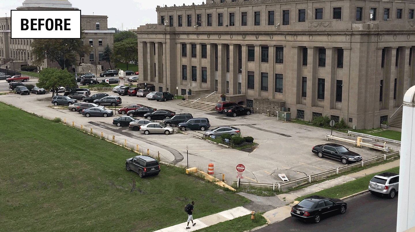
Assessing stormwater reduction using green infrastructure: Gary City Hall (Gary, Ind.)
The effectiveness of green infrastructure (rain gardens and decreased impervious surface) at reducing stormwater runoff and capturing dissolved chloride is being assessed at a redevelopment project at Gary City Hall (Gary, Indiana). This study will evaluate pre- and post-construction hydrologic conditions using data collected by monitoring storm-sewer flow, groundwater levels, soil moisture, and...

Kankakee River at Shelby Indiana
A Super Gage is a conventional streamflow gage equipped with continuous water-quality monitors. Super gages provide real-time data specifically designed to improved our understanding of watershed processes and to address specific water-resource issues such as climate and land-use effects, water-related human health issues, floods and droughts, or hazardous substance spills. Our ability to model...

GLRI Urban Stormwater Monitoring
The GLRI Urban Stormwater Monitoring effort brings together the expertise of the USGS with local and national partners to assess the ability of green infrastructure to reduce stormwater runoff in Great Lakes urban areas.

Ohio-Kentucky-Indiana Surface Water, Groundwater, Water-Quality Networks
The USGS has the principal responsibility within the federal government to provide the hydrologic information and understanding needed by others to achieve the best use and management of the nation’s water resources. Basic data are the key to solving many water-quantity or -quality problems. Ohio, Kentucky, and Indiana operate a large hydrologic network across the three states, collecting surface...

Low-Flow Statistics for Indiana Streams
Indiana and Kentucky scientists have produced new low-flow statistics for Indiana streams, specifically for 7-day, 10-year low flow (7Q10); 30-day, 10-year low flow (30Q10); 1-day, 10-year low flow (1Q10); and harmonic mean streamflow. The low-flow statistics are critical for the state of Indiana to administer the National Pollutant Discharge Elimination System (NPDES) permit program, watershed...

Ohio StreamGage Network
Our mission is provide the best quality stage and discharge information to our customers. The stage data along with discrete measurements are used to develop stage-discharge relationships thus inferring discharge.

Crest-Stage Streamgage Network In Ohio
Historically, streams with drainage areas less than 100 square miles have not been adequately represented in regional peak flow analysis. To help fill this data gap, crest-stage gages were installed in 2001 at 18 sites throughout Ohio in order to augment the peak flow record for small streams (less than 100 square miles). After enough peak flow data have been collected at these sites, an updated...

Indiana-Kentucky Climate Response Network
Do you recall the drought of 2012? Precipitation deficits during July 2012 were widespread. Morse Reservoir was a prominent sight that was highly visible in the news. Photos showed million dollar mansions with boats stranded on the lakebed. This drought took many by surprise, however, there were hydrologic signs during 2011. Events like this (and California) have brought some welcome attention to...

Bridge Scour Countermeasures
Flood events on rivers can cause erosion of the soil around a bridge foundation. This process is frequently referred to as bridge scour. Over time, scour can lead to bridge failure. To manage the risk from bridge scour, countermeasures are now used on bridge foundations. USGS scientists will be evaluating these bridge scour countermeasures at bridges across the country on rivers of various sizes.

River Meander Modeling - Wabash River
Significant flood events on the Wabash River between 3 mi downstream of Mt. Carmel, IL to 10 mi downstream from New Harmony, IN caused the collapse of the railroad pier, bridge, and trusses which crossed the river. Scientists are using two models to evaluate how future flooding may impact the current I-64 bridge and the river channel. One model will focus on river meander migration. The second...

Flood Inundation Mapping in Ohio, Kentucky, and Indiana
Flood inundation maps (FIMs) translate the stage of a river (shown on a hydrograph) to a map showing the extent and depth of flood waters. FIMS are created by combining datasets calculated by hydraulic models with ArcGIS, a geographic information system. FIMs can be used in conjunction with USGS real-time data and National Weather Service Flood Forecasts to plan and prepare for flood events. FIMs...