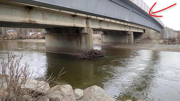
Surveying Contracted-Opening Indirect Measurements
Surveying Contracted-Opening Indirect MeasurementsThis video goes into detail about surveying high-water marks, various aspects of bridges, and cross sections for the contracted-opening method.

An official website of the United States government
Here's how you know
Official websites use .gov
A .gov website belongs to an official government organization in the United States.
Secure .gov websites use HTTPS
A lock () or https:// means you’ve safely connected to the .gov website. Share sensitive information only on official, secure websites.
Videos taken by Oklahoma-Texas Water Science Center employees .
 Surveying Contracted-Opening Indirect Measurements
This video goes into detail about surveying high-water marks, various aspects of bridges, and cross sections for the contracted-opening method.
This video goes into detail about surveying high-water marks, various aspects of bridges, and cross sections for the contracted-opening method.
This video discusses the general requirements that will be needed to accomplish a contracted-opening indirect discharge measurement. Approach section, contracted section, and necessary high-water mark locations are described along with scenarios where the method will not be successful.
This video discusses the general requirements that will be needed to accomplish a contracted-opening indirect discharge measurement. Approach section, contracted section, and necessary high-water mark locations are described along with scenarios where the method will not be successful.
Welcome to the USGS GeoLog Locator, an online tool for viewing and downloading digital borehole geophysical logs. These borehole logs are used to answer scientific questions about things like groundwater availability, geologic structure of the Earth, and certain characteristics of the structure of the soil and rock formations.
Welcome to the USGS GeoLog Locator, an online tool for viewing and downloading digital borehole geophysical logs. These borehole logs are used to answer scientific questions about things like groundwater availability, geologic structure of the Earth, and certain characteristics of the structure of the soil and rock formations.
 Be Water Aware: USGS "Water-on-the-Go" Mobile Application
The USGS Texas Water Science Center has developed a new mobile application called “Water On-the-Go” that gives people easy access to current conditions in streams across Texas. The information reflects what is happening in streams near you at that very moment.
The USGS Texas Water Science Center has developed a new mobile application called “Water On-the-Go” that gives people easy access to current conditions in streams across Texas. The information reflects what is happening in streams near you at that very moment.
 Awareness: USGS "Water-on-the-Go" Mobile App (Texas)
The USGS Texas Water Science Center has developed a new mobile application called “Water On-the-Go” that gives people easy access to current conditions in streams across Texas. The information reflects what is happening in streams near you at that very moment.
The USGS Texas Water Science Center has developed a new mobile application called “Water On-the-Go” that gives people easy access to current conditions in streams across Texas. The information reflects what is happening in streams near you at that very moment.
Hydrologists from Arizona aid the Texas Water Science Center in gathering measurements and other information after the catastrophic Blanco River flooding event that swept Austin, Texas.
Hydrologists from Arizona aid the Texas Water Science Center in gathering measurements and other information after the catastrophic Blanco River flooding event that swept Austin, Texas.
