
Science Posters
The USGS Pacific Coastal and Marine Science Center created posters about each of these completed research projects. Here, the posters are presented along with additional information.
Media

Sources/Usage: Public Domain. View Media Details
Media

Sources/Usage: Public Domain. View Media Details
Media

Sources/Usage: Public Domain. View Media Details
Media

Sources/Usage: Public Domain. View Media Details
Media

Sources/Usage: Public Domain. View Media Details
Media
Sources/Usage: Public Domain. View Media Details
Media

Sources/Usage: Public Domain. View Media Details
Media

Sources/Usage: Public Domain. View Media Details
Media

Sources/Usage: Public Domain. View Media Details
Media

Sources/Usage: Public Domain. View Media Details
Related
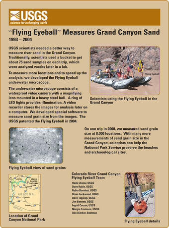
Below are science posters available from the USGS Pacific Coastal and Marine Science Center, which highlight a few of our completed studies.

Island-hopping Coral Larvae in Hawaii
Information about the USGS Pacific Coastal and Marine Science Center's 2003 study on island-hopping coral larvae in Hawaii.

Mapping Crater Lake, Oregon
Information about the USGS Pacific Coastal and Marine Science Center's Crater Lake mapping project in the summer of 2000.

Mapping Shipping Hazards in San Francisco Bay
Information about the 1997-1998 study by USGS Pacific Coastal and Marine Science Center, to map the floor of San Francisco Bay in order to reveal the bay's shipping hazards.

Giant Hawaiian Underwater Landslides
Information about the USGS Pacific Coastal and Marine Science Center's studies of giant underwater landslides in 1986 and 1988.
Related
Below are science posters available from the USGS Pacific Coastal and Marine Science Center, which highlight a few of our completed studies.
Island-hopping Coral Larvae in Hawaii
Information about the USGS Pacific Coastal and Marine Science Center's 2003 study on island-hopping coral larvae in Hawaii.
Mapping Crater Lake, Oregon
Information about the USGS Pacific Coastal and Marine Science Center's Crater Lake mapping project in the summer of 2000.
Mapping Shipping Hazards in San Francisco Bay
Information about the 1997-1998 study by USGS Pacific Coastal and Marine Science Center, to map the floor of San Francisco Bay in order to reveal the bay's shipping hazards.
Giant Hawaiian Underwater Landslides
Information about the USGS Pacific Coastal and Marine Science Center's studies of giant underwater landslides in 1986 and 1988.