
A 700-year rupture sequence of great eastern Aleutian earthquakes from tsunami evidence and modeling
New research from the USGS, University of Hawaiʻi, and the University of California, Santa Cruz provides fresh insights into a prehistoric sequence of earthquakes in the Aleutian Islands. Researchers inferred the earthquake sequence from coastal evidence of high tsunamis that inundated the eastern Aleutian Islands in the past 700 years.

Piecing Together Ancient Tsunami Events
Modeling demonstrated that the tsunamis generated by earthquakes in the Aleutian sequence propagated more than 3,910 km (2,400 mi) across the Pacific Ocean and inundated Hawaiian Island shorelines.
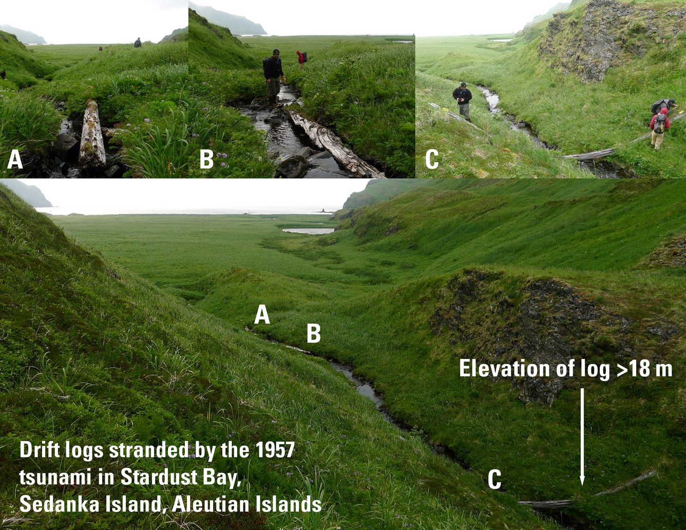
Deadly Aleutian-born tsunamis impacted Hawaiʻi in 1946 and 1957. However, the historical record of great earthquakes and tsunamis in the North Pacific is too short to assess the full range of hazards that may threaten Hawai'i. To explore the potential range of tsunami hazards caused by great Aleutian earthquakes, researchers were guided by evidence of large tsunamis archived in coastal sediment along Aleutian and Hawaiian shorelines. Researchers used the tsunami evidence to guide models representing the prehistoric tsunamis and earthquakes generated in the Aleutian Islands. The models that best fit the sedimentary evidence of tsunami inundation in both the Aleutians and Hawaiʻi represent a potential sequence of three great earthquakes in the Aleutian Islands going back 700 years. Similar methods were applied in the group’s earlier study that reconstructed the devastating 1957 Aleutian earthquake and tsunami.
Tsunami deposit stratigraphy in addition to earthquake and tsunami simulations suggest that three major earthquakes in the 18th (Mw ~8.4), 15th (Mw ~7.9), and 14th (Mw ~8.7) centuries each produced significant tsunamis, with inferred slip amounts along the Aleutian megathrust reaching up to 26, 32, and 22 meters, respectively.
The 14th-century event, in particular, led to inundation in Hawaiʻi that could have exceeded the inundation of the 1957 tsunami, highlighting the potential for hazards that exceed historic examples.
In the Aleutians, ports and coastal communities like Unalaska-Dutch Harbor on Unalaska Island, one of the nation’s largest fishing ports, would also be at severe risk during such events.
Why This Matters Now
Despite the relatively recent 1946 and 1957 events, tsunamis from the eastern Aleutian subduction zone remain a continuing threat to coastal communities in Hawaiʻi and Alaska.
This study improves understanding of the possible distribution and recurrence of these low-probability, great earthquakes along the Aleutian subduction zone, crucial for tsunami hazard assessments across the Pacific.
Related

Coastal and Marine Geohazards of the U.S. West Coast and Alaska
Related