
The Value of Our Reefs
Cost-benefit study confirms coral reef restoration could be a cost-effective way to save lives and money
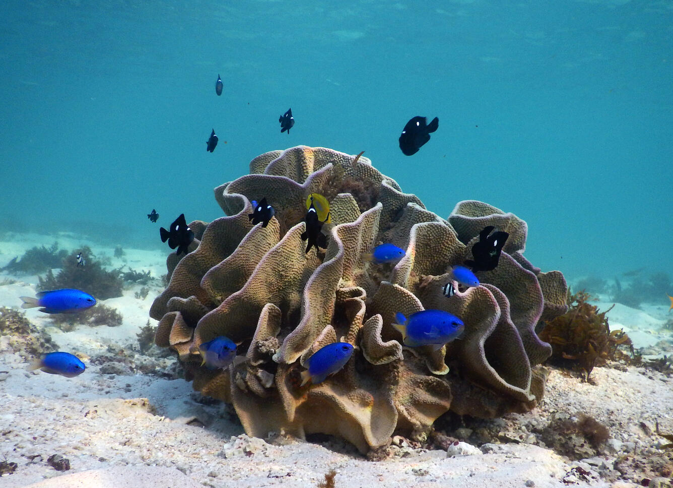
Explore the fascinating undersea world of coral reefs. Learn how we map, monitor, and model coral reefs so we can better understand, protect, and preserve our Nation's reefs.
Coral reefs are unique ecosystems of plants, animals, and their associated geological framework. Coral reefs cover less than 0.5 percent of the earth's surface, but are home to an estimated 25 percent of all marine species. Second only to tropical rainforests in size and complexity, some scientists estimate that more than one million species of plants and animals are associated with coral reefs.

Coral reefs are also of great economic importance to those who live on or visit islands in the Pacific and Atlantic Oceans. Reefs shelter and provide nursery grounds for many commercially and culturally important species of fish and invertebrates, they protect the islands' harbors, beaches, and shorelines from erosion and wave damage by storms, and they are vital to the marine tourism industry. These diverse ecosystems provide valuable goods and services worth about $4 billion each year to the U.S.’s coastal communities. Yet, as important as coral reefs are, these ecosystems are being threatened worldwide.


More than 8,500 square miles (22,000 square kilometers) of coral reef habitat is found in U.S. waters. Most of these coral reefs still appear to be relatively healthy, but some areas of dead and dying coral have been found in recent years. The causes of this degradation are poorly known, but are probably in part related to human activities.
The U.S. Geological Survey (USGS), working closely with academic institutions, state, and other Federal agencies, is spearheading an effort to better understand the geologic and oceanographic controls on the structure and processes of our Nation's coral reef ecosystems.
This web site is a gateway to USGS studies of coral reefs. We focus on the geophysical processes that influence the health and sustainability of coral reefs. From this work we are gaining new insight into the structure of coral reefs, providing the basis for future monitoring, and understanding better both the influences of natural processes and impacts of human activities on coral reef health. These efforts will help to preserve and protect the biodiversity, health, and social and economic value of these remarkable habitats.
Read more coral reef facts.
Learn about our current studies by topic:
We are developing new and unique oceanographic and environmental archives from coral skeleton records to better understand the compounding effects of land-use and environmental change on coral reef health.
We are conducting geophysical and geochemical research to address questions about coastal groundwater-to-reef flow and coral reef health, with the goal of informing management decisions related to planning and implementing activities in priority watershed-coral reef systems.
Reef Hydrodynamics and Sediment Processes
We are developing a better understanding how tides, waves, currents, and both land- and reef-derived sediment influence the development of coral reefs and their adjacent shorelines.
Role of Reefs in Coastal Protection
We are combining ocean, engineering, ecologic, social, and economic modeling to provide a high-resolution, rigorous, spatially-explicit valuation of the coastal flood protection benefits provided by coral reefs and the cost effectiveness of reef restoration for enhancing those benefits.
Reef Resource Assessments - Planning for the Future
We are mapping and assessing all of the important geologic and oceanographic factors to identify those coral reefs most at risk and those reefs that are potentially the most resilient and the most likely to recover from natural and human-driven impacts.
Learn about our studies by location:
Guam
Hawaiʻi
Kahoʻolawe
Kauaʻi
Kwajalein Island
Lānaʻi
Maui
Molokaʻi
Oʻahu
Puerto Rico
Roi-Namur Island
Tutuila
Our partners are numerous and include:
- U.S. Coral Reef Task Force (USCRTF)
- Department of the Interior
- Other Federal Partners
- State Partners
- Territorial and Commonwealth Partners
- Guam Division of Aquatic and Wildlife Resources
- Commonwealth of the Northern Mariana Islands Department of Land and Natural Resources
- American Samoa Department of Marine and Wildlife Resources
- Puerto Rico Department of Natural and Environmental Resources
- U.S. Virgin Islands Department of Planning and Natural Resources
- Academia
- University of California Santa Cruz - Institute of Marine Sciences
- University of Western Australia - Oceans Institute
- University of Puerto Rico at Mayaguez - Center for Applied Ocean Science & Engineering
- University of Hawaiʻi - Hawaiʻi Institute of Marine Biology
- Woods Hole Oceanographic Institution - Department of Geology and Geophysics
- Delft University of Technology - Department of Hydraulic Engineering
- Queen's University - Department of Civil Engineering
- University of Cantabria - Department of Sciences and Techniques in Water and Environment
- Non-governmental Organizations
Learn more about our related studies, and read basic facts about corals and reefs.
Guam coastal imagery and waves

View our web page that shows coastal imagery and wave characteristics near Adelup Point, Guam.
USGS Coral Reef Project

Explore the fascinating undersea world of coral reefs. Learn how we map, monitor, and model coral reefs so we can better understand, protect, and preserve our Nation's reefs.
Coral reefs are unique ecosystems of plants, animals, and their associated geological framework. Coral reefs cover less than 0.5 percent of the earth's surface, but are home to an estimated 25 percent of all marine species. Second only to tropical rainforests in size and complexity, some scientists estimate that more than one million species of plants and animals are associated with coral reefs.
Coral reefs are also of great economic importance to those who live on or visit islands in the Pacific and Atlantic Oceans. Reefs shelter and provide nursery grounds for many commercially and culturally important species of fish and invertebrates, they protect the islands' harbors, beaches, and shorelines from erosion and wave damage by storms, and they are vital to the marine tourism industry. These diverse ecosystems provide valuable goods and services worth about $4 billion each year to the U.S.’s coastal communities. Yet, as important as coral reefs are, these ecosystems are being threatened worldwide.
More than 8,500 square miles (22,000 square kilometers) of coral reef habitat is found in U.S. waters. Most of these coral reefs still appear to be relatively healthy, but some areas of dead and dying coral have been found in recent years. The causes of this degradation are poorly known, but are probably in part related to human activities.
The U.S. Geological Survey (USGS), working closely with academic institutions, state, and other Federal agencies, is spearheading an effort to better understand the geologic and oceanographic controls on the structure and processes of our Nation's coral reef ecosystems.
This web site is a gateway to USGS studies of coral reefs. We focus on the geophysical processes that influence the health and sustainability of coral reefs. From this work we are gaining new insight into the structure of coral reefs, providing the basis for future monitoring, and understanding better both the influences of natural processes and impacts of human activities on coral reef health. These efforts will help to preserve and protect the biodiversity, health, and social and economic value of these remarkable habitats.
Read more coral reef facts.
Learn about our current studies by topic:
We are developing new and unique oceanographic and environmental archives from coral skeleton records to better understand the compounding effects of land-use and environmental change on coral reef health.
We are conducting geophysical and geochemical research to address questions about coastal groundwater-to-reef flow and coral reef health, with the goal of informing management decisions related to planning and implementing activities in priority watershed-coral reef systems.
Reef Hydrodynamics and Sediment Processes
We are developing a better understanding how tides, waves, currents, and both land- and reef-derived sediment influence the development of coral reefs and their adjacent shorelines.
Role of Reefs in Coastal Protection
We are combining ocean, engineering, ecologic, social, and economic modeling to provide a high-resolution, rigorous, spatially-explicit valuation of the coastal flood protection benefits provided by coral reefs and the cost effectiveness of reef restoration for enhancing those benefits.
Reef Resource Assessments - Planning for the Future
We are mapping and assessing all of the important geologic and oceanographic factors to identify those coral reefs most at risk and those reefs that are potentially the most resilient and the most likely to recover from natural and human-driven impacts.
Learn about our studies by location:
Guam
Hawaiʻi
Kahoʻolawe
Kauaʻi
Kwajalein Island
Lānaʻi
Maui
Molokaʻi
Oʻahu
Puerto Rico
Roi-Namur Island
Tutuila
Our partners are numerous and include:
- U.S. Coral Reef Task Force (USCRTF)
- Department of the Interior
- Other Federal Partners
- State Partners
- Territorial and Commonwealth Partners
- Guam Division of Aquatic and Wildlife Resources
- Commonwealth of the Northern Mariana Islands Department of Land and Natural Resources
- American Samoa Department of Marine and Wildlife Resources
- Puerto Rico Department of Natural and Environmental Resources
- U.S. Virgin Islands Department of Planning and Natural Resources
- Academia
- University of California Santa Cruz - Institute of Marine Sciences
- University of Western Australia - Oceans Institute
- University of Puerto Rico at Mayaguez - Center for Applied Ocean Science & Engineering
- University of Hawaiʻi - Hawaiʻi Institute of Marine Biology
- Woods Hole Oceanographic Institution - Department of Geology and Geophysics
- Delft University of Technology - Department of Hydraulic Engineering
- Queen's University - Department of Civil Engineering
- University of Cantabria - Department of Sciences and Techniques in Water and Environment
- Non-governmental Organizations
Learn more about our related studies, and read basic facts about corals and reefs.
Guam coastal imagery and waves
View our web page that shows coastal imagery and wave characteristics near Adelup Point, Guam.
USGS Coral Reef Project