
Preliminary simulations of the 2011 Japan tsunami
Preliminary simulations of the tsunami from the March 11, 2011 M=9.1 subduction zone earthquake offshore of Honshu, Japan.
For more information about the earthquake that caused this tsunami:
- USGS Earthquake Hazards Program (EHP) event page
- USGS EHP Finite Fault Model used to create the tsunami generation
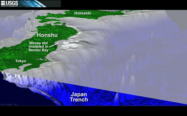
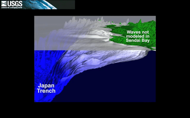
Please note that the program used to create these simulations does not model nonlinear and breaking effects as waves travel into shallow water (e.g., Sendai Bay).
Viewpoint north
Simulation shows first 2 hours of tsunami propagation.
Viewpoint south
Simulation shows first 2 hours of tsunami propagation.
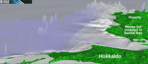
Close-up of the tsunami on the northern Honshu coast
Viewpoint looks to the south. Simulation shows first 2 hours of tsunami propagation.
See also, Notes From the Field
International Tsunami Survey Team visits Japan in May 2011, following the March 11, 2011 earthquake and tsunami.


Tsunami Hazards, Modeling, and the Sedimentary Record

Tsunami and Earthquake Research

Tsunami Field Studies

Preliminary Simulations of Recent Tsunamis
Preliminary simulations of the tsunami from the March 11, 2011 M=9.1 subduction zone earthquake offshore of Honshu, Japan.
For more information about the earthquake that caused this tsunami:
- USGS Earthquake Hazards Program (EHP) event page
- USGS EHP Finite Fault Model used to create the tsunami generation
Please note that the program used to create these simulations does not model nonlinear and breaking effects as waves travel into shallow water (e.g., Sendai Bay).
Viewpoint north
Simulation shows first 2 hours of tsunami propagation.
Viewpoint south
Simulation shows first 2 hours of tsunami propagation.
Close-up of the tsunami on the northern Honshu coast
Viewpoint looks to the south. Simulation shows first 2 hours of tsunami propagation.
See also, Notes From the Field
International Tsunami Survey Team visits Japan in May 2011, following the March 11, 2011 earthquake and tsunami.
Tsunami Hazards, Modeling, and the Sedimentary Record
Tsunami and Earthquake Research
Tsunami Field Studies