People fishing at Lees Ferry on the Colorado River
People fishing at Lees Ferry on the Colorado RiverFishing at dusk at Lees Ferry on the Colorado River, Glen Canyon. Photo by David Herasimtschuk, Freshwaters Illustrated.

Official websites use .gov
A .gov website belongs to an official government organization in the United States.
Secure .gov websites use HTTPS
A lock () or https:// means you’ve safely connected to the .gov website. Share sensitive information only on official, secure websites.
Below are images associated with SBSC's science and staff. Images appear according to the year they were taken. To search, type a keyword or select a year from the dropdown menu. Or, click through the pages using the arrows at the bottom of the page.
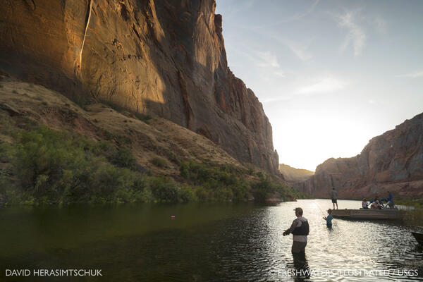
Fishing at dusk at Lees Ferry on the Colorado River, Glen Canyon. Photo by David Herasimtschuk, Freshwaters Illustrated.
Fishing at dusk at Lees Ferry on the Colorado River, Glen Canyon. Photo by David Herasimtschuk, Freshwaters Illustrated.
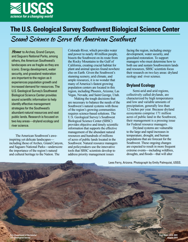
Southwest Biological Science Center fact sheet front cover. Fact Sheet available at FS 2019-3041: Sound Science to Serve the American Southwest (usgs.gov)
Southwest Biological Science Center fact sheet front cover. Fact Sheet available at FS 2019-3041: Sound Science to Serve the American Southwest (usgs.gov)

USGS Restoration Assessment and Monitoring Program for the Southwest (RAMPS) is helping to build capacity in ecosystem restoration on the Navajo Nation with a series of projects in collaboration with Navajo Nation Department of Natural Hertiage, Dine Native Plant Program, and the Native-led non-profit Tolani Lake Enterprises.
USGS Restoration Assessment and Monitoring Program for the Southwest (RAMPS) is helping to build capacity in ecosystem restoration on the Navajo Nation with a series of projects in collaboration with Navajo Nation Department of Natural Hertiage, Dine Native Plant Program, and the Native-led non-profit Tolani Lake Enterprises.
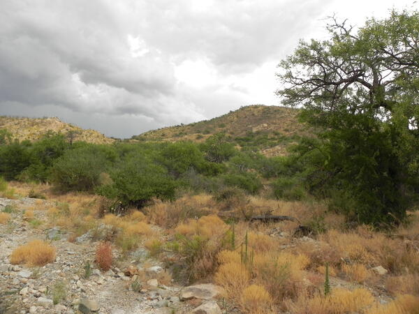
Arrieta Wash in southern Arizona, July 2019. Arrieta Wash is in Buenos Aires National Wildlife Refuge, just north of the U.S. and Mexico border, and is western yellow-billed cuckoo habitat. Photo by Charles Drost, SBSC, USGS.
Arrieta Wash in southern Arizona, July 2019. Arrieta Wash is in Buenos Aires National Wildlife Refuge, just north of the U.S. and Mexico border, and is western yellow-billed cuckoo habitat. Photo by Charles Drost, SBSC, USGS.

Dr. Rodrigo Macip with students, checking traps for mud turtles at Pátzcuaro lake, Michoacán, México. Dr. Macip is an authority on Méxican turtle ecology. He is a visiting scientist at USGS, Southwest Biological Science Center, Flagstaff, AZ.
Dr. Rodrigo Macip with students, checking traps for mud turtles at Pátzcuaro lake, Michoacán, México. Dr. Macip is an authority on Méxican turtle ecology. He is a visiting scientist at USGS, Southwest Biological Science Center, Flagstaff, AZ.
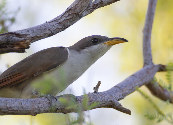
A western yellow-billed cuckoo (Coccyzus americanus) on a branch, Ash Meadows National Wildlife Refuge, NV, July 2019. Photo by Peter Pearsall, USGS.
A western yellow-billed cuckoo (Coccyzus americanus) on a branch, Ash Meadows National Wildlife Refuge, NV, July 2019. Photo by Peter Pearsall, USGS.

Image screen shot of GCMRC sediment monitoring application
Image screen shot of GCMRC sediment monitoring application

A USGS technician places a pin drop on a transect during monitoring soil and vegetation outcomes on a reclaimed oil or gas pad near Grand Junction, Colorado. Photo by Mike Duniway, SBSC, USGS.
A USGS technician places a pin drop on a transect during monitoring soil and vegetation outcomes on a reclaimed oil or gas pad near Grand Junction, Colorado. Photo by Mike Duniway, SBSC, USGS.

Dr Rodrigo Macip is an authority on Méxican turtle ecology. He is currently a visiting scientist at USGS, Southwest Biological Science Center's Flagstaff's campus.
Dr Rodrigo Macip is an authority on Méxican turtle ecology. He is currently a visiting scientist at USGS, Southwest Biological Science Center's Flagstaff's campus.

Graham's beardtongue (Penstemon grahamii) in the Book Cliffs south of the Uinta Basin, Utah. This species is confined to the Green River Formation, which contains oil shale that is actively mined across the species' range. Photo by Daniel Winkler, SBSC, USGS.
Graham's beardtongue (Penstemon grahamii) in the Book Cliffs south of the Uinta Basin, Utah. This species is confined to the Green River Formation, which contains oil shale that is actively mined across the species' range. Photo by Daniel Winkler, SBSC, USGS.
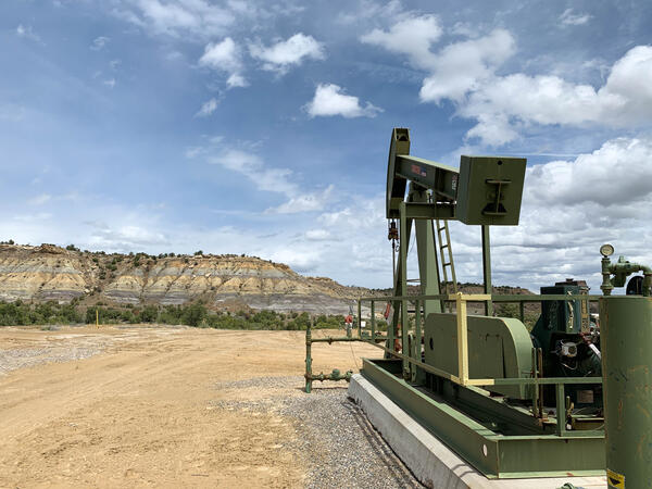
A pumpjack on an active oil or gas drilling site near Farmington, New Mexico. Photo by Mike Duniway, USGS, SBSC.
A pumpjack on an active oil or gas drilling site near Farmington, New Mexico. Photo by Mike Duniway, USGS, SBSC.

Lewis flax or Blue flax (Linum lewisii) flower at Canyonlands Research Center, Utah. Photo by Katie Laushman, USGS, SBSC.
Lewis flax or Blue flax (Linum lewisii) flower at Canyonlands Research Center, Utah. Photo by Katie Laushman, USGS, SBSC.

Dr. Brian Healy is a research biologist and post doctoral research fellow at the US Geological Survey
Dr. Brian Healy is a research biologist and post doctoral research fellow at the US Geological Survey

Photographs of a windblown (aeolian) dune in Grand Canyon National Park adjacent to a Colorado river sandbar before (inset) and after vegetation removal conducted by the National Park Service, which is intended to increase aeolian sand transport inland from the river, toward the right side of the photograph. This area is near an archaeological site.
Photographs of a windblown (aeolian) dune in Grand Canyon National Park adjacent to a Colorado river sandbar before (inset) and after vegetation removal conducted by the National Park Service, which is intended to increase aeolian sand transport inland from the river, toward the right side of the photograph. This area is near an archaeological site.

A partially-buried archaeological site in Grand Canyon National Park threatened by gully erosion of sediment on a river terrace near the Colorado River. Photo by Helen Fairley, USGS, SBSC, Grand Canyon Monitoring and Research Center, May 2019.
A partially-buried archaeological site in Grand Canyon National Park threatened by gully erosion of sediment on a river terrace near the Colorado River. Photo by Helen Fairley, USGS, SBSC, Grand Canyon Monitoring and Research Center, May 2019.

A research and monitoring area at a sandbar/sand dune near an archaeological site along the Colorado River in Grand Canyon before encroaching vegetation removal. Photo courtesy of Joel Sankey, USGS, Southwest Biological Science Center, Grand Canyon Monitoring and Research Center.
A research and monitoring area at a sandbar/sand dune near an archaeological site along the Colorado River in Grand Canyon before encroaching vegetation removal. Photo courtesy of Joel Sankey, USGS, Southwest Biological Science Center, Grand Canyon Monitoring and Research Center.
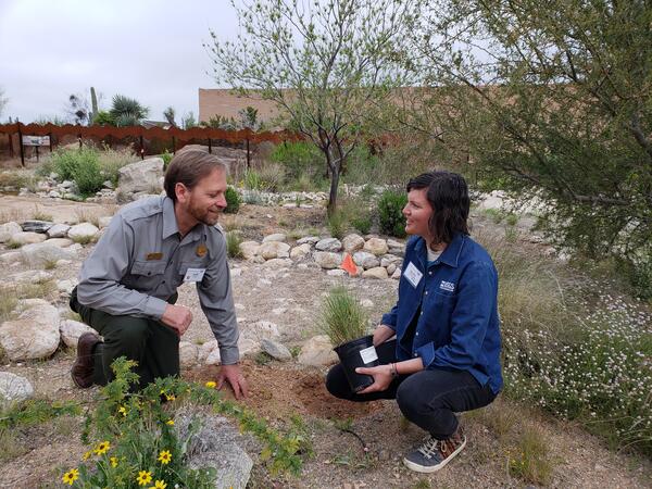
The USGS RAMPS program partnered with Saguaro National Park and the NPS Sonoran Desert Network Inventory and Monitoring Program to share knowledge about techniques for improving pollinator habitat at the NPS Desert Research and Learning Center in Tucson, AZ.
The USGS RAMPS program partnered with Saguaro National Park and the NPS Sonoran Desert Network Inventory and Monitoring Program to share knowledge about techniques for improving pollinator habitat at the NPS Desert Research and Learning Center in Tucson, AZ.

The Restoration Assessment and Monitoring Program for the Southwest (RAMPS) is working with the Navajo Nation Natural Heritage Program's Dine Native Plant Program to increase tribal native seed sovereignty by developing educational workshops, restoration experiments, and opportunities for famers to grow native seeds for restoration.
The Restoration Assessment and Monitoring Program for the Southwest (RAMPS) is working with the Navajo Nation Natural Heritage Program's Dine Native Plant Program to increase tribal native seed sovereignty by developing educational workshops, restoration experiments, and opportunities for famers to grow native seeds for restoration.

Inside view of a research boat on Lake Powell. SBSC conducts water quality monitoring in collaboration with the U.S. Bureau of Reclamation.
Inside view of a research boat on Lake Powell. SBSC conducts water quality monitoring in collaboration with the U.S. Bureau of Reclamation.

Panorama of Lake Powell with water quality monitoring research boat. Photo by SBSC, 2019.
Panorama of Lake Powell with water quality monitoring research boat. Photo by SBSC, 2019.

Original photos by P. Cryan (wind farm) and M. Huso (solar power tower), USGS. Blended photo created by S. Kemp, USGS.
Original photos by P. Cryan (wind farm) and M. Huso (solar power tower), USGS. Blended photo created by S. Kemp, USGS.