


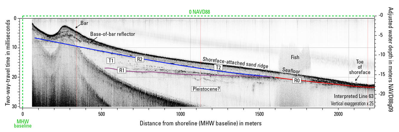


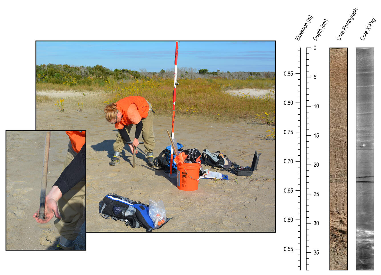


Research Geologist Daniel Ciarletta holds up a sand auger core collected at Fire Island
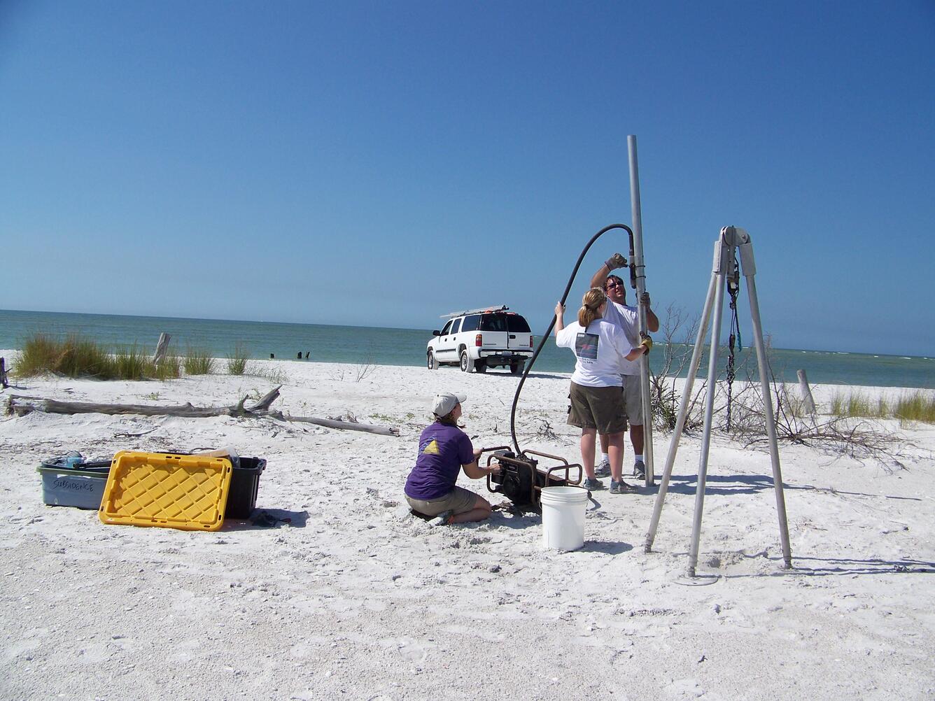
Research Geologist Daniel Ciarletta holds up a sand auger core collected at Fire IslandScientists collected sand auger cores from Fire Island to help reconstruct the evolution of the barrier over the last several centuries, with the goal of quantifying changes in sediment input and partitioning through time (e.g., how sand is distributed between the terrestrial portion of the barrier and the beach/shoreface).


