
Global Seabed Mineral Resources
Providing stakeholders with best available science regarding potential resources and environmental impacts associated with accessing those resources
Providing stakeholders with best available science regarding potential resources and environmental impacts associated with accessing those resources
Major Update to Satellite-Based Datasets Used to Assess Salt Marsh Vulnerability Nationwide
Seafloor Seismographs Rapidly Deployed Following Major Earthquake Offshore Northern California
Coral reef restoration
Cost-benefit study confirms coral reef restoration could be a cost-effective way to save lives and money
Cost-benefit study confirms coral reef restoration could be a cost-effective way to save lives and money
Ocean
USGS science improves our understanding of ocean processes, marine resources and submarine geohazards.
USGS science improves our understanding of ocean processes, marine resources and submarine geohazards.
Coasts
USGS provides critical science that informs risk reduction, protecting people, businesses, infrastructure, and resources along our coastlines, where 40% of our population lives.
USGS provides critical science that informs risk reduction, protecting people, businesses, infrastructure, and resources along our coastlines, where 40% of our population lives.
Meet the Coastal Science Navigator
Learn more about this new product to help you find useful USGS coastal data and tools
Learn more about this new product to help you find useful USGS coastal data and tools
Coastal and Marine Hazards and Resources Program
Scientists and staff study coastal and ocean processes, from shorelines to the deep sea, to identify hazards and provide critical information on our nation's resources. This work supports preparedness, emergency response, and the protection of people and resources in coastal and ocean environments.
Sound Waves Newsletter
Sound Waves Newsletter

Coastal and marine news from across the U.S. Geological Survey

News
Tracking sediment erosion and transport in a reef-adjacent watershed
Tracking sediment erosion and transport in a reef-adjacent watershed
SPCMSC and University of Miami Scientists Collaborate on New Experiments to Guide National Park Service Coral Restoration Plans
SPCMSC and University of Miami Scientists Collaborate on New Experiments to Guide National Park Service Coral Restoration Plans
Fate of barrier islands facing rising seas tied to underwater shape, new models show
Fate of barrier islands facing rising seas tied to underwater shape, new models show
Publications
Compounding of 100-year coastal floods by rainfall in an urban environment Compounding of 100-year coastal floods by rainfall in an urban environment
Coastal and pluvial flooding are both becoming more prevalent and severe due to climate change and urbanization in floodplains. The co-occurrence of these flood drivers is generally assumed to exacerbate the resulting flood impacts, a result referred to as compound flooding. However, few observational or modeling studies have investigated the circumstances under which this occurs. Here...
Comparisons of shoreline positions from satellite-derived and traditional field- and remote-sensing techniques Comparisons of shoreline positions from satellite-derived and traditional field- and remote-sensing techniques
Satellite-derived shorelines (SDS) have the potential to help researchers answer critical coastal science questions and support work to predict coastal change by filling in the spatial and temporal gaps present in current field-based and remote-sensing data collection methods. The U.S. Geological Survey conducted comparison analyses of traditionally sourced shorelines and SDS in diverse...
Proceedings of the Deepwater Hydrate Coring Expedition UT-GOM2-2 Proceedings of the Deepwater Hydrate Coring Expedition UT-GOM2-2
This report was the result of a scientific collaboration between the following institutions The University of Texas at Austin (UT), DOE, NETL, the United States Geological Survey (USGS), the Bureau of Ocean Energy Management (BOEM), The Ohio State University, Columbia University, University of New Hampshire, Oregon State University, University of Washington, Tufts University, Colorado...
Science
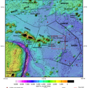
American Samoa Mapping Project
USGS scientists are leading a sampling effort to the Samoan Basin, offshore of American Samoa. This work is part of an interagency supported three-month hydrograph survey project led by NOAA and in partnership with BOEM.

Digital Shoreline Analysis System (DSAS)
Software for calculating positional boundary change over time The Digital Shoreline Analysis System (DSAS) version 6 is a standalone application that calculates shoreline or boundary change over time. The GIS of a user’s choice is used to prepare the data for DSAS. Like previous versions, DSAS v.6 enables a user to calculate rate-of-change statistics from multiple historical shoreline positions...
GeoPackage of Seabed Hazards to Offshore Infrastructure
Energy and resource development is increasing along the Nation’s outer continental shelves, where coastal waters meet the deep sea. Offshore infrastructure, such as oil and gas platforms and mining devices, help extract and transport resources from beneath the seafloor to where they’re needed on land. These resources are essential for powering homes and businesses across the country and supporting...