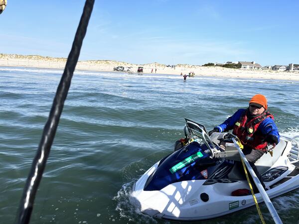
I study the geology of coastal margins, specifically how sediment availability and fluxes influence coastal evolution over a variety of time and space scales. My work, which spans the Atlantic and Gulf coasts, supports coastal management by providing insight into modern and future coastal behavior, the extent and quality of sediment resources, and spatial variability in ecosystem resilience.
I received a B.S. in Marine Science and a B.A. in Spanish from the University of South Carolina and a Ph.D. in Marine Science with a specialization in Coastal Geology from the Virginia Institute of Marine Science. In 2008, I started an NRC Postdoctoral Research Associateship at the Naval Research Laboratory at Stennis Space Center in Mississippi. In 2010, I began working for the USGS at the Saint Petersburg Coastal and Marine Science Center, where I explore how geologic variability influences coastal system change over a range of time scales. Using geophysics, remote sensing, and sediment sampling, I characterize coastal geology and identify relationships between geology and coastal system response to climate and storms. Also, I integrate observations with models to quantify the impact of existing variability on future coastal response.
Professional Experience
2010-present: Research Geologist, USGS, St. Petersburg Coastal and Marine Science Center
2008-2010: National Research Council Postdoctoral Fellow, Naval Research Laboratory, Stennis Space Center
Education and Certifications
2008: Ph.D., Marine Science, Coastal Geology concentration, Virginia Institute of Marine Science, College of William and Mary
2001: B.S. with Honors, Marine Science, University of South Carolina, Magna Cum Laude
2001: B.A. with Honors, Spanish, University of South Carolina, Magna Cum Laude
Science and Products
DUNEX Nearshore Geology
USGS DUNEX Operations on the Outer Banks
Storm-Related Barrier Island Morphological Evolution
Barrier Island Sensitivity to Changes in Sediment Supply
Shoreface Morphology and Geology
Modeling Barrier Island Evolution, Shoreface Morphology, and Overwash
Coastal Sediment Availability and Flux (CSAF) Capabilities
Coastal Sediment Availability and Flux (CSAF)
Coastal Change at Fire Island, a geonarrative
Coastal System Change at Fire Island, New York
Breach Evolution - Coastal System Change at Fire Island, New York
Hurricane Sandy - Coastal System Change at Fire Island, New York
Archive of Chirp Subbottom Profile Data Collected in 2022 From Seven Mile Island, New Jersey
Coastal Single-beam Bathymetry Data Collected in 2022 off Seven Mile Island, New Jersey
Sediment Data From Vibracores and Sand Augers Collected in 2021 and 2022 From Fire Island, New York
Ground Penetrating Radar and Global Positioning System Data Collected in 2021 From Fire Island, New York
Coastal Multibeam Bathymetry and Backscatter Data Collected in May 2021 from Seven Mile Island, New Jersey
Coastal Bathymetry and Backscatter Data Collected in June 2021 from Rockaway Peninsula, New York
Grain-Size Data From Sediment Samples at Seven Mile Island, New Jersey and Rockaway Peninsula, New York
Archive of Chirp Subbottom Profile Data Collected in 2019 From Rockaway Peninsula, New York
Coastal Bathymetry and Backscatter Data Collected in September-October 2019 from Rockaway Peninsula, New York
Archive of Chirp Subbottom Profile Data Collected in 2019 From Cedar Island, Virginia
Coastal Bathymetry and Backscatter Data Collected in August 2019 from Cedar Island, Virginia
Coastal Bathymetry Data Collected in August 2018 from the Chandeleur Islands, Louisiana
Exploring centennial barrier-inlet evolution: Insights from undeveloped and developed phases at Barnegat Inlet, New Jersey
Reconstructing the geomorphic evolution and sediment budget history of a dynamic barrier island: Anclote Key, Florida
Shoreface sediment availability offshore of a rapidly migrating, mixed-energy barrier island
Incorporating wave climate complexity into modeling lower shoreface morphology and transport
Contributions to uncertainty in runup forecasts
Exploring centennial barrier-inlet evolution: Insights from undeveloped and developed phases at Barnegat Inlet, New Jersey
Reconstructing the geomorphic evolution and sediment budget history of a dynamic barrier island: Anclote Key, Florida
Contributions to uncertainty in runup forecasts
Undeveloped and developed phases in the centennial evolution of a barrier-marsh-lagoon system: The case of Long Beach Island, New Jersey
Geologic framework, anthropogenic impacts, and hydrodynamics contribute to variable sediment availability and shoreface morphology at the Rockaway Peninsula, NY
Shoreface and Holocene sediment thickness offshore of Rockaway Peninsula, New York
Satellite-derived barrier response and recovery following natural and anthropogenic perturbations, northern Chandeleur Islands, Louisiana
Non-USGS Publications**
**Disclaimer: The views expressed in Non-USGS publications are those of the author and do not represent the views of the USGS, Department of the Interior, or the U.S. Government.
Subaerial Barrier Sediment Partitioning (SBSP) Model Version 1.0
Science and Products
- Science
Filter Total Items: 23
DUNEX Nearshore Geology
As part of the DUring Nearshore Event eXperiment (DUNEX) we are mapping the geology and morphology of the nearshore coastal environment before and after weather events to assess the impact storms have on coastal erosion.USGS DUNEX Operations on the Outer Banks
DUring Nearshore Event eXperiment (DUNEX) is a multi-agency, academic, and non-governmental organization (NGO) collaborative community experiment designed to study nearshore coastal processes during storm events. The experiment began in 2019 and is scheduled for completion in the fall of 2021. USGS participation in DUNEX will contribute new measurements and models that will increase our...Storm-Related Barrier Island Morphological Evolution
Storms quickly and dramatically alter barrier island environments by changing adjacent seafloor morphology, eroding beaches, scarping or leveling dunes, and sometimes creating new inlets. Measuring the magnitude of barrier island sediment movement during and after storms allows us to track rates of beach recovery, dune growth, and inlet-related alterations to barrier island sediment supply.Barrier Island Sensitivity to Changes in Sediment Supply
Observations and models show that maintaining barrier islands requires a balance between sea-level rise and sediment supply. However, most estimates of sediment supply are not based on modern conditions, which could result in less accurate predictions of sediment fluxes. We explore how natural and human alterations impact modern sediment fluxes, or changes, on barrier islands – research that has...Shoreface Morphology and Geology
Exchanges of sediment between the shoreface and barrier islands allow barrier islands to adjust to changes in water level, such as those associated with storms or sea-level rise. Characterizing shoreface morphology and geology allows us to explore how past and present processes have impacted modern barrier island sediment transport and what that means for future barrier island evolution.Modeling Barrier Island Evolution, Shoreface Morphology, and Overwash
Barrier island field observations provide information about past and current environmental conditions and changes over time; however, they can’t tell us about the future. Models can predict possible future behaviors but are only as good as their input data. By integrating both observations and models, we can extend observations and arrive at more realistic predictions of barrier island behavior...Coastal Sediment Availability and Flux (CSAF) Capabilities
As part of the Coastal Sediment Availability and Flux project, we use innovative technology and integrate a variety of techniques to characterize barrier island environments, reconstruct their past history, and predict their future vulnerability.Coastal Sediment Availability and Flux (CSAF)
Sediments are the foundation of coastal systems, including barrier islands. Their behavior is driven by not only sediment availability, but also sediment exchanges between barrier island environments. We collect geophysical, remote sensing, and sediment data to estimate these parameters, which are integrated with models to improve prediction of coastal response to extreme storms and sea-level rise...Coastal Change at Fire Island, a geonarrative
For more than two decades the U.S. Geological Survey has been researching Fire Island's offshore, nearshore, and barrier island systems to better understand drivers of coastal change and evolution. This geonarrative delves into how barrier islands change and evolve, demonstrates how seasons, storms and humans change beaches, and explores the role models play in predicting what the beach might look...Coastal System Change at Fire Island, New York
Fire Island is a 50-km long barrier island along the south shore of Long Island, New York. The island is comprised of seventeen year-round communities; federal, state, and county parks; and supports distinct ecosystems alongside areas of economic and cultural value. In addition to providing resources to its residents, the barrier island also protects the heavily-populated mainland from storm waves...Breach Evolution - Coastal System Change at Fire Island, New York
In 2012, during Hurricane Sandy, a breach formed in the Otis Pike High Dune Wilderness Area on Fire Island, NY.Hurricane Sandy - Coastal System Change at Fire Island, New York
USGS used several techniques to quantify the impacts of Hurricane Sandy on the ocean shoreline of Fire Island. - Data
Filter Total Items: 25
Archive of Chirp Subbottom Profile Data Collected in 2022 From Seven Mile Island, New Jersey
As part of the Coastal Sediment Availability and Flux project, scientists from the U.S. Geological Survey (USGS) St. Petersburg Coastal and Marine Science Center (SPCMSC) conducted a nearshore geophysical survey to map the shoreface and inner shelf, as well as characterizing stratigraphy near Seven Mile Island, New Jersey (NJ) in April and May 2022. The objective of the project is to improve the uCoastal Single-beam Bathymetry Data Collected in 2022 off Seven Mile Island, New Jersey
The U.S. Geological Survey St. Petersburg Coastal and Marine Science Center (USGS SPCMSC) collected single beam echosounder (SBES) data in the nearshore environment off Seven Mile Island, New Jersey in May 2022. This USGS data release includes the processed elevation point data (xyz) for Field Activity Number (FAN) 2022-309-FA, SubFAN 22BIM03 on board the research vessel (RV) Sallenger and SubFANSediment Data From Vibracores and Sand Augers Collected in 2021 and 2022 From Fire Island, New York
In 2021 and 2022, scientists from the U.S. Geological Survey (USGS) St. Petersburg Coastal and Marine Science Center (SPCMSC) and the USGS New York Water Science Center (NYWSC), on behalf of SPCMSC, conducted sediment sampling and ground penetrating radar (GPR) surveys at Point O' Woods and Ho-Hum Beach (NYWSC, 2021) and Watch Hill, Long Cove, and Smith Point (SPCMSC, 2022), Fire Island, New York.Ground Penetrating Radar and Global Positioning System Data Collected in 2021 From Fire Island, New York
In 2016, the U.S. Geological Survey (USGS) conducted ground penetrating radar (GPR) surveys and sediment sampling at Fire Island, New York to characterize and quantify spatial variability in the subaerial geology (Forde and others, 2018). These surveys, in combination with historical data, allowed for a preliminary reconstruction of the barriers long-term evolution. In 2021, scientists from the USCoastal Multibeam Bathymetry and Backscatter Data Collected in May 2021 from Seven Mile Island, New Jersey
Scientists from the U.S. Geological Survey St. Petersburg Coastal and Marine Science Center in St. Petersburg, Florida (USGS - SPCSMC), conducted a geophysical survey nearshore Seven Mile Island, New Jersey, during May 2021. During this study, multibeam bathymetry and acoustic backscatter data were collected aboard the R/V Sallenger. Efforts were supported by the National Fish and Wildlife FoundatCoastal Bathymetry and Backscatter Data Collected in June 2021 from Rockaway Peninsula, New York
Scientists from the U.S. Geological Survey St. Petersburg Coastal and Marine Science Center in St. Petersburg, Florida (USGS-SPCSMC), conducted a geophysical survey nearshore the Rockaway Peninsula, New York, during June 2021. During this study, multibeam bathymetry and acoustic backscatter data were collected aboard the R/V Sallenger. Efforts were supported by the National Fish and Wildlife FoundGrain-Size Data From Sediment Samples at Seven Mile Island, New Jersey and Rockaway Peninsula, New York
Sediment grab samples were collected from one onshore location and 32 undisturbed locations along the seafloor around Seven Mile Island, New Jersey (NJ) and Rockaway Peninsula, New York (NY). The sediment grab samples were collected in May and June of 2021 at locations within the area where multibeam bathymetry surveys were also conducted during the same trip. All sediment samples were analyzed usArchive of Chirp Subbottom Profile Data Collected in 2019 From Rockaway Peninsula, New York
As part of the Coastal Sediment Availability and Flux Project, scientists from the U.S. Geological Survey (USGS) St. Petersburg Coastal and Marine Science Center conducted a nearshore geophysical survey to map the shoreface of Rockaway, New York (NY) between September and October of 2019. The objective of the project is to improve the understanding of barrier island geomorphic evolution and the seCoastal Bathymetry and Backscatter Data Collected in September-October 2019 from Rockaway Peninsula, New York
Scientists from the U.S. Geological Survey St. Petersburg Coastal and Marine Science Center in St. Petersburg, Florida (USGS - SPCSMC), conducted a geophysical survey nearshore the Rockaway Peninsula, New York, during September and October 2019. During this study, multibeam bathymetry and acoustic backscatter data were collected aboard the R/V Sallenger (two separate survey efforts: Leg 1-OctoberArchive of Chirp Subbottom Profile Data Collected in 2019 From Cedar Island, Virginia
As part of the Coastal Sediment Availability and Flux Project, scientists from the U.S. Geological Survey (USGS) St. Petersburg Coastal and Marine Science Center conducted a nearshore geophysical survey to map the shoreface of Cedar Island, Virginia (VA) in August of 2019. The objective of the project is to improve the understanding of barrier island geomorphic evolution and the sediment fluxes thCoastal Bathymetry and Backscatter Data Collected in August 2019 from Cedar Island, Virginia
Scientists from the U.S. Geological Survey St. Petersburg Coastal and Marine Science Center in St. Petersburg, Florida (USGS SPCSMC), conducted a geophysical survey of Cedar Island, Virginia, August 2019. During this study, multibeam bathymetry and backscatter data were collected aboard the R/V Sallenger, while single-beam bathymetry were collected aboard a towed seismic sled. Efforts were supportCoastal Bathymetry Data Collected in August 2018 from the Chandeleur Islands, Louisiana
Scientists from the U.S. Geological Survey St. Petersburg Coastal and Marine Science Center in St. Petersburg, Florida (USGS-SPCSMC), conducted a bathymetric survey of the Northern Chandeleur Islands, in August 2018. During this study, multibeam bathymetry data were collected aboard the research vessel (R/V) Sallenger, while single-beam bathymetry data were collected aboard the R/V Jabba Jaw. Effo - Multimedia
- Publications
Filter Total Items: 51
Exploring centennial barrier-inlet evolution: Insights from undeveloped and developed phases at Barnegat Inlet, New Jersey
This study aims to identify the natural processes and the subsequent responses to coastal engineering and development on the alongshore evolution of the IB-BI-LBI inlet-barrier system. The primary focus will be the quantification of barrier island and inlet sediment partitioning at decadal to centennial timescales, from 1839-1941. We analyze historical alongshore evolution and track coastal engineAuthorsShane Nichols-O'Neill, Jorge Lorenzo-Trueba, Daniel J. Ciarletta, Jennifer L. MiselisReconstructing the geomorphic evolution and sediment budget history of a dynamic barrier island: Anclote Key, Florida
Decadal to centennial variations in sediment availability are a primary driver of coastal change within barrier systems. Models help explore how barrier morphology relates to past changes in magnitude of sediment availability, but this requires insights and validation from field efforts. In this study, we investigate the progradation of Anclote Key via its morphostratigraphy, a presently dynamic bAuthorsDaniel J. Ciarletta, Jennifer L. Miselis, Julie Bernier, Arnell S. Forde, Shannon A. MahanShoreface sediment availability offshore of a rapidly migrating, mixed-energy barrier island
Less is known about sediment exchanges between shorefaces and mixed-energy barrier islands (MEBI) than between shorefaces and wave-dominated barrier islands. We used seismic stratigraphy from Cedar Island, Virginia, USA to understand the interplay between shoreface deposits and MEBI morphodynamics. Interpretations reveal that the shelf and shoreface are extensively dissected by breach and inlet chAuthorsEmily A. Wei, Jennifer L. MiselisIncorporating wave climate complexity into modeling lower shoreface morphology and transport
The lower shoreface, a transitional subaqueous region extending from the seaward limit of the surf zone to beyond the closure depth, serves as a sediment reservoir and pathway in sandy beach environments over annual to millennial time scales. Despite the important role this region plays in shoreline dynamics, the morphodynamics of the lower shoreface remain poorly quantified and understood. To betAuthorsMegan Gillen, Andrew D. Ashton, Jennifer L. Miselis, Daniel J. Ciarletta, Emily A. Wei, Christopher R. SherwoodContributions to uncertainty in runup forecasts
The U.S. Geological Survey (USGS) provides operational forecasts of total water levels (TWL) and coastal change. Uncertainties around forecast TWL are based on the temporal and spatial range of observed beach slopes near the forecast site. This paper investigates other sources of uncertainty that are not accounted for, focusing on four beaches where the USGS has deployed remote cameras, and on outAuthorsChristopher R. Sherwood, Alfredo Aretxabaleta, Peter A. Traykovski, Jin-Si R. Over, Erin Lyons, David S. Foster, Jennifer L. Miselis, Timothy Nelson, Erdinc SogutExploring centennial barrier-inlet evolution: Insights from undeveloped and developed phases at Barnegat Inlet, New Jersey
This study aims to identify the natural processes and the subsequent responses to coastal engineering and development on the alongshore evolution of the IB-BI-LBI inlet-barrier system. The primary focus will be the quantification of barrier island and inlet sediment partitioning at decadal to centennial timescales, from 1839-1941. We analyze historical alongshore evolution and track coastal engineAuthorsShane Nichols-O'Neill, Jorge Lorenzo-Trueba, Daniel J. Ciarletta, Jennifer L. MiselisReconstructing the geomorphic evolution and sediment budget history of a dynamic barrier island: Anclote Key, Florida
Decadal to centennial variations in sediment availability are a primary driver of coastal change within barrier systems. Models help explore how barrier morphology relates to past changes in magnitude of sediment availability, but this requires insights and validation from field efforts. In this study, we investigate the progradation of Anclote Key via its morphostratigraphy, a presently dynamic bAuthorsDaniel J. Ciarletta, Jennifer L. Miselis, Julie Bernier, Arnell S. Forde, Shannon A. MahanContributions to uncertainty in runup forecasts
The U.S. Geological Survey (USGS) provides operational forecasts of total water levels (TWL) and coastal change. Uncertainties around forecast TWL are based on the temporal and spatial range of observed beach slopes near the forecast site. This paper investigates other sources of uncertainty that are not accounted for, focusing on four beaches where the USGS has deployed remote cameras, and on outAuthorsChristopher R. Sherwood, Alfredo Aretxabaleta, Peter A. Traykovski, Jin-Si R. Over, David S. Foster, Jennifer L. Miselis, Tim Nelson, Erdinc SogutUndeveloped and developed phases in the centennial evolution of a barrier-marsh-lagoon system: The case of Long Beach Island, New Jersey
Barrier islands and their associated backbarrier environments protect mainland population centers and infrastructure from storm impacts, support biodiversity, and provide long-term carbon storage, among other ecosystem services. Despite their socio-economic and ecological importance, the response of coupled barrier-marsh-lagoon environments to sea-level rise is poorly understood. Undeveloped barriAuthorsChristopher Tenebruso, Shane Nichols-O'Neill, Jorge Lorenzo-Trueba, Daniel J. Ciarletta, Jennifer L. MiselisGeologic framework, anthropogenic impacts, and hydrodynamics contribute to variable sediment availability and shoreface morphology at the Rockaway Peninsula, NY
Recent field and modeling studies have shown that barrier island resiliency is sensitive to sediment fluxes from the shoreface, making it important to evaluate how shoreface sediment availability varies in coastal systems. To do this, we assessed shoreface geology and morphology along the Rockaway Peninsula, NY, USA. We find that spatial variability in shoreface volume is influenced by sediment acAuthorsEmily A. Wei, Jennifer L. MiselisShoreface and Holocene sediment thickness offshore of Rockaway Peninsula, New York
During September and October 2019, the U.S. Geological Survey mapped the shoreface and inner continental shelf offshore of the Rockaway Peninsula in New York using high-resolution chirp seismic reflection and single-beam bathymetry geophysical techniques. The results from this study are important for assessing the Quaternary evolution of the Rockaway Peninsula and determining coastal sediment avaiAuthorsEmily A. Wei, Jennifer L. Miselis, Arnell S. FordeSatellite-derived barrier response and recovery following natural and anthropogenic perturbations, northern Chandeleur Islands, Louisiana
The magnitude and frequency of storm events, relative sea-level rise (RSLR), sediment supply, and anthropogenic alterations drive the morphologic evolution of barrier island systems, although the relative importance of any one driver will vary with the spatial and temporal scales considered. To explore the relative contributions of storms and human alterations to sediment supply on de-cadal changeAuthorsJulie Bernier, Jennifer L. Miselis, Nathaniel PlantNon-USGS Publications**
McNinch, J.E. and Miselis, J.L. (2012). Geology metrics for predicting shoreline change using seabed and sub-bottom observations from the surf zone. Eds. Sherwood, C., Li, M. International Association of Sedimentologists Special Publication, Vol. 44, 99-120.Miselis, J.L. and McNinch, J.E. (2006). Calculating shoreline erosion potential using nearshore stratigraphy and sediment volume: Outer Banks, North Carolina. Journal of Geophysical Research-Earth Surface, VOL. 111, F02019, doi:10.1029/2005JF000389)Kohn, M.J., Miselis, J.L., Fremd, T.J. (2002). Oxygen isotope evidence for progressive uplift of the Cascade Range, Oregon. Earth and Planetary Science Letters, 204: 151-165.**Disclaimer: The views expressed in Non-USGS publications are those of the author and do not represent the views of the USGS, Department of the Interior, or the U.S. Government.
- Software
Subaerial Barrier Sediment Partitioning (SBSP) Model Version 1.0
The Subaerial Barrier Sediment Partitioning (SBSP) model is a framework to simulate the morphological development of an idealized barrier coast in the cross-shore domain. The model code, built in MATLAB, consists of two scripts which must reside within the same folder when executed. The first, SBSP_InputControl.m, contains the user-defined input variables to run the simulation. The second, SBSP_Pr - News
Filter Total Items: 16