
Hurricane Joaquin - Forecast and Documentation of Coastal Change
Hurricane Joaquin coastal change forecast and pre- and post-storm photos documenting coastal change.
Hurricane Joaquin, though it did not make direct landfall on the U.S. coastline, affected a broad swath of mid-Atlantic and North-eastern states, from South Carolina to Massachusetts. Onshore winds from Joaquin combined with a non-tropical low pressure system led to high waves and elevated total water levels that impacted the coast for several days, causing extensive beach and dune erosion and even overwash in some locations.
Response Activities
- Forecast of potential coastal-change impacts (see below)
- Pre- and post-storm photo comparisons (see galleries below)
- Measuring post-storm morphology using airborne lidar. A lidar survey was conducted on November 28, 2015 over the entire extent of Assateague Island. Published as a USGS Data Release.
Forecast of Potential Coastal Change
The coastal change forecast model predicts the probability of where and how sand dunes along the coast will be impacted by water levels during a storm. This includes the combined effect of surge and wave runup. The color band closest to the shoreline is the probability of dune erosion, the middle color band is the probability that sand dunes will be overtopped by waves during the storm, and the outer color band is the probability that the sand dunes will be completely inundated/flooded. The model forecast is available on the Coastal Change Hazards Portal and more information about the model can be found here: Scenario-Based Assessments for Coastal Change Hazard Forecasts.

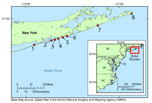
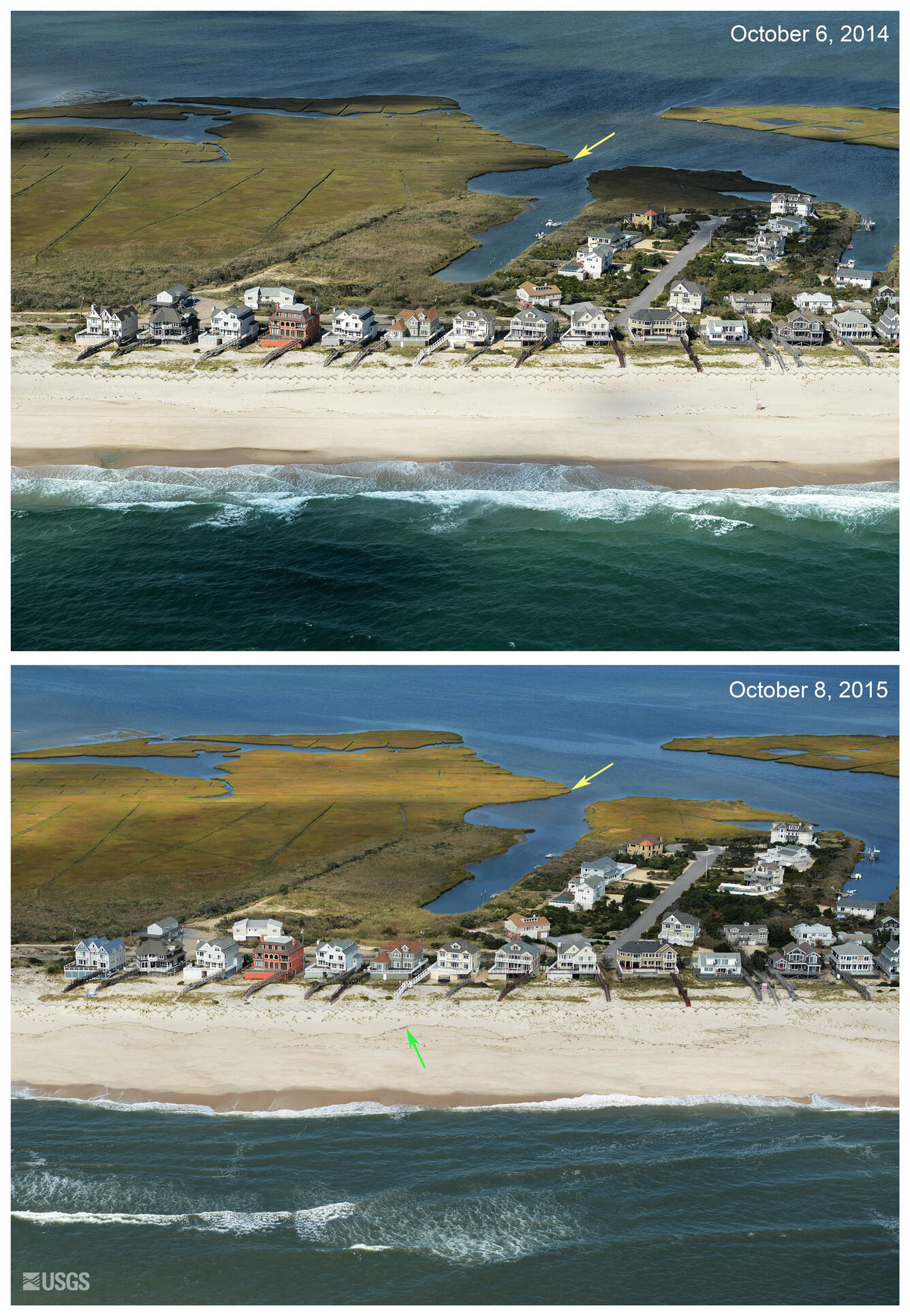
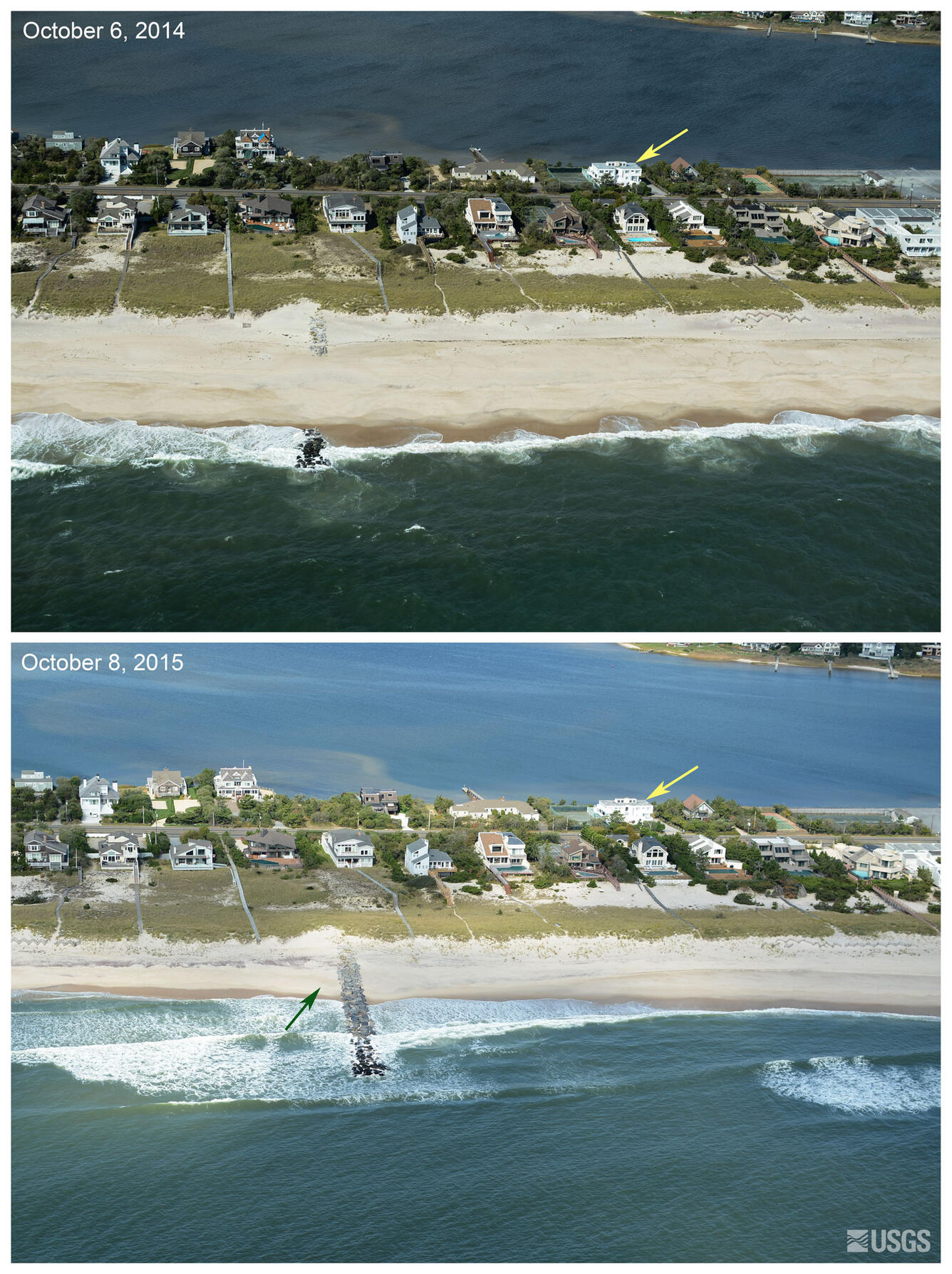
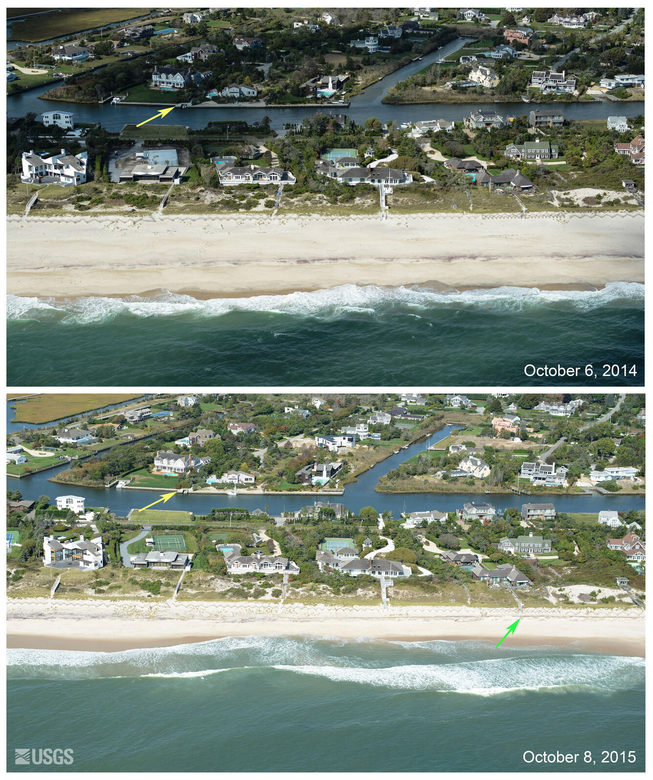
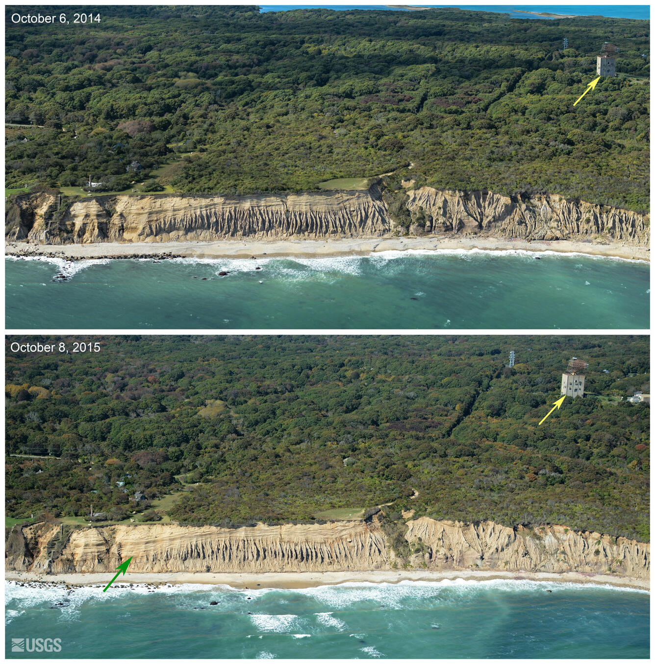
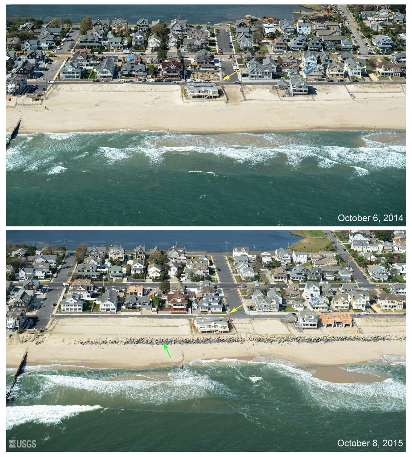
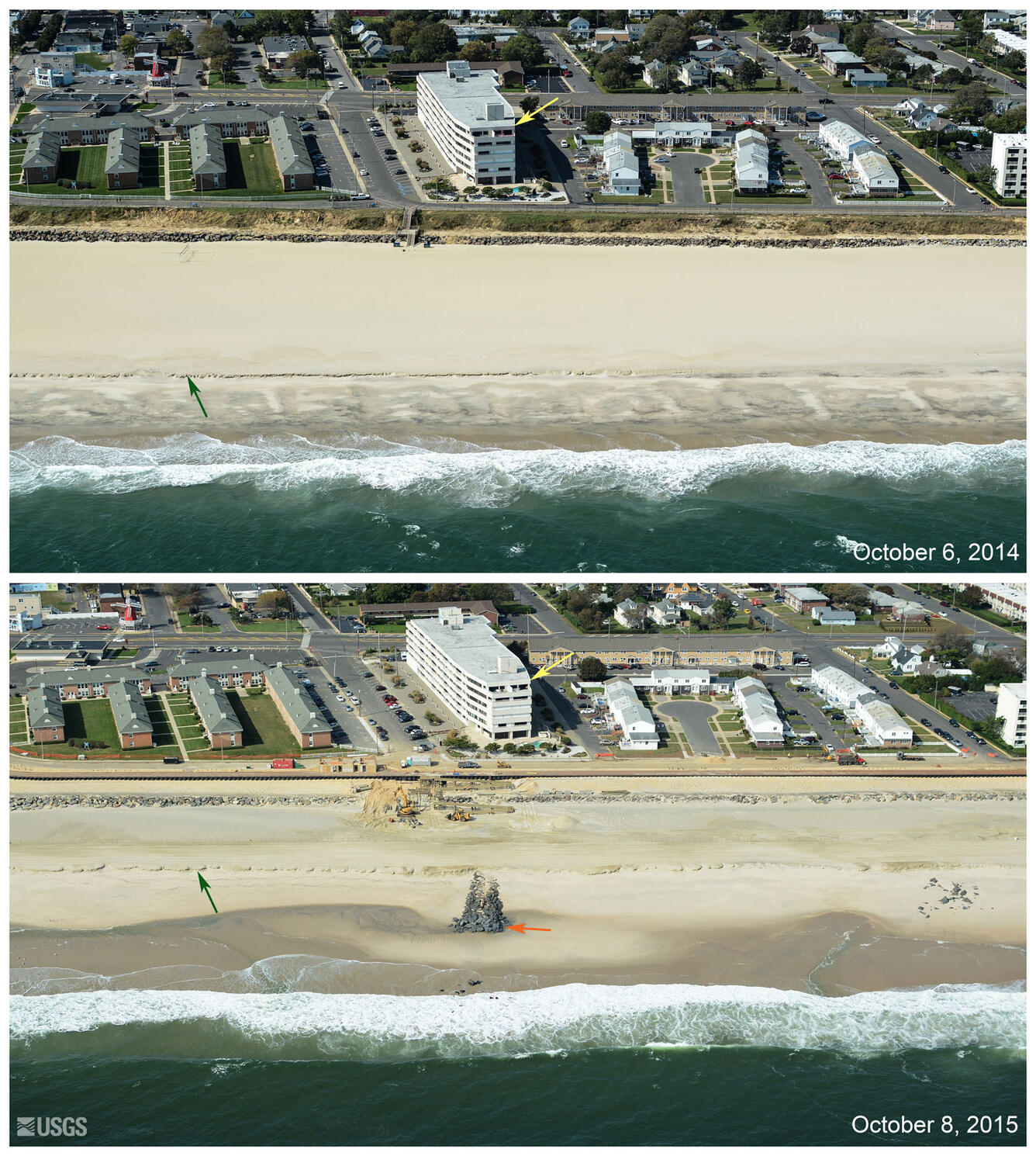
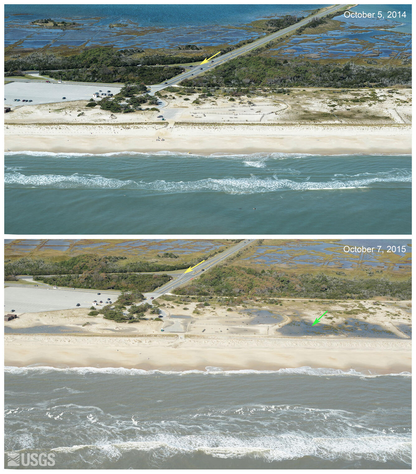
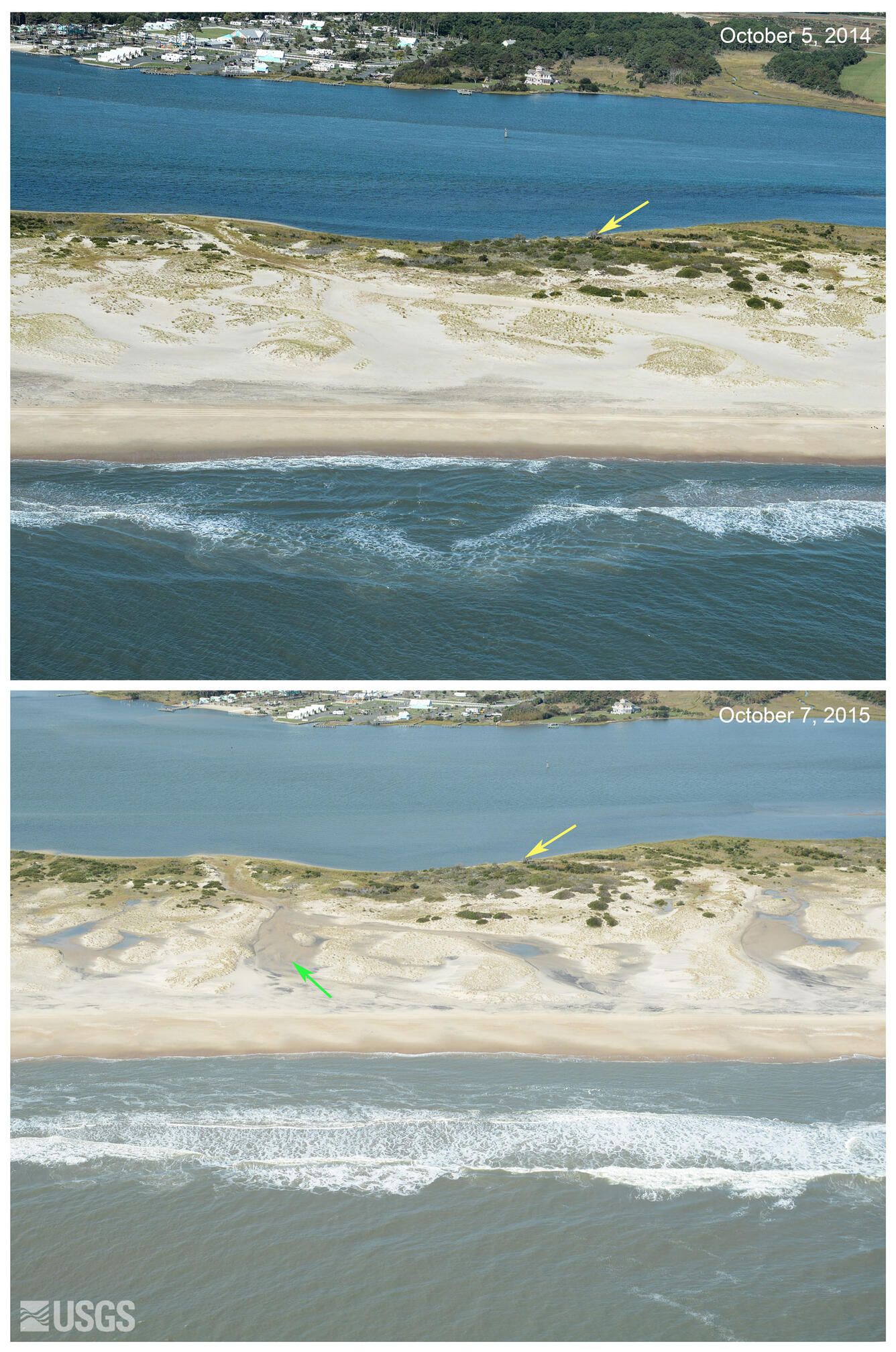
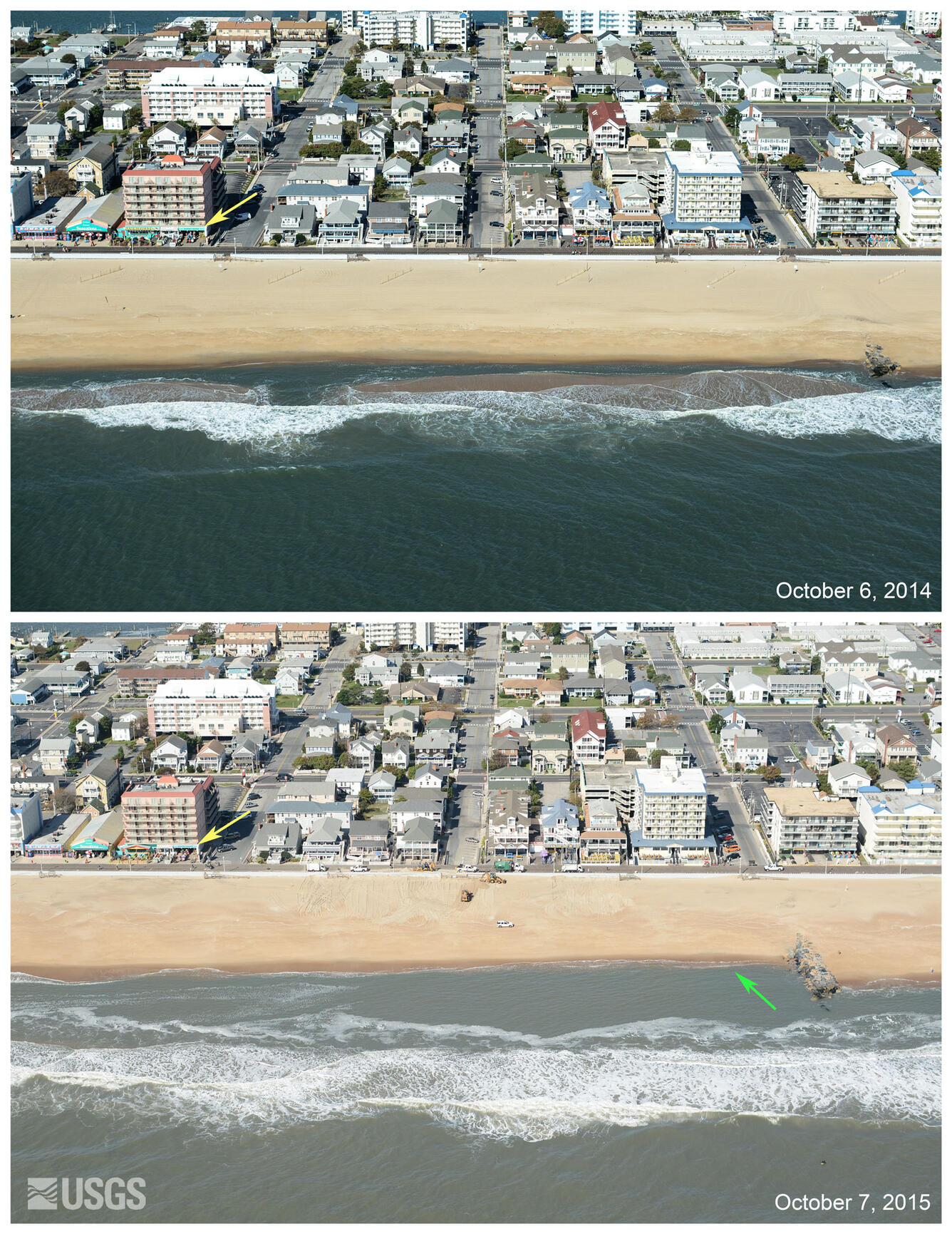
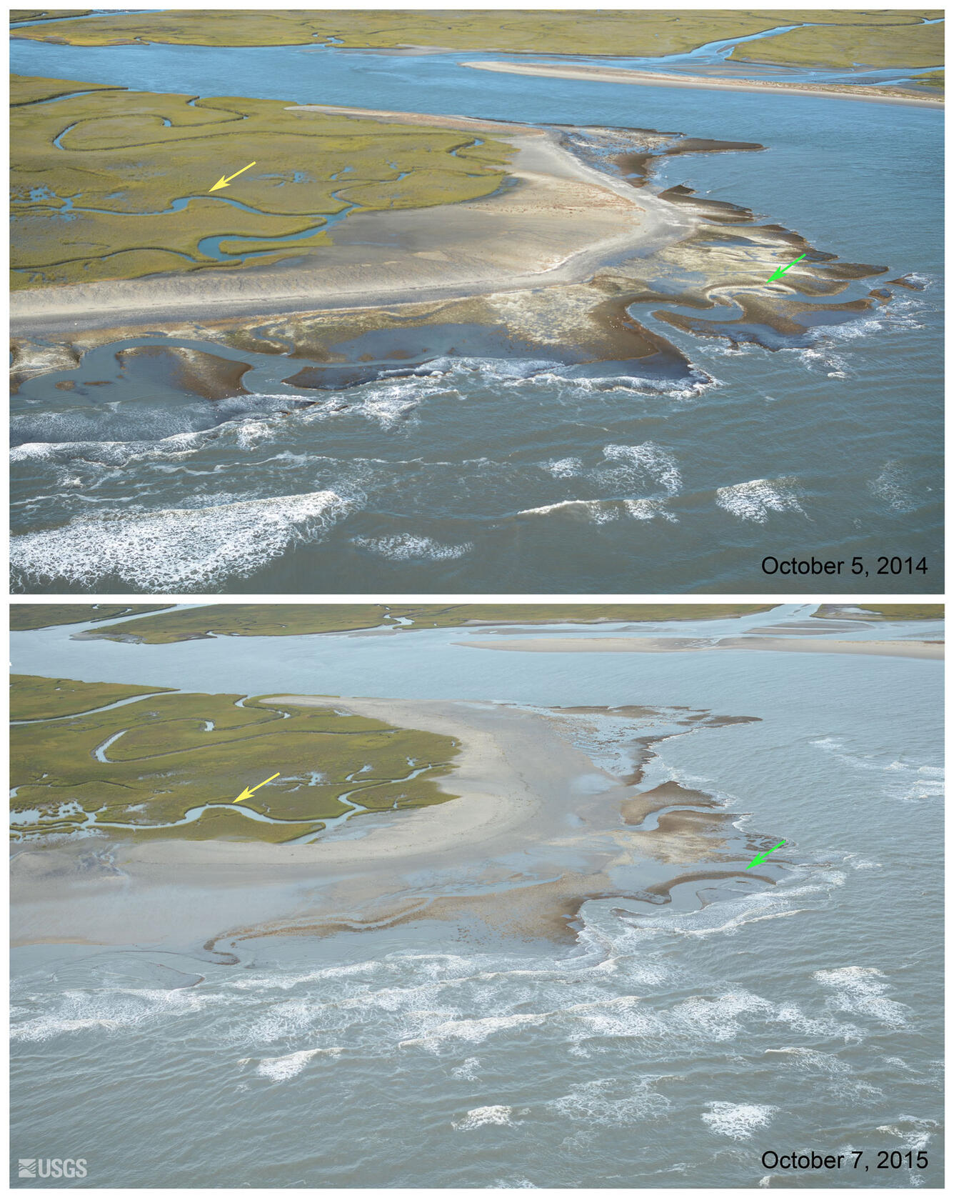
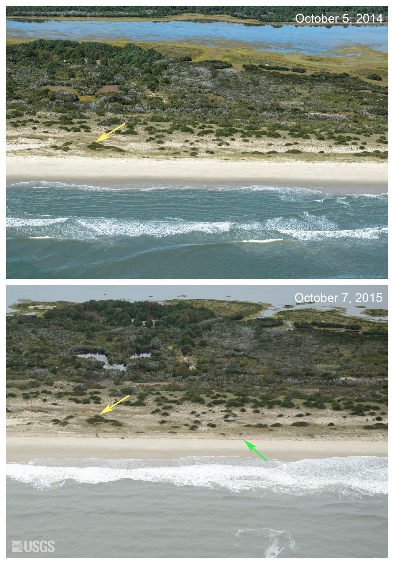
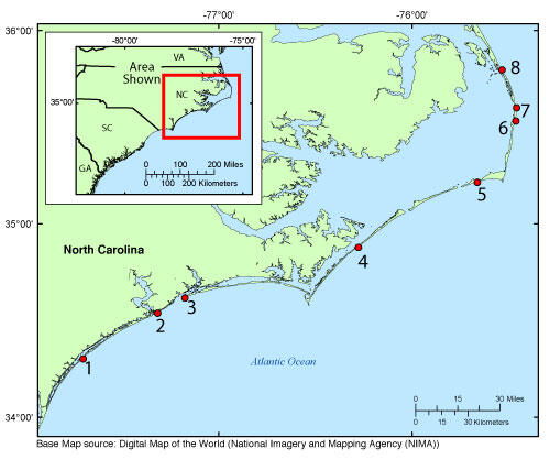
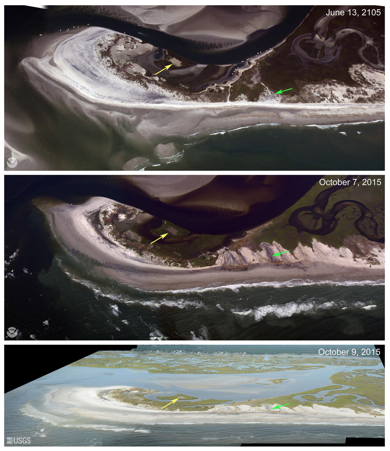
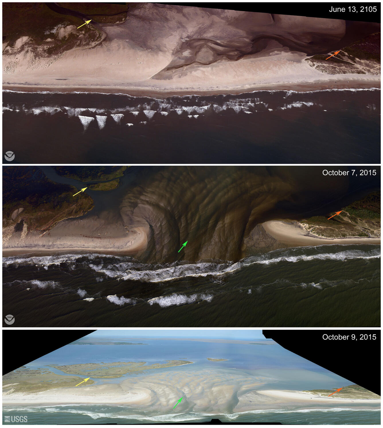
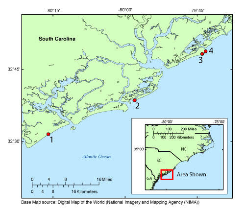
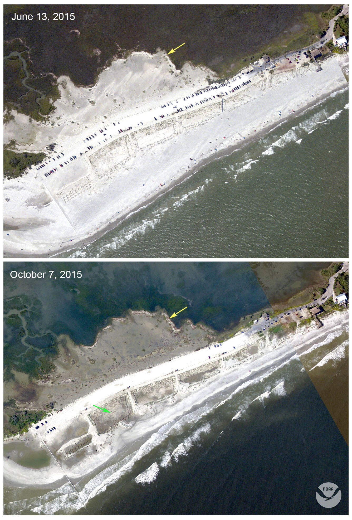
Pre-and Post-Storm Photo Comparisons
Photos pairs were used to compare the pre-storm and post-storm conditions at locations representing a broad range of coastal configurations and their response to the storm. Pre-storm photos were acquired during a baseline survey on October 6, 2014, and post-storm photos were acquired October 7, 2015.


Below are other science projects associated with this project.

Forecasting Coastal Change

National Assessment of Coastal Change Hazards
Hurricane Joaquin coastal change forecast and pre- and post-storm photos documenting coastal change.
Hurricane Joaquin, though it did not make direct landfall on the U.S. coastline, affected a broad swath of mid-Atlantic and North-eastern states, from South Carolina to Massachusetts. Onshore winds from Joaquin combined with a non-tropical low pressure system led to high waves and elevated total water levels that impacted the coast for several days, causing extensive beach and dune erosion and even overwash in some locations.
Response Activities
- Forecast of potential coastal-change impacts (see below)
- Pre- and post-storm photo comparisons (see galleries below)
- Measuring post-storm morphology using airborne lidar. A lidar survey was conducted on November 28, 2015 over the entire extent of Assateague Island. Published as a USGS Data Release.
Forecast of Potential Coastal Change
The coastal change forecast model predicts the probability of where and how sand dunes along the coast will be impacted by water levels during a storm. This includes the combined effect of surge and wave runup. The color band closest to the shoreline is the probability of dune erosion, the middle color band is the probability that sand dunes will be overtopped by waves during the storm, and the outer color band is the probability that the sand dunes will be completely inundated/flooded. The model forecast is available on the Coastal Change Hazards Portal and more information about the model can be found here: Scenario-Based Assessments for Coastal Change Hazard Forecasts.
Pre-and Post-Storm Photo Comparisons
Photos pairs were used to compare the pre-storm and post-storm conditions at locations representing a broad range of coastal configurations and their response to the storm. Pre-storm photos were acquired during a baseline survey on October 6, 2014, and post-storm photos were acquired October 7, 2015.
Below are other science projects associated with this project.
Forecasting Coastal Change