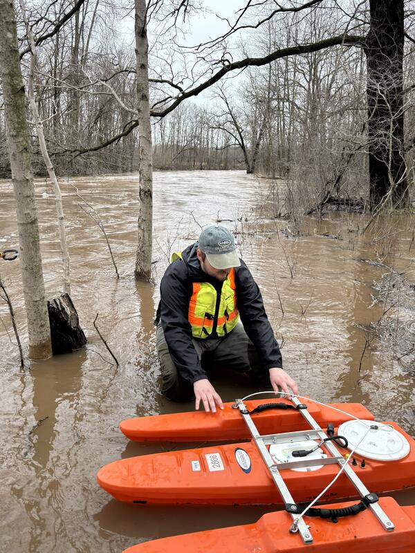
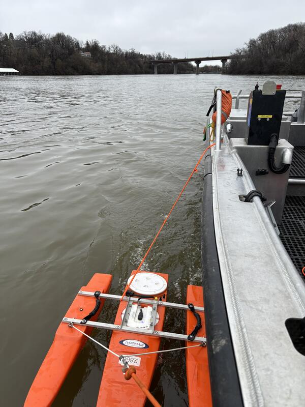
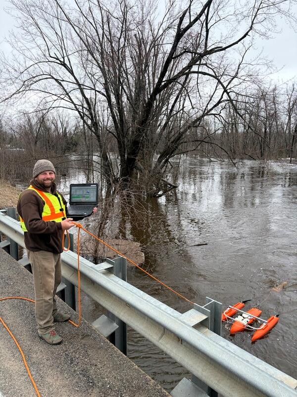
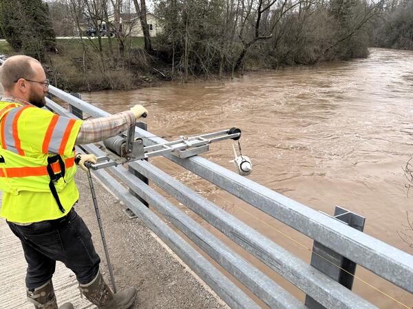
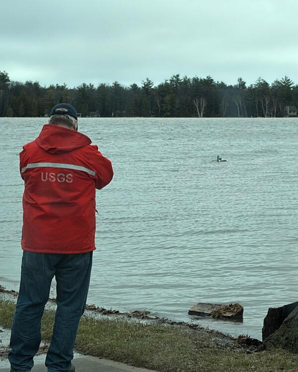
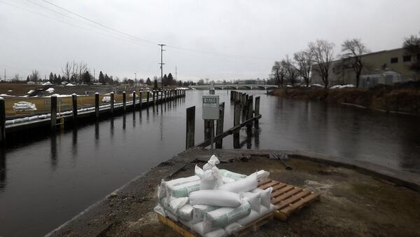
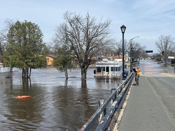
U.S. flag

An official website of the United States government

Images

Upper Midwest Water Science Center images.

Filter Total Items: 548
Continuous water quality site with Seabird SUNA, GreenEyes NULAB and EXO3 YSI Sonde 
Continuous water quality site at Clinton River at Moravian Drive at Mt. Clemens, MI - USGS-04165500
Milwaukee Harbor in foreground with Discovery World building and other tall buildings in background
Milwaukee Harbor and Discovery World on an early autumn day

Milwaukee Harbor in foreground with Discovery World building featured, on an early autumn day.

Watercolor and ink painting depicting117 species of plants near a mine site in northern Arizona
Floral Heritage
Floral Heritage
Floral Heritage

Painting (watercolor and ink) depicting the 117 species of plants found in and around a mine site that are utilized by the tribal community in northern Arizona.

Painting (watercolor and ink) depicting the 117 species of plants found in and around a mine site that are utilized by the tribal community in northern Arizona.

A USGS technician in a bright green safety jacket takes a photo of a flooded river
Field Crew at Little Menomonee River in Milwaukee, Wisconsin at streamgage 04087070 after flood

A USGS technician in a bright green safety jacket takes a photo of a flooded Little Menomonee River at Milwaukee, Wisconsin, after a flood in August 2025.

Little Menomonee River at Milwaukee, WI - USGS-04087070

https://waterdata.usgs.gov/monitoring-location/USGS-04087070/

A bright orange acoustic Doppler current profiler takes a streamflow measurement in a flooded stream
ADCP measurement at 04087088 Underwood Creek after flooding

An acoustic Doppler current profiler (ADCP) device takes a streamflow measurement at streamgage 04087088 Underwood Creek, near Milwaukee, Wisconsin after a flood event in August 2025.

An acoustic Doppler current profiler (ADCP) device takes a streamflow measurement at streamgage 04087088 Underwood Creek, near Milwaukee, Wisconsin after a flood event in August 2025.

Brown floodwaters swirling in foreground with green trees in background
Flooding at streamgage 04087120 Menomonee River in Wauwatosa, Wisconsin

Floodwaters swirl in the foreground and trees peek up in the background, during flooding of the Menomonee River in Wauwasota, Wisconsin in August 2025, at streamgage 04087120.

https://waterdata.usgs.gov/monitoring-location/USGS-04087120/

Scientist takes a water sample from a glacial lake in Alaska
Collecting a surface water sample from Grewingk Glacer Lake in Alaska

Hydrologist Laura Flucke collects a surface water sample from Grewingk Glacer Lake in Alaska to understand glacial inputs of mercury.

Man standing on boat with large bridge in background
Scientist conducting field work on the Detroit River

Physical scientist Brent Heerspink conducts sampling on the Detroit River with the Gordie Howe International Bridge in the background.

Gouache painting depicting the Blue Mesa Reservoir during a year of low precipitation totals
Blue Mesa Reservoir in Dry Conditions

Painting (gouache painting) depicting the Blue Mesa Reservoir during a year of low precipitation totals and the resulting cyanobacteria distribution.

Painting (gouache painting) depicting the Blue Mesa Reservoir during a year of low precipitation totals and the resulting cyanobacteria distribution.

Gouache painting depicting the Blue Mesa Reservoir during a year with relatively greater levels of precipitation
Blue Mesa Reservoir in Wet Conditions

Painting (gouache painting) depicting the Blue Mesa Reservoir during a year with relatively greater levels of precipitation and the resulting cyanobacteria distribution.

Painting (gouache painting) depicting the Blue Mesa Reservoir during a year with relatively greater levels of precipitation and the resulting cyanobacteria distribution.

View of Hoan Bridge in Milwaukee with seagulls flying in foreground
Hoan Bridge in Milwaukee with seagulls flying in foreground
Vibrant map of the Harbor Habitat of Milwaukee, Wisconsin
Harbor Habitat Milwaukee Wisconsin

The center of a vibrant downtown and a commercial shipping hub, the Milwaukee Harbor teems with underwater activity in pockets of habitat full of aquatic life. But look on any map and the harbor is just a blue-black void. The map on this page fills in that gap and invites you to explore the complexity of this remarkable urban ecosystem.

The center of a vibrant downtown and a commercial shipping hub, the Milwaukee Harbor teems with underwater activity in pockets of habitat full of aquatic life. But look on any map and the harbor is just a blue-black void. The map on this page fills in that gap and invites you to explore the complexity of this remarkable urban ecosystem.

USGS hydrologic technician installs equipment inside streamgage housing on shore of lake
Installing automated sampler and wireless camera at Barkers Island

USGS Supervisory Hydrologic Technician Ben Torrison installs an automated sampler and wireless camera at Barker’s Island to aid in the remote observation of nearshore algal blooms.

HIVIS | Lake Superior at Barkers Island at Superior

A large plastic sample bottle contains water and brown lignin settling at the bottom
Water sample containing lignin

A large plastic sample bottle contains water and brown lignin settling at the bottom. This is used in benchtop experiments to explore how effective the lignin composites are for removing mercury.

A large plastic sample bottle contains water and brown lignin settling at the bottom. This is used in benchtop experiments to explore how effective the lignin composites are for removing mercury.

Was this page helpful?