U.S. flag

An official website of the United States government

Images

Upper Midwest Water Science Center images.

Filter Total Items: 581
A Hydrologic Technician works on equipment inside a monitoring location housing in knee-deep snow next to a snowmobile
Streamgage 462159084442201 46N 04W 24DAAD01 Chippewa CO (Raco)

A USGS Hydrologic Technician works on equipment inside a monitoring location housing in knee-deep snow. A snowmobile with a basket of gear on the back rests alongside. The housing is in a forest clearing, surrounded by pine trees with a gray sky overhead.

46N 04W 24DAAD01 Chippewa CO (Raco) - USGS-462159084442201
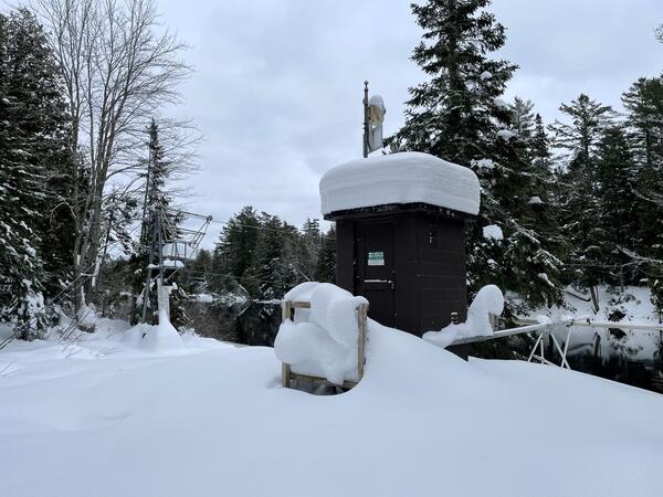
A USGS Hydrologic Technician works on equipment inside a monitoring location housing in knee-deep snow. A snowmobile with a basket of gear on the back rests alongside. The housing is in a forest clearing, surrounded by pine trees with a gray sky overhead.

46N 04W 24DAAD01 Chippewa CO (Raco) - USGS-462159084442201

Gouache painting of sign at Horn Creek in the Grand Canyon
Horn Creek Sign Grand Canyon

This gouache painting is of a sign located near Horn Creek in the Grand Canyon. The Creek is contaminated with high levels of Uranium. Sign states: "Horn Creek, Danger, Contaminated Water, Do Not Drink! Water in Horn Creek exceeds EPA health standards for radioactivity".

This gouache painting is of a sign located near Horn Creek in the Grand Canyon. The Creek is contaminated with high levels of Uranium. Sign states: "Horn Creek, Danger, Contaminated Water, Do Not Drink! Water in Horn Creek exceeds EPA health standards for radioactivity".

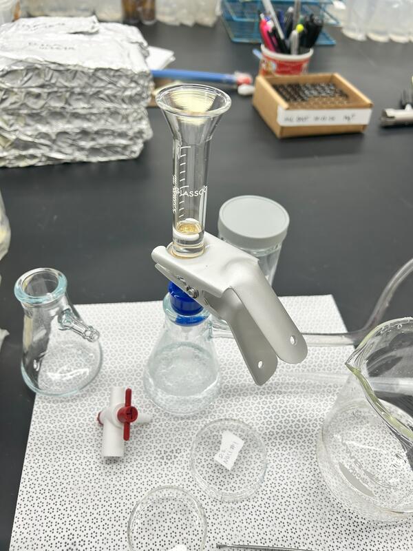
Dark field microscope for microplastics
Dark field microscope image, microplastics

Dark field microscope from the manuscript, " a) A dark-field image of 1.5 µm PS LMMPs on a 0.4 μm PCTE membrane sensor. b) A Raman map of PS acquired by tracking its Raman band at 996 cm-1

Dark field microscope from the manuscript, " a) A dark-field image of 1.5 µm PS LMMPs on a 0.4 μm PCTE membrane sensor. b) A Raman map of PS acquired by tracking its Raman band at 996 cm-1

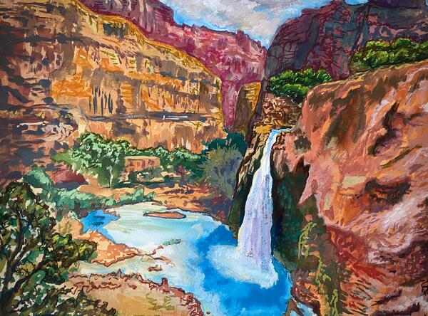
Gouache painting of Havasupai Falls, Arizona
Havasupai Falls Arizona

Top view of Havasupai Falls, its aquamarine colored water is highly recognizable and it is a site of tribal, cultural, and recreational significance to the greater Grand Canyon region.

Top view of Havasupai Falls, its aquamarine colored water is highly recognizable and it is a site of tribal, cultural, and recreational significance to the greater Grand Canyon region.

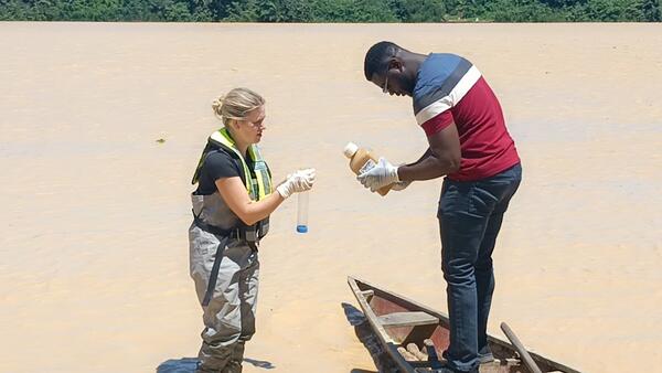
USGS scientist standing in shallow brown river training Ghanaian scientist standing on wood canoe on water sample collection
USGS scientist training Ghanaian scientist on mercury sampling techniques

USGS scientist, Grace Armstrong, training a scientist in Accra, Ghana on proper mercury sampling techniques as part of a U.S. State Department Embassy Fellowship Program.

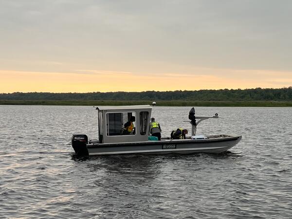
USGS research boat on river at dawn
USGS sediment sampling vessel on the Rainy River, Minnesota

USGS scientists aboard a sediment sampling vessel on the Rainy River, Minnesota, preparing for a day of sampling.

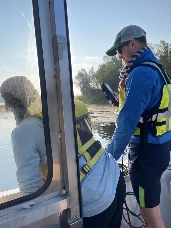
Two scientists measure water quality from a boat
Measuring water quality on the Rainy River, Minnesota

Two USGS scientists measuring water quality along the Rainy River and at its mouth in Four-Mile Bay, Lake of the Woods, Minnesota, to study how phosphorus stored in sediment may be interacting with river water and potentially contributing to problematic algal blooms in Lake of the Woods.

Two USGS scientists measuring water quality along the Rainy River and at its mouth in Four-Mile Bay, Lake of the Woods, Minnesota, to study how phosphorus stored in sediment may be interacting with river water and potentially contributing to problematic algal blooms in Lake of the Woods.

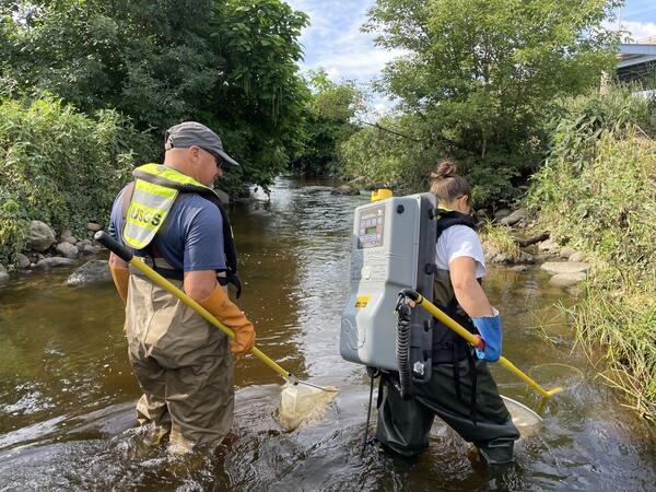
Scientists collect fish from creek using backpack shocker
Electrofishing at Underwood Creek, Wauwatosa, Wisconsin

Hydrologic Technician Ryan Ennis and Physical Scientist Kathryn Johncock collect fish from Underwood Creek in Wauwatosa, Wisconsin, using a backpack shocker. The backpack shocker is used to sample fish via electrofishing.

Hydrologic Technician Ryan Ennis and Physical Scientist Kathryn Johncock collect fish from Underwood Creek in Wauwatosa, Wisconsin, using a backpack shocker. The backpack shocker is used to sample fish via electrofishing.

A woman holds a test tube with green water up to show another woman peering at it through her glasses
Secretary Haaland views a cyanobacteria culture grown from Lake Superior water

Upper Midwest Water Science Center and Michigan Bacteriological Research Lab (MI-BaRL) Supervisory Research Hydrologist, Carrie Givens, shows Secretary of Interior Deb Haaland a cyanobacteria culture grown from Lake Superior water.

Upper Midwest Water Science Center and Michigan Bacteriological Research Lab (MI-BaRL) Supervisory Research Hydrologist, Carrie Givens, shows Secretary of Interior Deb Haaland a cyanobacteria culture grown from Lake Superior water.

Hydrologic technician in bright green PFD stands on bridge to measure flow with ADCP in water below
Hydrologic technician conducts ADCP measurement above Rapidan Dam on the Blue Earth River, near Rapidan, Minnesota

Hydrologic technicians Garret Welsh (pictured) and Patrick Farrell (photo credit) made a discharge measurement using an Acoustic Doppler Current Profiler (ADCP) at streamgage 05320000, Blue Earth River at Rapidan, Minnesota above the failing Rapidan Dam at 1:33 pm on Tuesday, June 25, 2024.

Man in wide-brimmed hat and sunglasses on boat on river holding a clear plastic cylinder with water sample
Collecting water sample on Fox River, Wisconsin

Biologist Leon Katona collects a water sample on the Fox River, Wisconsin as part of a sampling effort using the Fast Limnological Automated Measurements (FLAMe) platform.

Biologist Leon Katona collects a water sample on the Fox River, Wisconsin as part of a sampling effort using the Fast Limnological Automated Measurements (FLAMe) platform.

Cyanobacteria bloom, Fox River, Wisconsin
Cyanobacteria bloom near the shoreline of North Bar Lake in Sleeping Bear Dunes National Lakeshore, Michigan
USGS water data expert Garret Welsh measures water flow in the pouring rain at the Straight River near Faribault, Minnesota.
USGS Flood Monitoring: Eastern Minnesota

USGS water data expert Garret Welsh measures water flow in the pouring rain at the Straight River near Faribault, Minnesota. This measurement recorded the 6th highest flow in the station's 59-year history, highlighting the severity of current flood conditions. Such data is crucial for emergency managers and forecasters to protect communities at risk.

USGS water data expert Garret Welsh measures water flow in the pouring rain at the Straight River near Faribault, Minnesota. This measurement recorded the 6th highest flow in the station's 59-year history, highlighting the severity of current flood conditions. Such data is crucial for emergency managers and forecasters to protect communities at risk.

A small flock of brown and golden chickens
A small flock of chickens

A small flock of brown and golden laying hens (chickens), on a farm in the Upper Midwest.

A small flock of brown and golden laying hens (chickens), on a farm in the Upper Midwest.

Was this page helpful?