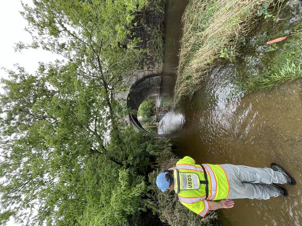
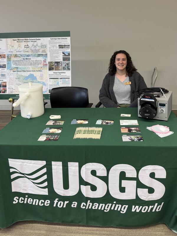
A large plastic sample bottle contains water and brown lignin settling at the bottom. This is used in benchtop experiments to explore how effective the lignin composites are for removing mercury.
Images
Upper Midwest Water Science Center images.
A large plastic sample bottle contains water and brown lignin settling at the bottom. This is used in benchtop experiments to explore how effective the lignin composites are for removing mercury.
Student working with researchers at Forest Products Laboratory
Student working with researchers at Forest Products LaboratoryUSGS M3 Research Laboratory summer research student Noor from the University of Wisconsin: Freshwater@UW Summer Research Opportunties Program (Freshwater@UW Summer Research Opportunities Program - Water@UW-Madison) learning how to construct columns for flow through testing with USDA
Treated Wastewater from Soybean Processing Facility
Treated Wastewater from Soybean Processing FacilityEffluent from soybean processing facility following treatment, entering nearby surface water body. Photo taken by USGS, Sandra Leal.
Treated Wastewater from Soybean Processing Facility
Treated Wastewater from Soybean Processing FacilityEffluent from soybean processing facility following treatment, entering nearby surface water body. Photo taken by USGS, Sandra Leal.
Anniston: Toxic Legacy, Reclaimed future. – Painting (gouache painting) depicts the PCB contamination embedded in the community and ecosystems of Anniston, Alabama and the restoration work taking place to through U.S. Fish and Wildlife Service, U.S. Geological Survey Natural Resource Damage Assessment and Restoration (NRDAR), and U.S.
ADCP measurement via cableway at streamgage 04040500 Sturgeon River Near Sidnaw, Michigan
ADCP measurement via cableway at streamgage 04040500 Sturgeon River Near Sidnaw, MichiganA USGS hydrologic technician takes an acoustic Doppler current profiler streamflow measurement from the center of a river, while suspended in a metal cableway. A laptop with data on screen in shown in the foreground.
Streamgage 04040500 Sturgeon River Near Sidnaw, Michigan.
Streamgage 04065106 Menominee River at Niagara, Wisconsin on a winter day
Streamgage 04065106 Menominee River at Niagara, Wisconsin on a winter dayA gray metal streamgage housing with an attached solar panel sits on the Wisconsin shore of a snow-covered frozen Menominee River. Michigan is in the background across the river.
Streamgage 04065106 Menominee River at Niagara, Wisconsin.
Scientists taking discharge measurement under ice at Pigeon River, Michigan
Scientists taking discharge measurement under ice at Pigeon River, MichiganHydrologic Technician Jim Wilkinson teaching Field Assistant Hannah Michel how to take a discharge measurement under the ice at the Pigeon River near Pigeon, Michigan.
Streamgage 05106000 Sprague Creek Near Sprague, Manitoba, Canada
Streamgage 05106000 Sprague Creek Near Sprague, Manitoba, CanadaUSGS streamgage housing with solar panel and sensors mounted on a pole, against a snow-covered rural background under a cloudy sky.
Streamgage 05106000 Sprague Creek Near Sprague, Manitoba, Canada
https://waterdata.usgs.gov/monitoring-location/USGS-05106000/
Streamgage 05106000 Sprague Creek Near Sprague, Manitoba, Canada
Streamgage 05106000 Sprague Creek Near Sprague, Manitoba, CanadaUSGS streamgage housing with solar panel and sensors mounted on a pole, against a snow-covered rural background under a cloudy sky.
Streamgage 05106000 Sprague Creek Near Sprague, Manitoba, Canada
https://waterdata.usgs.gov/monitoring-location/USGS-05106000/
Streamgage 04096590 Hog Creek at Cady RD at Hodunk, Michigan
Streamgage 04096590 Hog Creek at Cady RD at Hodunk, MichiganA streamgage housing is mounted on the side of a bridge over a creek. Ice covers the shoreline. Leafless trees are reflected in the still water of the creek.
Streamgage 04096590 Hog Creek at Cady RD at Hodunk, Michigan.
Rhinelander, Wisconsin field office staff and Hodag
Rhinelander, Wisconsin field office staff and HodagUpper Midwest Water Science center staff (left to right) Hydrologic Technicians Jarvis Kaderlik and Brandon Nelson, Biologist Eric Dantoin, Hydrologic Technician Ryan Jirik and Biologist Patrick Perner pose with a large statue of a Hodag.
Beneath the Rim: Water Movement Pathways in the Grand Canyon
Beneath the Rim: Water Movement Pathways in the Grand CanyonPainting (gouache painting) is a generalized schematic view, not to scale, through the Grand Canyon with the Colorado River in the center, an unmined breccia pipe on the left side, and the Orphan Mine and associated breccia pipe on the right side. Dashed lines show a conceptual understanding of how water may interact with the Orphan Mine.
Streamgage 462159084442201 46N 04W 24DAAD01 Chippewa CO (Raco)
Streamgage 462159084442201 46N 04W 24DAAD01 Chippewa CO (Raco)A USGS Hydrologic Technician works on equipment inside a monitoring location housing in knee-deep snow. A snowmobile with a basket of gear on the back rests alongside. The housing is in a forest clearing, surrounded by pine trees with a gray sky overhead.
46N 04W 24DAAD01 Chippewa CO (Raco) - USGS-462159084442201
Streamgage 04045500 Tahquamenon River Near Paradise, Michigan covered in snow
Streamgage 04045500 Tahquamenon River Near Paradise, Michigan covered in snowStreamgage 04045500 Tahquamenon River Near Paradise, Michigan, covered in snow on a December day.
https://waterdata.usgs.gov/monitoring-location/04045500/
This gouache painting is of a sign located near Horn Creek in the Grand Canyon. The Creek is contaminated with high levels of Uranium. Sign states: "Horn Creek, Danger, Contaminated Water, Do Not Drink! Water in Horn Creek exceeds EPA health standards for radioactivity".
This is a photo of a filtration apparatus being used for microplastics analysis, November 2024.
Dark field microscope from the manuscript, " a) A dark-field image of 1.5 µm PS LMMPs on a 0.4 μm PCTE membrane sensor. b) A Raman map of PS acquired by tracking its Raman band at 996 cm-1
Top view of Havasupai Falls, its aquamarine colored water is highly recognizable and it is a site of tribal, cultural, and recreational significance to the greater Grand Canyon region.
USGS scientist training Ghanaian scientist on mercury sampling techniques
USGS scientist training Ghanaian scientist on mercury sampling techniquesUSGS scientist, Grace Armstrong, training a scientist in Accra, Ghana on proper mercury sampling techniques as part of a U.S. State Department Embassy Fellowship Program.
Cyanobacteria bloom in a shallow Michigan lake during the fall of 2024. Photo by Leon Katona
Tahquamenon River at streamgage 04045500 Tahquamenon River Near Paradise, MI in autumn
Tahquamenon River at streamgage 04045500 Tahquamenon River Near Paradise, MI in autumnTahquamenon River at streamgage 04045500 Tahquamenon River Near Paradise, Michigan, in autumn.
Tahquamenon River at streamgage 04045500 Tahquamenon River Near Paradise, MI in autumn
Tahquamenon River at streamgage 04045500 Tahquamenon River Near Paradise, MI in autumnTahquamenon River at streamgage 04045500 Tahquamenon River Near Paradise, Michigan, in autumn.
USGS sediment sampling vessel on the Rainy River, Minnesota
USGS sediment sampling vessel on the Rainy River, MinnesotaUSGS scientists aboard a sediment sampling vessel on the Rainy River, Minnesota, preparing for a day of sampling.
USGS sediment sampling vessel on the Rainy River, Minnesota
USGS sediment sampling vessel on the Rainy River, MinnesotaUSGS scientists aboard a sediment sampling vessel on the Rainy River, Minnesota, preparing for a day of sampling.