Scientist conducting field work on the Detroit River
Scientist conducting field work on the Detroit RiverPhysical scientist Brent Heerspink conducts sampling on the Detroit River with the Gordie Howe International Bridge in the background.


Official websites use .gov
A .gov website belongs to an official government organization in the United States.

Secure .gov websites use HTTPS
A lock () or https:// means you’ve safely connected to the .gov website. Share sensitive information only on official, secure websites.

Upper Midwest Water Science Center images.
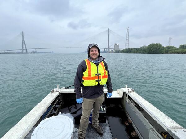
Physical scientist Brent Heerspink conducts sampling on the Detroit River with the Gordie Howe International Bridge in the background.
Physical scientist Brent Heerspink conducts sampling on the Detroit River with the Gordie Howe International Bridge in the background.
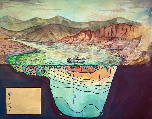
Painting (gouache painting) depicting the Blue Mesa Reservoir during a year of low precipitation totals and the resulting cyanobacteria distribution.
Painting (gouache painting) depicting the Blue Mesa Reservoir during a year of low precipitation totals and the resulting cyanobacteria distribution.
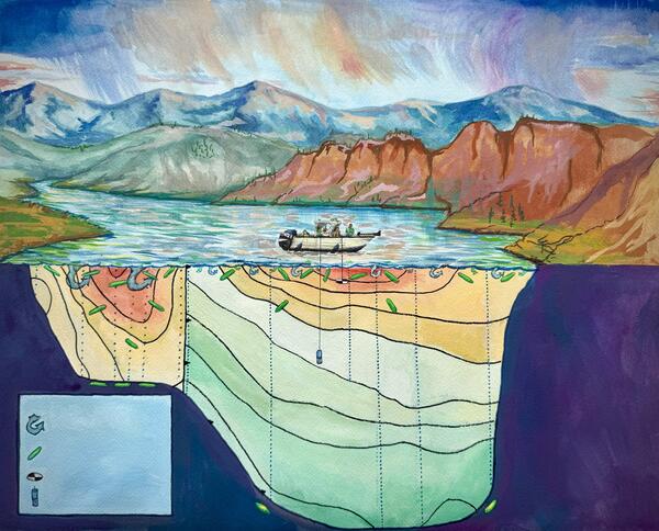
Painting (gouache painting) depicting the Blue Mesa Reservoir during a year with relatively greater levels of precipitation and the resulting cyanobacteria distribution.
Painting (gouache painting) depicting the Blue Mesa Reservoir during a year with relatively greater levels of precipitation and the resulting cyanobacteria distribution.
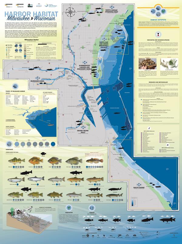
The center of a vibrant downtown and a commercial shipping hub, the Milwaukee Harbor teems with underwater activity in pockets of habitat full of aquatic life. But look on any map and the harbor is just a blue-black void. The map on this page fills in that gap and invites you to explore the complexity of this remarkable urban ecosystem.
The center of a vibrant downtown and a commercial shipping hub, the Milwaukee Harbor teems with underwater activity in pockets of habitat full of aquatic life. But look on any map and the harbor is just a blue-black void. The map on this page fills in that gap and invites you to explore the complexity of this remarkable urban ecosystem.

View of the Hoan Bridge in Milwaukee, Wisconsin with seagulls flying in foreground.
View of the Hoan Bridge in Milwaukee, Wisconsin with seagulls flying in foreground.

Jones Island streamgage on the shore of the Milwaukee River in Milwaukee, Wisconsin.
Milwaukee River at Mouth at Milwaukee, WI - USGS Water Data for the Nation
Jones Island streamgage on the shore of the Milwaukee River in Milwaukee, Wisconsin.
Milwaukee River at Mouth at Milwaukee, WI - USGS Water Data for the Nation
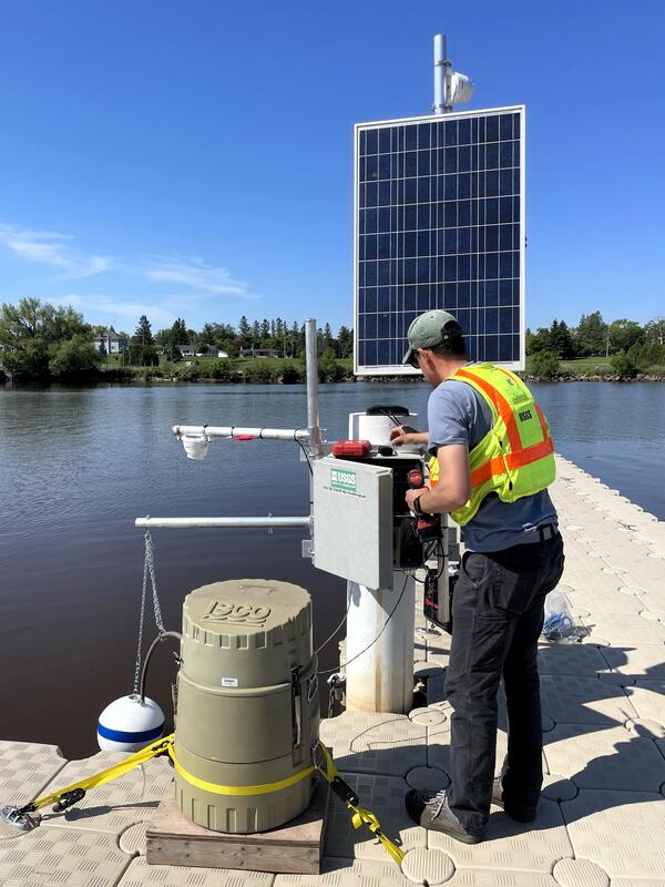
USGS Supervisory Hydrologic Technician Ben Torrison installs an automated sampler and wireless camera at Barker’s Island to aid in the remote observation of nearshore algal blooms.
USGS Supervisory Hydrologic Technician Ben Torrison installs an automated sampler and wireless camera at Barker’s Island to aid in the remote observation of nearshore algal blooms.
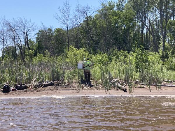
Biologist Pat Perner installs a streamgage at Allouez Bay at Wisconsin Point at Superior, Wisconsin.
https://waterdata.usgs.gov/monitoring-location/USGS-464144091594301/
Biologist Pat Perner installs a streamgage at Allouez Bay at Wisconsin Point at Superior, Wisconsin.
https://waterdata.usgs.gov/monitoring-location/USGS-464144091594301/

Experimental flow through system for testing lignin foam composite for mercury removal in natural surface waters.
Experimental flow through system for testing lignin foam composite for mercury removal in natural surface waters.
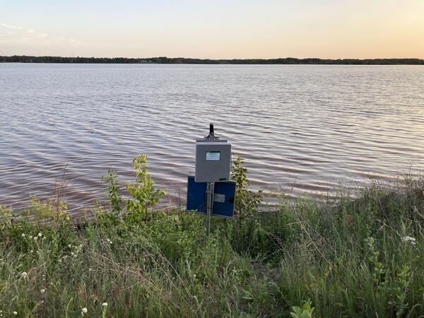
Streamgage at sunset at Allouez Bay at Wisconsin Point at Superior, Wisconsin
https://waterdata.usgs.gov/monitoring-location/USGS-464144091594301/
Streamgage at sunset at Allouez Bay at Wisconsin Point at Superior, Wisconsin
https://waterdata.usgs.gov/monitoring-location/USGS-464144091594301/

A large plastic sample bottle contains water and brown lignin settling at the bottom. This is used in benchtop experiments to explore how effective the lignin composites are for removing mercury.
A large plastic sample bottle contains water and brown lignin settling at the bottom. This is used in benchtop experiments to explore how effective the lignin composites are for removing mercury.
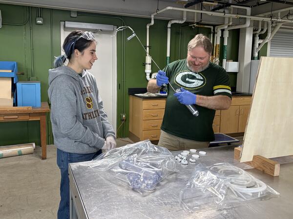
USGS M3 Research Laboratory summer research student Noor from the University of Wisconsin: Freshwater@UW Summer Research Opportunties Program (Freshwater@UW Summer Research Opportunities Program - Water@UW-Madison) learning how to construct columns for flow through testing with USDA
USGS M3 Research Laboratory summer research student Noor from the University of Wisconsin: Freshwater@UW Summer Research Opportunties Program (Freshwater@UW Summer Research Opportunities Program - Water@UW-Madison) learning how to construct columns for flow through testing with USDA
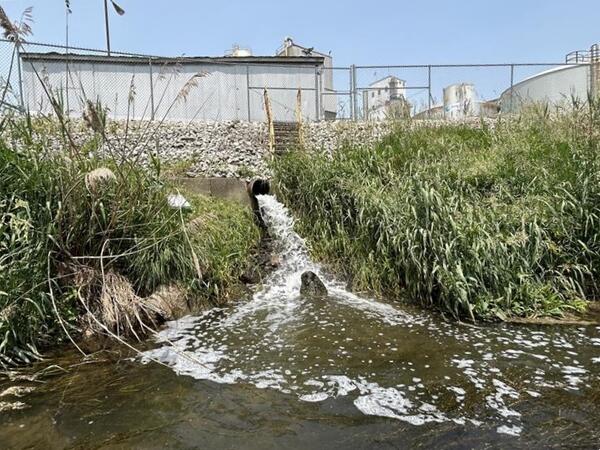
Effluent from soybean processing facility following treatment, entering nearby surface water body. Photo taken by USGS, Sandra Leal.
Effluent from soybean processing facility following treatment, entering nearby surface water body. Photo taken by USGS, Sandra Leal.

Anniston: Toxic Legacy, Reclaimed future. – Painting (gouache painting) depicts the PCB contamination embedded in the community and ecosystems of Anniston, Alabama and the restoration work taking place to through U.S. Fish and Wildlife Service, U.S. Geological Survey Natural Resource Damage Assessment and Restoration (NRDAR), and U.S.
Anniston: Toxic Legacy, Reclaimed future. – Painting (gouache painting) depicts the PCB contamination embedded in the community and ecosystems of Anniston, Alabama and the restoration work taking place to through U.S. Fish and Wildlife Service, U.S. Geological Survey Natural Resource Damage Assessment and Restoration (NRDAR), and U.S.
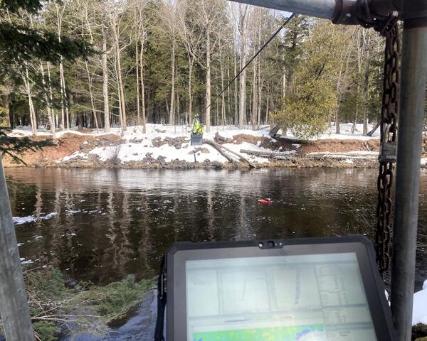
A USGS hydrologic technician takes an acoustic Doppler current profiler streamflow measurement from the center of a river, while suspended in a metal cableway. A laptop with data on screen in shown in the foreground.
Streamgage 04040500 Sturgeon River Near Sidnaw, Michigan.
A USGS hydrologic technician takes an acoustic Doppler current profiler streamflow measurement from the center of a river, while suspended in a metal cableway. A laptop with data on screen in shown in the foreground.
Streamgage 04040500 Sturgeon River Near Sidnaw, Michigan.
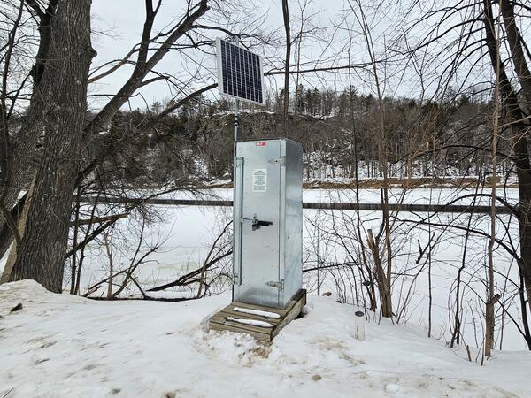
A gray metal streamgage housing with an attached solar panel sits on the Wisconsin shore of a snow-covered frozen Menominee River. Michigan is in the background across the river.
Streamgage 04065106 Menominee River at Niagara, Wisconsin.
A gray metal streamgage housing with an attached solar panel sits on the Wisconsin shore of a snow-covered frozen Menominee River. Michigan is in the background across the river.
Streamgage 04065106 Menominee River at Niagara, Wisconsin.
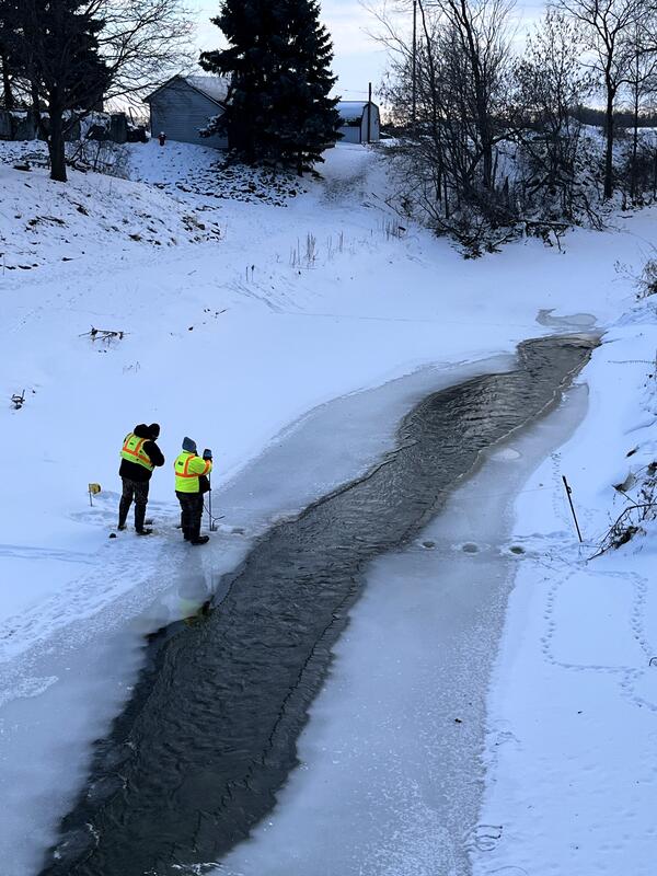
Hydrologic Technician Jim Wilkinson teaching Field Assistant Hannah Michel how to take a discharge measurement under the ice at the Pigeon River near Pigeon, Michigan.
Hydrologic Technician Jim Wilkinson teaching Field Assistant Hannah Michel how to take a discharge measurement under the ice at the Pigeon River near Pigeon, Michigan.
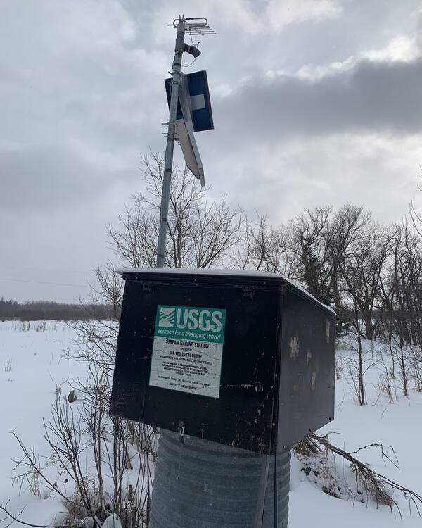
USGS streamgage housing with solar panel and sensors mounted on a pole, against a snow-covered rural background under a cloudy sky.
Streamgage 05106000 Sprague Creek Near Sprague, Manitoba, Canada
https://waterdata.usgs.gov/monitoring-location/USGS-05106000/
USGS streamgage housing with solar panel and sensors mounted on a pole, against a snow-covered rural background under a cloudy sky.
Streamgage 05106000 Sprague Creek Near Sprague, Manitoba, Canada
https://waterdata.usgs.gov/monitoring-location/USGS-05106000/
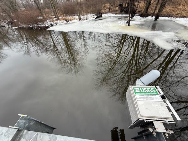
A streamgage housing is mounted on the side of a bridge over a creek. Ice covers the shoreline. Leafless trees are reflected in the still water of the creek.
Streamgage 04096590 Hog Creek at Cady RD at Hodunk, Michigan.
A streamgage housing is mounted on the side of a bridge over a creek. Ice covers the shoreline. Leafless trees are reflected in the still water of the creek.
Streamgage 04096590 Hog Creek at Cady RD at Hodunk, Michigan.

Upper Midwest Water Science center staff (left to right) Hydrologic Technicians Jarvis Kaderlik and Brandon Nelson, Biologist Eric Dantoin, Hydrologic Technician Ryan Jirik and Biologist Patrick Perner pose with a large statue of a Hodag.
Upper Midwest Water Science center staff (left to right) Hydrologic Technicians Jarvis Kaderlik and Brandon Nelson, Biologist Eric Dantoin, Hydrologic Technician Ryan Jirik and Biologist Patrick Perner pose with a large statue of a Hodag.
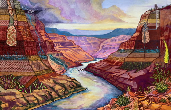
Painting (gouache painting) is a generalized schematic view, not to scale, through the Grand Canyon with the Colorado River in the center, an unmined breccia pipe on the left side, and the Orphan Mine and associated breccia pipe on the right side. Dashed lines show a conceptual understanding of how water may interact with the Orphan Mine.
Painting (gouache painting) is a generalized schematic view, not to scale, through the Grand Canyon with the Colorado River in the center, an unmined breccia pipe on the left side, and the Orphan Mine and associated breccia pipe on the right side. Dashed lines show a conceptual understanding of how water may interact with the Orphan Mine.