
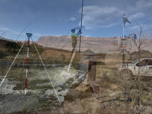
This is an overlay of three images showing new gage installations in Utah.
Multimedia
Multimedia from the Utah Water Science Center.
Images
New Gages Carousel
This is an overlay of three images showing new gage installations in Utah.

Cinnamon teal wearing a tracking backpack
Cinnamon teal with a GPS tracking backpack that weighs 10 grams, making it much more successful in staying on longer than heavier tracking devices.
Cinnamon teal with a GPS tracking backpack that weighs 10 grams, making it much more successful in staying on longer than heavier tracking devices.

Shore of Lake Abert, Oregon
Lake Abert, Oregon is one of the 20 terminal lakes identified by USGS partners as priority ecosystems for study by the Saline Lakes Ecosystems IWAA.
By
Ecosystems Mission Area, Water Resources Mission Area, Forest and Rangeland Ecosystem Science Center, Fort Collins Science Center, Nevada Water Science Center, Oregon Water Science Center, Utah Water Science Center, Western Ecological Research Center (WERC), Saline Lake Ecosystems Integrated Water Availability Assessment

GSL.Applegate
USGS Director, David Applegate visits Great Salt Lake with Rocky Mt Region Director, Peter Griffiths, UT WSC Director, David O'Leary, UT WSC scientists, and many cooperators.
USGS Director, David Applegate visits Great Salt Lake with Rocky Mt Region Director, Peter Griffiths, UT WSC Director, David O'Leary, UT WSC scientists, and many cooperators.

Goose Lake, Oregon-California
Goose Lake, on the Oregon-California border, is one of the 20 terminal lakes identified by USGS partners as priority ecosystems for study by the Saline Lakes Ecosystems IWAA.
By
Ecosystems Mission Area, Water Resources Mission Area, Species Management Research Program, Water Resources Research Act Program, Forest and Rangeland Ecosystem Science Center, Fort Collins Science Center, Nevada Water Science Center, Oregon Water Science Center, Utah Water Science Center, Western Ecological Research Center (WERC), Saline Lake Ecosystems Integrated Water Availability Assessment

A hovercraft glides over the surface of Summer Lake, Oregon
A hovercraft glides over the surface of Summer Lake, OregonSummer Lake, Oregon is one of the 20 terminal lakes identified by USGS partners as priority ecosystems for study by the Saline Lakes Ecosystems IWAA.
By
Ecosystems Mission Area, Water Resources Mission Area, Species Management Research Program, Water Availability and Use Science Program, Forest and Rangeland Ecosystem Science Center, Fort Collins Science Center, Nevada Water Science Center, Oregon Water Science Center, Utah Water Science Center, Western Ecological Research Center (WERC), Saline Lake Ecosystems Integrated Water Availability Assessment
Videos

Saline Lakes IWAA Fall 2024 Webinar Series: Satellite Observations of Lake Surface Water Dynamics
Saline Lakes IWAA Fall 2024 Webinar Series: Satellite Observations of Lake Surface Water DynamicsThe sixth and final webinar in the Saline Lakes Ecosystems IWAA Fall 2024 Webinar Series is on satellite observations of lake surface water dynamics. John W. Jones of the USGS Hydrologic Remote Sensing Branch introduces the surface water and wetland remote sensing component of the Integrated Water Availability Assessment.
By
Ecosystems Mission Area, Water Resources Mission Area, Species Management Research Program, Water Availability and Use Science Program, Forest and Rangeland Ecosystem Science Center, Fort Collins Science Center, Nevada Water Science Center, Oregon Water Science Center, Utah Water Science Center, Western Ecological Research Center (WERC), Saline Lake Ecosystems Integrated Water Availability Assessment

Saline Lakes IWAA Fall 2024 Webinar Series: Waterbird Prey Availability
Saline Lakes IWAA Fall 2024 Webinar Series: Waterbird Prey AvailabilityThe fifth webinar in the Saline Lakes Ecosystems IWAA Fall 2024 Webinar Series is on waterbird prey availability in Great Basin terminal lakes.
By
Ecosystems Mission Area, Water Resources Mission Area, Species Management Research Program, Water Availability and Use Science Program, Forest and Rangeland Ecosystem Science Center, Fort Collins Science Center, Nevada Water Science Center, Oregon Water Science Center, Utah Water Science Center, Western Ecological Research Center (WERC), Saline Lake Ecosystems Integrated Water Availability Assessment

Saline Lakes Ecosystems IWAA Fall 2024 Webinar Series: Bird Movements
Saline Lakes Ecosystems IWAA Fall 2024 Webinar Series: Bird MovementsThe fourth webinar in the Saline Lakes Ecosystems IWAA Fall 2024 Webinar Series is on movement of bird species associated with Great Basin terminal lake ecosystems. Cory Overton of the Western Ecological Research Center gives an overview of the USGS bird movement monitoring strategy and presents results from the 2024 field season.
By
Ecosystems Mission Area, Water Resources Mission Area, Species Management Research Program, Water Availability and Use Science Program, Forest and Rangeland Ecosystem Science Center, Fort Collins Science Center, Nevada Water Science Center, Oregon Water Science Center, Utah Water Science Center, Western Ecological Research Center (WERC), Saline Lake Ecosystems Integrated Water Availability Assessment

Saline Lakes Ecosystems IWAA Fall 2024 Webinar Series: Water-Quality Monitoring of Great Basin Terminal Lake Ecosystems
Saline Lakes Ecosystems IWAA Fall 2024 Webinar Series: Water-Quality Monitoring of Great Basin Terminal Lake EcosystemsThe third webinar in the Saline Lakes Ecosystems IWAA Fall 2024 Webinar Series is on water-quality monitoring of Great Basin terminal lake ecosystems. Christine Rumsey of the Utah Water Science Center and Casie Smith of the Oregon Water Science Center give an overview of the USGS water-quality monitoring strategy and present results from the 2024 field season.
By
Ecosystems Mission Area, Water Resources Mission Area, Species Management Research Program, Water Availability and Use Science Program, Forest and Rangeland Ecosystem Science Center, Fort Collins Science Center, Nevada Water Science Center, Oregon Water Science Center, Utah Water Science Center, Western Ecological Research Center (WERC), Saline Lake Ecosystems Integrated Water Availability Assessment

Saline Lake Ecosystems IWAA Fall 2024 Webinar Series: Physical and Chemical Monitoring in Support of Water Budgets of Select Great Basin Saline Lakes
Saline Lake Ecosystems IWAA Fall 2024 Webinar Series: Physical and Chemical Monitoring in Support of Water Budgets of Select Great Basin Saline LakesThe second webinar in the Saline Lake Ecosystems IWAA Fall 2024 Webinar Series is on physical and chemical monitoring in support of water budgets of select Great Basin saline lakes.
By
Ecosystems Mission Area, Water Resources Mission Area, Species Management Research Program, Water Availability and Use Science Program, Forest and Rangeland Ecosystem Science Center, Fort Collins Science Center, Nevada Water Science Center, Oregon Water Science Center, Utah Water Science Center, Western Ecological Research Center (WERC), Saline Lake Ecosystems Integrated Water Availability Assessment

Saline Lake Ecosystems IWAA Fall 2024 Webinar Series: Project Overview
Saline Lake Ecosystems IWAA Fall 2024 Webinar Series: Project OverviewAllison Shipp, Deputy Regional Director for Science and Research and Saline Lake Ecosystems IWAA Project Manager, kicked off the Fall 2024 webinar series. This presentation gives an overview of the project and introduces topics that will be covered by the USGS research team throughout the webinar series.
By
Ecosystems Mission Area, Water Resources Mission Area, Species Management Research Program, Water Availability and Use Science Program, Forest and Rangeland Ecosystem Science Center, Fort Collins Science Center, Nevada Water Science Center, Oregon Water Science Center, Utah Water Science Center, Western Ecological Research Center (WERC), Saline Lake Ecosystems Integrated Water Availability Assessment