
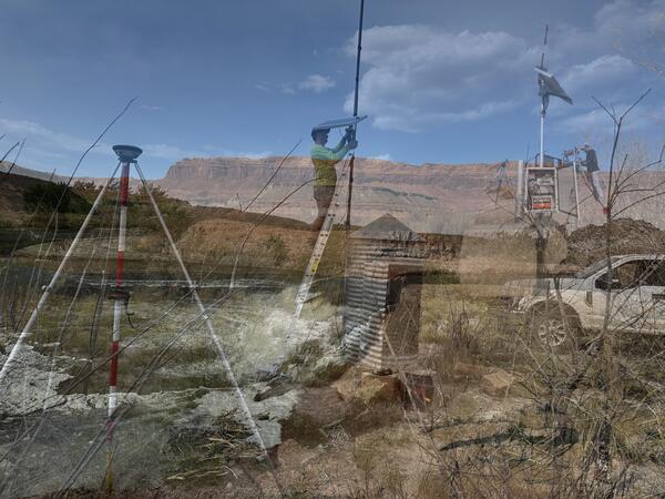
This is an overlay of three images showing new gage installations in Utah.
Images
Images from the Utah Water Science Center.
Filter Total Items: 112
New Gages Carousel
This is an overlay of three images showing new gage installations in Utah.

Cinnamon teal wearing a tracking backpack
Cinnamon teal with a GPS tracking backpack that weighs 10 grams, making it much more successful in staying on longer than heavier tracking devices.
Cinnamon teal with a GPS tracking backpack that weighs 10 grams, making it much more successful in staying on longer than heavier tracking devices.

Shore of Lake Abert, Oregon
Lake Abert, Oregon is one of the 20 terminal lakes identified by USGS partners as priority ecosystems for study by the Saline Lakes Ecosystems IWAA.
By
Ecosystems Mission Area, Water Resources Mission Area, Forest and Rangeland Ecosystem Science Center, Fort Collins Science Center, Nevada Water Science Center, Oregon Water Science Center, Utah Water Science Center, Western Ecological Research Center (WERC), Saline Lake Ecosystems Integrated Water Availability Assessment

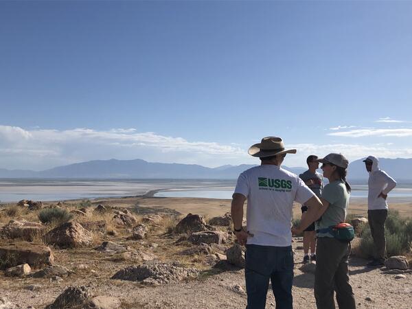
GSL.Applegate
USGS Director, David Applegate visits Great Salt Lake with Rocky Mt Region Director, Peter Griffiths, UT WSC Director, David O'Leary, UT WSC scientists, and many cooperators.
USGS Director, David Applegate visits Great Salt Lake with Rocky Mt Region Director, Peter Griffiths, UT WSC Director, David O'Leary, UT WSC scientists, and many cooperators.

Goose Lake, Oregon-California
Goose Lake, on the Oregon-California border, is one of the 20 terminal lakes identified by USGS partners as priority ecosystems for study by the Saline Lakes Ecosystems IWAA.
By
Ecosystems Mission Area, Water Resources Mission Area, Species Management Research Program, Water Resources Research Act Program, Forest and Rangeland Ecosystem Science Center, Fort Collins Science Center, Nevada Water Science Center, Oregon Water Science Center, Utah Water Science Center, Western Ecological Research Center (WERC), Saline Lake Ecosystems Integrated Water Availability Assessment

A hovercraft glides over the surface of Summer Lake, Oregon
A hovercraft glides over the surface of Summer Lake, OregonSummer Lake, Oregon is one of the 20 terminal lakes identified by USGS partners as priority ecosystems for study by the Saline Lakes Ecosystems IWAA.
By
Ecosystems Mission Area, Water Resources Mission Area, Species Management Research Program, Water Availability and Use Science Program, Forest and Rangeland Ecosystem Science Center, Fort Collins Science Center, Nevada Water Science Center, Oregon Water Science Center, Utah Water Science Center, Western Ecological Research Center (WERC), Saline Lake Ecosystems Integrated Water Availability Assessment

Salt deposits outside Moab, UT
Salt deposits outside Moab, UT. USGS scientists are studying how salinity in the Upper Colorado Basin has changed over time and how factors like irrigation and climate influence salinity.
Salt deposits outside Moab, UT. USGS scientists are studying how salinity in the Upper Colorado Basin has changed over time and how factors like irrigation and climate influence salinity.

Dolores River, CO
The Dolores River, CO, a tributary of the Colorado River. USGS scientists are studying salinity in the Upper Colorado Basin.
The Dolores River, CO, a tributary of the Colorado River. USGS scientists are studying salinity in the Upper Colorado Basin.

Walking the shallows of Lake Abert, Oregon
Lake Abert, Oregon is one of the 20 terminal lakes identified by USGS partners as priority ecosystems for study by the Saline Lakes Ecosystems IWAA.
By
Ecosystems Mission Area, Water Resources Mission Area, Species Management Research Program, Water Availability and Use Science Program, Forest and Rangeland Ecosystem Science Center, Fort Collins Science Center, Nevada Water Science Center, Oregon Water Science Center, Utah Water Science Center, Western Ecological Research Center (WERC), Saline Lake Ecosystems Integrated Water Availability Assessment

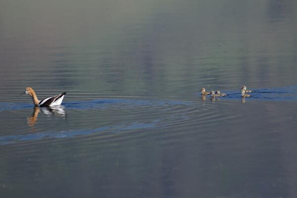
Avocets flying above Farmington Bay Wildlife Management Area, Utah
Avocets flying above Farmington Bay Wildlife Management Area, UtahThe Saline Lake Ecosystems IWAA Waterbird Movement Project began tagging American Avocets in March 2023 to track their movements across the landscape. Tracking data from these birds will help scientists better understand why these birds choose to use the terminal lake and wetland habitats they do in the Great Basin.
By
Ecosystems Mission Area, Water Resources Mission Area, Species Management Research Program, Water Resources Research Act Program, Forest and Rangeland Ecosystem Science Center, Fort Collins Science Center, Nevada Water Science Center, Oregon Water Science Center, Utah Water Science Center, Western Ecological Research Center (WERC), Saline Lake Ecosystems Integrated Water Availability Assessment
American Avocet trailed by chicks
American Avocet are a bird that relies heavily on the Saline Lakes ecosystem during their spring migration periods. Over 50% of these birds exist here. Part of their use includes using the terminal lakes there to breed.
By
Ecosystems Mission Area, Water Resources Mission Area, Species Management Research Program, Forest and Rangeland Ecosystem Science Center, Fort Collins Science Center, Nevada Water Science Center, Oregon Water Science Center, Utah Water Science Center, Western Ecological Research Center (WERC), Saline Lake Ecosystems Integrated Water Availability Assessment
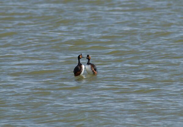
Eared grebes engaged in a courtship behavior
Eared grebes in a courtship behavior in the Great Salt Lake. They are one of many migratory birds in the Great Basin that rely on terminal lakes and wetlands in the area to stop rest and feed.
By
Ecosystems Mission Area, Water Resources Mission Area, Species Management Research Program, Forest and Rangeland Ecosystem Science Center, Fort Collins Science Center, Oregon Water Science Center, Utah Water Science Center, Western Ecological Research Center (WERC), Saline Lake Ecosystems Integrated Water Availability Assessment
Summer Lake Wildlife Area
Photograph of Summer Lake Wildlife Area, an important stopping spot for migratory birds on their spring and fall migration flights.
By
Ecosystems Mission Area, Water Resources Mission Area, Species Management Research Program, Forest and Rangeland Ecosystem Science Center, Fort Collins Science Center, Nevada Water Science Center, Utah Water Science Center, Western Ecological Research Center (WERC), Saline Lake Ecosystems Integrated Water Availability Assessment

0020-iamSeaWolf-16112022
USGS prepares to connect with water-quality platform to service instrumentation and prepare to remove from lake for winter.
USGS prepares to connect with water-quality platform to service instrumentation and prepare to remove from lake for winter.

0001-iamSeawolf-16112022
Scientists prepare to remove water-quality platform from the lake for the winter.
Scientists prepare to remove water-quality platform from the lake for the winter.

0008-iamSeaWolf-16112022
USGS boat approaches water-quality platform. Technicians prepare to pull anchor and remove for lake for winter.
USGS boat approaches water-quality platform. Technicians prepare to pull anchor and remove for lake for winter.

0010-iamSeawolf-16112022
Photographer, Jake Seawolf, captured an aerial view of Bear Lake, USGS boat, and employees on a water-quality platform on a cold and blustery November day using a drone. Jake volunteered his time and talents with the USGS. He is a full-time professional photographer for the US Army.
Photographer, Jake Seawolf, captured an aerial view of Bear Lake, USGS boat, and employees on a water-quality platform on a cold and blustery November day using a drone. Jake volunteered his time and talents with the USGS. He is a full-time professional photographer for the US Army.

Title page from WBD Standards TM11-a3 publication Version 5
Title page from WBD Standards TM11-a3 publication Version 5Title page from the Federal Standards and Procedures for the National Watershed Boundary Dataset (WBD), Techniques and Methods 11-A3, Fifth Edition, 2022.This document establishes Federal standards and procedures for creating the WBD as seamless and hierarchical hydrologic unit data, based on topographic and hydrologic features at a 1:24,000 scale (Alaska at 1:

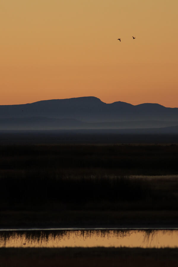
Lone goose at sunrise at Summer Lake Wildlife Area
Lone goose at sunrise at Summer Lake Wildlife AreaLooking east on Bullgate Pond at sunrise with lone tule white-fronted goose (Anser albifrons elgasi) in upper right, Summer Lake Wildlife Area, near Summer Lake, Oregon.
By
Ecosystems Mission Area, Water Resources Mission Area, Species Management Research Program, Water Availability and Use Science Program, Forest and Rangeland Ecosystem Science Center, Fort Collins Science Center, Nevada Water Science Center, Oregon Water Science Center, Utah Water Science Center, Western Ecological Research Center (WERC), Saline Lake Ecosystems Integrated Water Availability Assessment
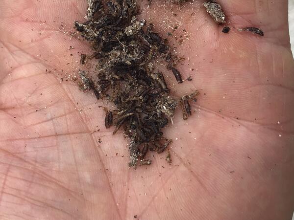
Brine fly pile
These brine flies are an important fuel source for migratory birds, giving them energy for long flights.
By
Ecosystems Mission Area, Water Resources Mission Area, Species Management Research Program, Forest and Rangeland Ecosystem Science Center, Nevada Water Science Center, Oregon Water Science Center, Utah Water Science Center, Western Ecological Research Center (WERC), Saline Lake Ecosystems Integrated Water Availability Assessment
Scientist looking out onto the GSL from Antelope Island
Scientist looking out onto the GSL from Antelope IslandThese scientists are working on The Great Salt Lake to determine the amount of water and qualities of it. This will help them in developing better management techniques that will work to support the migratory birds that frequent the area.
By
Ecosystems Mission Area, Water Resources Mission Area, Species Management Research Program, Forest and Rangeland Ecosystem Science Center, Fort Collins Science Center, Nevada Water Science Center, Oregon Water Science Center, Utah Water Science Center, Western Ecological Research Center (WERC), Saline Lake Ecosystems Integrated Water Availability Assessment