
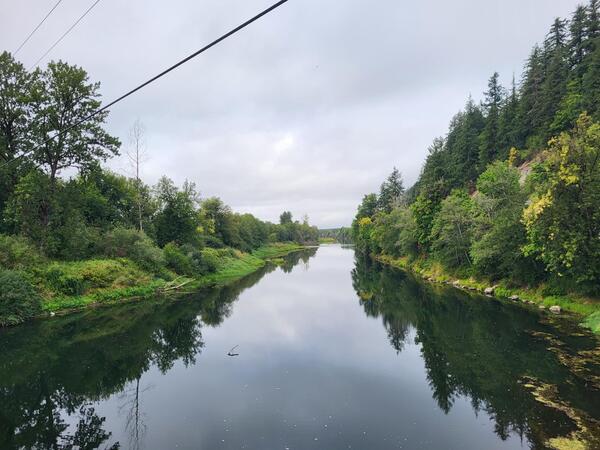
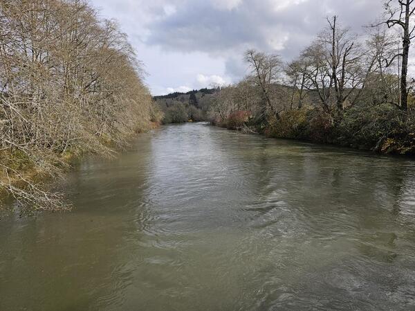
Chehalis River storm waters receded. The green-blue water color indicates a lower sediment concentration.
Images
Below are images associated with the Washington Water Science Center's science and staff. Images appear according to the year they were taken. To search, type a keyword or select a year from the dropdown menu. Or, click through the pages using the arrows at the bottom of the page.
Filter Total Items: 238
Chehalis River, WA
Chehalis River storm waters receded. The green-blue water color indicates a lower sediment concentration.
Technician collects streamflow information at Scatter Creek, WA
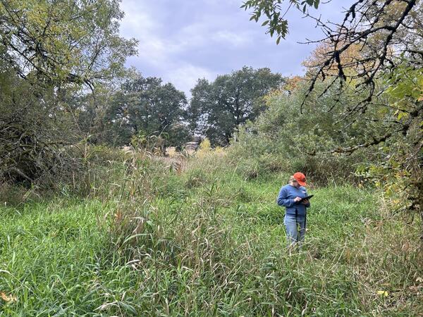
Technician collects streamflow information at Scatter Creek, WAA USGS field technician collects data near Scatter Creek, WA. Scientists are researching where and when streams go dry in this basin. Field observations, including photographs, help determine when streams are flowing or dry.
Technician collects streamflow information at Scatter Creek, WA
Technician collects streamflow information at Scatter Creek, WAA USGS field technician collects data near Scatter Creek, WA. Scientists are researching where and when streams go dry in this basin. Field observations, including photographs, help determine when streams are flowing or dry.
Chehalis River in rainstorm
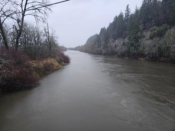
Chehalis River during a winter rainstorm. The brown water indicates a higher sediment concentration.
Chehalis River during a winter rainstorm. The brown water indicates a higher sediment concentration.

Quillayute River
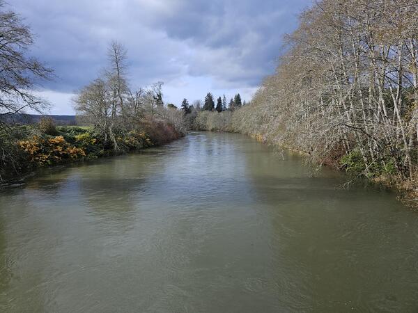
The Quillayute River drains the Olympic Mountains in Washington State. The river and its tributaries provide habitat for several salmon species.
The Quillayute River drains the Olympic Mountains in Washington State. The river and its tributaries provide habitat for several salmon species.
Suspended Sediment in the Wynoochee River, WA
The Wynoochee River turns dark with suspended sediment near the USGS streamgage at Wynoochee River Above Black Creek NR Montesano, WA. The USGS monitored sediment in the Chehalis Basin to better und
The Wynoochee River turns dark with suspended sediment near the USGS streamgage at Wynoochee River Above Black Creek NR Montesano, WA. The USGS monitored sediment in the Chehalis Basin to better und
High turbidity in the Wynoochee River, WA
The Wynoochee River turns a darker color during periods of high sediment transport. The USGS monitored sediment transport in the Chehalis watershed.
The Wynoochee River turns a darker color during periods of high sediment transport. The USGS monitored sediment transport in the Chehalis watershed.
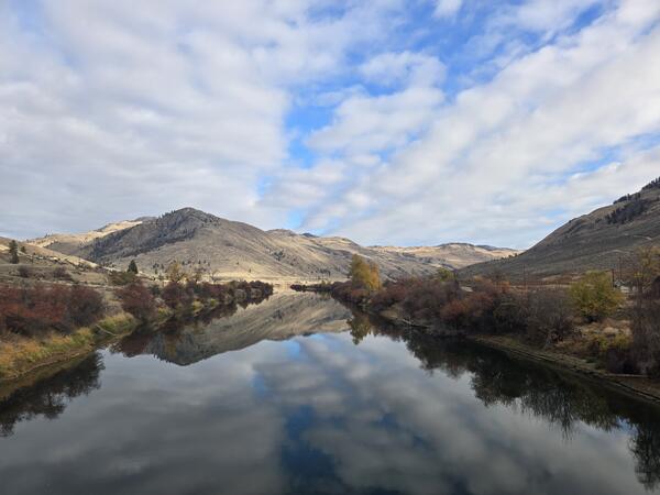
Similkameen River, WA
The Similkameen River flows through north-central Washington. The USGS monitors flow and water quality at multiple locations along its length.
The Similkameen River flows through north-central Washington. The USGS monitors flow and water quality at multiple locations along its length.
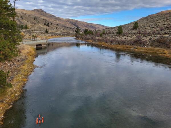
Measuring Streamflow at Similkameen River Near Nighthawk, WA
Measuring Streamflow at Similkameen River Near Nighthawk, WAThe USGS monitors streamflow and water quality at the Similkameen River Near Nighthawk, WA (12442500). Technicians measure streamflow using ADCPs - the small orange boat pictured.
South Fork Nooksack River
The South Fork Nooksack River at USGS Station 12210485. Real-time data are available at: South Fork Nooksack River Above Potter Bridge at Van Zandt, WA.
The South Fork Nooksack River at USGS Station 12210485. Real-time data are available at: South Fork Nooksack River Above Potter Bridge at Van Zandt, WA.

South Fork Tolt River, WA
Water flows around boulders and large wood in the South Fork Tolt River, WA.
Access water data: South Fork Tolt River Near Carnation, WA.
Water flows around boulders and large wood in the South Fork Tolt River, WA.
Access water data: South Fork Tolt River Near Carnation, WA.

Green River, Washington
The USGS monitors streamflow at the Green River at Purification Plant Near Palmer, WA.
The USGS monitors streamflow at the Green River at Purification Plant Near Palmer, WA.

Storm drain
Water flows over pavement into a storm drain.
Water flows over pavement into a storm drain.

Measuring streamflow in the Pend Oreille River, WA
Measuring streamflow in the Pend Oreille River, WAA hydrologic technician uses a cableway to measure streamflow in the Pend Oreille River on a winter day. On-shore, a computer shows streamflow data in real-time, allowing the team to monitor their progress.

Pond sediment sample
Particulate sample collected from the Clarks Creek watershed, Washington. The murky material consists of sediment and organics.
Particulate sample collected from the Clarks Creek watershed, Washington. The murky material consists of sediment and organics.
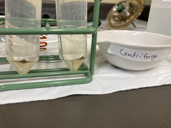
Centrifuged Solids
USGS scientists have developed a novel technique for collecting particulate samples via continuous flow centrifugation.
USGS scientists have developed a novel technique for collecting particulate samples via continuous flow centrifugation.
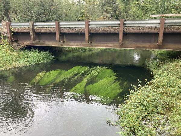
Elodea growth in Washington stream
Elodea and other aquatic plants grow in a thick clump in Clarks Creek, WA. Plants growing in streams may change the water chemistry as well as how quickly water can flow through the stream. USGS scientists study these dynamics.
Elodea and other aquatic plants grow in a thick clump in Clarks Creek, WA. Plants growing in streams may change the water chemistry as well as how quickly water can flow through the stream. USGS scientists study these dynamics.

Hydrologic technician measures streamflow in Tokul Creek
Hydrologic technician measures streamflow in Tokul CreekUSGS Hydrologic Technician Katie Johnson measures streamflow in Tokul Creek near Snoqualmie, WA (12145000).
Hydrologic technician measures streamflow in Tokul Creek
Hydrologic technician measures streamflow in Tokul CreekUSGS Hydrologic Technician Katie Johnson measures streamflow in Tokul Creek near Snoqualmie, WA (12145000).

River rapids
Water rushes over boulders to form rapids. Photo is from a river in western Washington State.
Water rushes over boulders to form rapids. Photo is from a river in western Washington State.

Moclips River Stormwater Assessment Site
Stormwater assessment site on the Moclips River Near Moclips, WA on the Quinault Indian Nation Tribal land.
Stormwater assessment site on the Moclips River Near Moclips, WA on the Quinault Indian Nation Tribal land.
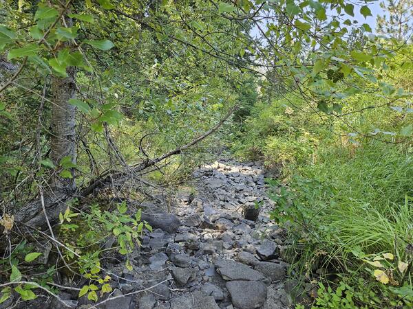
Dry Stream near Blewett Pass, Washington
A small stream near Blewett Pass, Washington is dry in late summer. Scientists visited to record streamflow conditions with the FLOwPER mobile field form.
A small stream near Blewett Pass, Washington is dry in late summer. Scientists visited to record streamflow conditions with the FLOwPER mobile field form.

Pacific Lamprey Habitat
Type 1 Pacific lamprey habitat on the Klickitat River near Glenwood, WA. Type I (preferred) lamprey habitat that consists of a mixed substrate of silt, clay, organic matter, and sand.
Type 1 Pacific lamprey habitat on the Klickitat River near Glenwood, WA. Type I (preferred) lamprey habitat that consists of a mixed substrate of silt, clay, organic matter, and sand.