
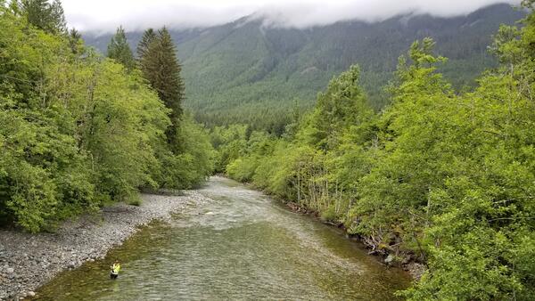
Scientists conduct a float survey of the Quillayute River. They measure water temperatures at different depths and locations within the channel along the river's length.
Images
Below are images associated with the Washington Water Science Center's science and staff. Images appear according to the year they were taken. To search, type a keyword or select a year from the dropdown menu. Or, click through the pages using the arrows at the bottom of the page.
Filter Total Items: 238

Temperature survey of the Quillayute River
Scientists conduct a float survey of the Quillayute River. They measure water temperatures at different depths and locations within the channel along the river's length.
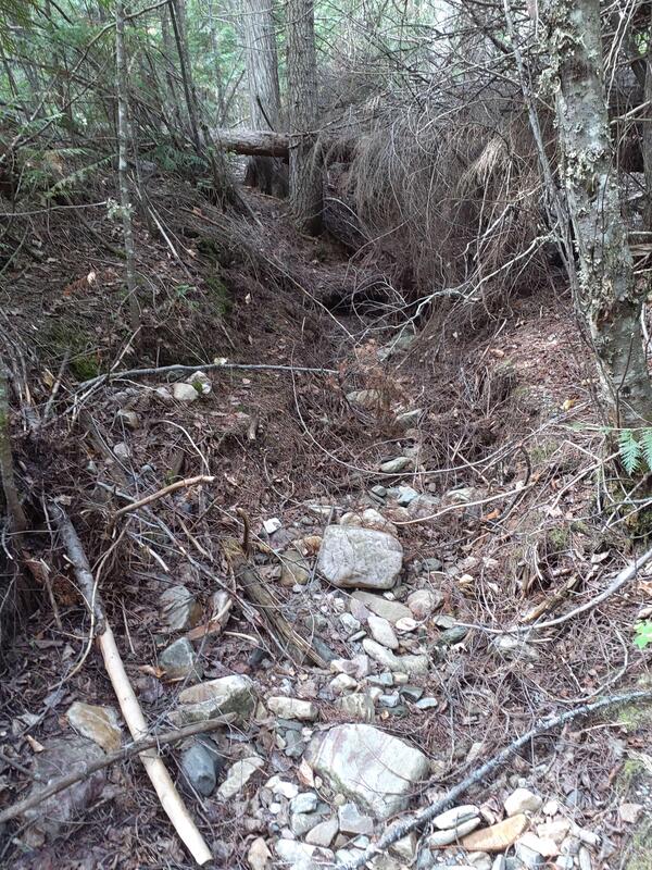
Dry Stream in the Colville National Forest, Washington
Dry Stream in the Colville National Forest, WashingtonA stream channel in the Colville National Forest has no surface water flow in the late summer. Scientists visited to record streamflow conditions with the FLOwPER mobile field form.
Dry Stream in the Colville National Forest, Washington
Dry Stream in the Colville National Forest, WashingtonA stream channel in the Colville National Forest has no surface water flow in the late summer. Scientists visited to record streamflow conditions with the FLOwPER mobile field form.
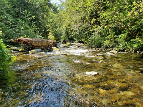
South Fork Tolt River, WA
This reach of the South Fork Tolt River runs through a lush forest over a boulder bed.
Access water data: South Fork Tolt River Near Carnation, WA.
This reach of the South Fork Tolt River runs through a lush forest over a boulder bed.
Access water data: South Fork Tolt River Near Carnation, WA.
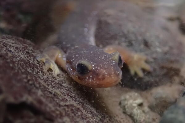
Torrent salamander
Torrent salamanders are endemic to the Pacific Northwest region of the United States.
Torrent salamanders are endemic to the Pacific Northwest region of the United States.

USGS scientists measure bathymetry on the White River, Washington with a Q-boat
USGS scientists measure bathymetry on the White River, Washington with a Q-boatUSGS Hydrologic Technicians from the Washington Water Science Center operate a Q-Boat equipped with an ADCP to measure the bathymetry along the White River, Washington.

Skagit River, Washington
Skagit River in the North Cascades, Washington. Stumps left by logging are visible among the wetland vegetation. The USGS monitors water quality near this site.
Skagit River in the North Cascades, Washington. Stumps left by logging are visible among the wetland vegetation. The USGS monitors water quality near this site.
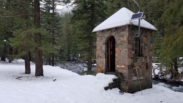
Gagehouse on the American River, WA
Gagehouses protect USGS water monitoring equipment from the elements.
Gagehouses protect USGS water monitoring equipment from the elements.

Lost Creek, Washington: FLOwPER streamflow status "dry"
Lost Creek, Washington: FLOwPER streamflow status "dry"Lost Creek, tributary to Little White Salmon, Washington, showing a FLOwPER streamflow status of "dry." The FLOwPER (FLOW PERmanence) field form provides standardized data collection to map the presence of flow in streams and upload the input data to an ArcGIS database.
Measuring flow in the South Fork Snoqualmie River, WA
Measuring flow in the South Fork Snoqualmie River, WAHydrologic Technician Gary Heard measures streamflow in the South Fork of the Snoqualmie River, Washington. A USGS streamgage provides real-time flow data at this location and technicians make regular field measurements to ensure data quality.
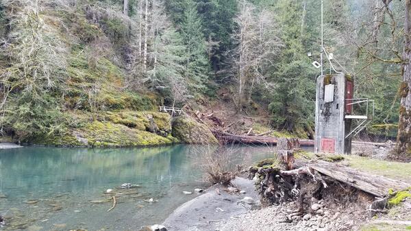
Streamgage on NF Skokomish River, WA
Streamgage on the NF Skokomish River, WA.
Streamgage on the NF Skokomish River, WA.

AfterThomas_Wildfires_Dec2017.jpg
A Landsat image after the Thomas fire in California in 2017. This image is to be used for the after image for a before and after image.
A Landsat image after the Thomas fire in California in 2017. This image is to be used for the after image for a before and after image.

Measuring the Colville River at Kettle Falls, WA
USGS Hydrologic Technician Kim Cesal measuring 3170 cfs at 12409000 Colville River at Kettle Falls, WA. This measurement is the highest made at the gaging site. The gage has been in operation since October 1922. The gage was installed to monitor flows from Meyer Falls Dam and Power Generation.
USGS Hydrologic Technician Kim Cesal measuring 3170 cfs at 12409000 Colville River at Kettle Falls, WA. This measurement is the highest made at the gaging site. The gage has been in operation since October 1922. The gage was installed to monitor flows from Meyer Falls Dam and Power Generation.

Elwha River Mouth
Aerial photo by Tom Roorda of the mouth of the Elwha River near Port Angeles, Wash.
Aerial photo by Tom Roorda of the mouth of the Elwha River near Port Angeles, Wash.

Elwha River Salmon
A female Chinook salmon, among the first wave of fish to recolonize waters that haven't had salmon in 100 years, excavates a nest inside Olympic National Park.
A female Chinook salmon, among the first wave of fish to recolonize waters that haven't had salmon in 100 years, excavates a nest inside Olympic National Park.

Cableway measurement of flooding river
Cableways allow hydrologic technicians to safely measure streamflow. Here, a technician measures flood waters.
Cableways allow hydrologic technicians to safely measure streamflow. Here, a technician measures flood waters.

Measuring discharge in the Sauk River, Washington
A hydrologic technician wades across the Sauk River to measure streamflow at USGS streamgage 12186000. The staff gage in front of the boulder can be used to read the water level.
A hydrologic technician wades across the Sauk River to measure streamflow at USGS streamgage 12186000. The staff gage in front of the boulder can be used to read the water level.
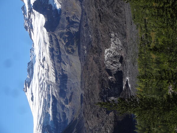
White River flows from the Emmons Glacier, Mount Rainier
White River flows from the Emmons Glacier, Mount RainierThe White River flows from the base of the Emmons Glacier on Mount Rainier, WA. The USGS researches the rivers and streams originating from the volcano.
White River flows from the Emmons Glacier, Mount Rainier
White River flows from the Emmons Glacier, Mount RainierThe White River flows from the base of the Emmons Glacier on Mount Rainier, WA. The USGS researches the rivers and streams originating from the volcano.

Centrifuge Bowl Containing River Suspended Sediment for Analysis
Centrifuge Bowl Containing River Suspended Sediment for AnalysisA U.S. Geological Survey hydrologist holds a centrifuge bowl containing river suspended sediment for analysis of metals and organic chemicals. The sample was collected using a new in-field continuous-flow centrifugation technique to separate and collect suspended sediment from large volumes of water.

Centrifuge for suspended sediment collection
A hydrologist collects a suspended sediment sample using a continuous flow centrifuge.
A hydrologist collects a suspended sediment sample using a continuous flow centrifuge.

The confluence of the Suiattle River (muddy river) into the Sauk River
The confluence of the Suiattle River (muddy river) into the Sauk RiverThe confluence of the Suiattle River (muddy river) into the Sauk River.
The confluence of the Suiattle River (muddy river) into the Sauk River
The confluence of the Suiattle River (muddy river) into the Sauk RiverThe confluence of the Suiattle River (muddy river) into the Sauk River.

Mount Rainier Looms over the Puyallup Valley, Washington
Mount Rainier Looms over the Puyallup Valley, WashingtonMount Rainier volcano looms over Puyallup Valley, near Orting, Washington.
Mount Rainier Looms over the Puyallup Valley, Washington
Mount Rainier Looms over the Puyallup Valley, WashingtonMount Rainier volcano looms over Puyallup Valley, near Orting, Washington.