
A view of American (left) and Horseshoe Falls in Niagara Falls from the Canadian side of the falls.
Images
Images
Filter Total Items: 9454

American and Horseshoe Falls in Niagara Falls
A view of American (left) and Horseshoe Falls in Niagara Falls from the Canadian side of the falls.

Horseshoe Falls
A view of Horseshoe Falls from the Canadian side of Niagara Falls.
A view of Horseshoe Falls from the Canadian side of Niagara Falls.

American Falls
A view of American Falls from the Canadian side of Niagara Falls.
A view of American Falls from the Canadian side of Niagara Falls.

Panorama of American and Horseshoe Falls in Niagara Falls
Panorama of American and Horseshoe Falls in Niagara FallsA panorama of American and Horseshoe Falls in Niagara Falls from the Canadian side of the waterfall.
Panorama of American and Horseshoe Falls in Niagara Falls
Panorama of American and Horseshoe Falls in Niagara FallsA panorama of American and Horseshoe Falls in Niagara Falls from the Canadian side of the waterfall.

Niagara River Rapids
A view of rapids on the Niagara River, just upstream of American Falls.
A view of rapids on the Niagara River, just upstream of American Falls.

Niagara River Rapids
A view of rapids on the Niagara River, just upstream of American Falls.
A view of rapids on the Niagara River, just upstream of American Falls.

American Falls
A view of American Falls from the United States side of Niagara Falls.
A view of American Falls from the United States side of Niagara Falls.

American Falls
A view of American Falls from the United States side of Niagara Falls.
A view of American Falls from the United States side of Niagara Falls.

International Border at Niagara Falls
The international border at Niagara Falls.
The international border at Niagara Falls.

American and Horseshoe Falls in Niagara Falls
A view of American (left) and Horseshoe Falls in Niagara Falls from the Canadian side of the falls.
A view of American (left) and Horseshoe Falls in Niagara Falls from the Canadian side of the falls.

Horseshoe Falls
A view of Horseshoe Falls from the Canadian side of Niagara Falls.
A view of Horseshoe Falls from the Canadian side of Niagara Falls.

American Falls
A view of American Falls from the Canadian side of Niagara Falls.
A view of American Falls from the Canadian side of Niagara Falls.

Chukchi Sea sea ice
Sea ice in the Chukchi Sea.
Sea ice in the Chukchi Sea.

CERC Scientists Operate a Sediment Sampler on the Yellowstone River
CERC Scientists Operate a Sediment Sampler on the Yellowstone RiverA USGS scientist operates a Petite Ponar substrate sampler to sample bed material in an area identified as a pallid sturgeon spawning location on the Yellowstone River, North Dakota.

Close-up Sample
A close-up image of lignite-dominated gravel sampled from a spawning area with Petite Ponar sampler.
A close-up image of lignite-dominated gravel sampled from a spawning area with Petite Ponar sampler.

Petite Ponar Sampler and Sample
Collecting and storing substrate samples using a Petite Ponar sampler (top right) for later analysis.
Collecting and storing substrate samples using a Petite Ponar sampler (top right) for later analysis.
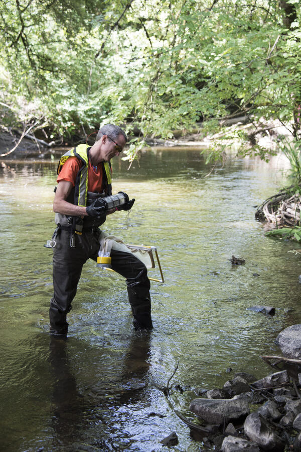
A USGS researcher takes algae samples at Bear Creek in Redmond, WA.
A USGS researcher takes algae samples at Bear Creek in Redmond, WA.A USGS researcher takes algae samples at Bear Creek in Redmond, Washington.
A USGS researcher takes algae samples at Bear Creek in Redmond, WA.
A USGS researcher takes algae samples at Bear Creek in Redmond, WA.A USGS researcher takes algae samples at Bear Creek in Redmond, Washington.

John Redmond Reservoir
John Redmond Reservoir Outlet, June 22, 2015. Ten thousand cubic feet per second being released.
John Redmond Reservoir Outlet, June 22, 2015. Ten thousand cubic feet per second being released.

Multibeam on the Yellowstone River
USGS research vessel outfitted with a compact multibeam sonar echosounder system with an inertial motion unit and real time kinematic positioning global positioning system (RTK GPS) surveys the Yellowstone River near Fairview, North Dakota.
USGS research vessel outfitted with a compact multibeam sonar echosounder system with an inertial motion unit and real time kinematic positioning global positioning system (RTK GPS) surveys the Yellowstone River near Fairview, North Dakota.

Pallid Sturgeon Free Embryo
Newly hatched pallid sturgeon free embryo. On average, pallid sturgeon hatch between 7 to 9 millimeters (about 0.25 to 0.35 inch).
Newly hatched pallid sturgeon free embryo. On average, pallid sturgeon hatch between 7 to 9 millimeters (about 0.25 to 0.35 inch).

Pallid Sturgeon Embryos
Well-developed pallid sturgeon embryos can be seen approximately four days after fertilization.
Well-developed pallid sturgeon embryos can be seen approximately four days after fertilization.