
Retrieving a trotline on the Lower Missouri River in March 2011.
Images
Images
Filter Total Items: 9454

Retrieving a Trotline on the Lower Missouri River
Retrieving a trotline on the Lower Missouri River in March 2011.

Ultrasound of Pallid Sturgeon
An ultrasound is used to determine the reproductive condition of female pallid sturgeon.
An ultrasound is used to determine the reproductive condition of female pallid sturgeon.

Open Water
Open weir at Apple Creek near Menoken, North Dakota. Flow is 36.7 cubic feet per second.
Open weir at Apple Creek near Menoken, North Dakota. Flow is 36.7 cubic feet per second.

Pallid Sturgeon Blood Samples
Blood samples from pallid sturgeon are taken to assess hormone levels and reproductive condition.
Blood samples from pallid sturgeon are taken to assess hormone levels and reproductive condition.

Disappeared Ice Spikes
Increase flow in the Des Lacs River and warmer temperatures probably
caused instability in the area of the ice spikes causing them to disappear.
Increase flow in the Des Lacs River and warmer temperatures probably
caused instability in the area of the ice spikes causing them to disappear.

Alligator and Python Struggle
An American alligator and a Burmese python locked in a struggle to prevail in Everglades National Park. This python appears to be losing, but snakes in similar situations have apparently escaped unharmed, and in other situations pythons have eaten alligators.
An American alligator and a Burmese python locked in a struggle to prevail in Everglades National Park. This python appears to be losing, but snakes in similar situations have apparently escaped unharmed, and in other situations pythons have eaten alligators.

Demonstration Wetland at Henderson, Nevada
Demonstration wetland at Henderson, Nevada, where vegetated hummocks were built into the wastewater treatment wetland to improve its effectiveness and sustainability, as well as provide quality wildlife habitat.
Demonstration wetland at Henderson, Nevada, where vegetated hummocks were built into the wastewater treatment wetland to improve its effectiveness and sustainability, as well as provide quality wildlife habitat.

Launching at Hartsburg Boat Ramp
Launching a cabin boat outfitted with telemetry tracking equipment during high water on the Missouri River from the Hartsburg, Missouri, boat ramp.
Launching a cabin boat outfitted with telemetry tracking equipment during high water on the Missouri River from the Hartsburg, Missouri, boat ramp.

Telemetry Receivers
Acoustic receivers detect and process the acoustic signal from the telemetry tags telling the tracking crew which direction to go to find the fish, and even which fish it is.
Acoustic receivers detect and process the acoustic signal from the telemetry tags telling the tracking crew which direction to go to find the fish, and even which fish it is.

Gator Below the Site
A gator relaxes in the shade underneath our station’s dock.
A gator relaxes in the shade underneath our station’s dock.

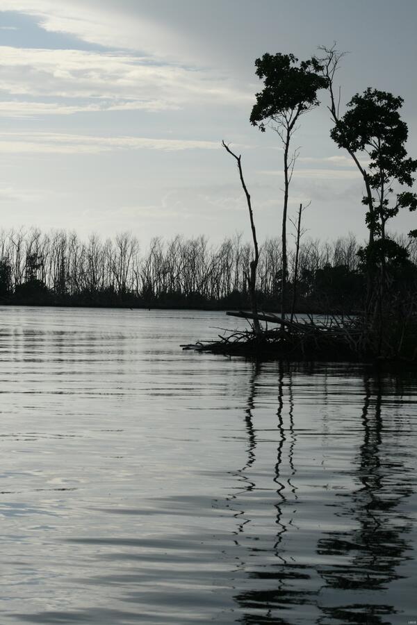
North New River Station
An excessive amount of weeds flows down North New River.
An excessive amount of weeds flows down North New River.

Closing off Seine
Scientists close off a center bag seine prior to pursing net to recover fish sample.
Scientists close off a center bag seine prior to pursing net to recover fish sample.

Juvenile Sheepshead
Employee holds a sheepshead, a juvenile fish of recreational importance captured in a mangrove-lined tidal creek.
Employee holds a sheepshead, a juvenile fish of recreational importance captured in a mangrove-lined tidal creek.

Measuring a Cross-Sectional Creek Profile
Scientist measures the profile of a tidal creek at low tide. Note mudflat in background.
Scientist measures the profile of a tidal creek at low tide. Note mudflat in background.

Tidal Creek Salt Marsh Recon
Conducting a reconnaissance of a salt marsh-lined tidal creek.
Conducting a reconnaissance of a salt marsh-lined tidal creek.

Conducting Fieldwork
Mara Tongue download data from phenocam located in Idaho. The phenocam takes a picture daily and that data is used to help track phenological changes (the timing and vigor of seasonal biological events). The data from the phenocam is used (with other data) to gain a better understanding of vegetation changes over the entire ecoregion.
Mara Tongue download data from phenocam located in Idaho. The phenocam takes a picture daily and that data is used to help track phenological changes (the timing and vigor of seasonal biological events). The data from the phenocam is used (with other data) to gain a better understanding of vegetation changes over the entire ecoregion.

Conducting Fieldwork
Alicia Torregrosa download data from a phenocam located in Idaho. The phenocam takes a picture daily and that data is used to help track phenological changes (the timing and vigor of seasonal biological events). The data from the phenocam is used (with other data) to gain a better understanding of vegetation changes over the entire ecoregion.
Alicia Torregrosa download data from a phenocam located in Idaho. The phenocam takes a picture daily and that data is used to help track phenological changes (the timing and vigor of seasonal biological events). The data from the phenocam is used (with other data) to gain a better understanding of vegetation changes over the entire ecoregion.

Fog in the Valley over the Tailrace
Standing on the Earth and Dam at Cougar as the fog rolled in and over the tailrace. (South Fork of the McKenzie River)
Standing on the Earth and Dam at Cougar as the fog rolled in and over the tailrace. (South Fork of the McKenzie River)
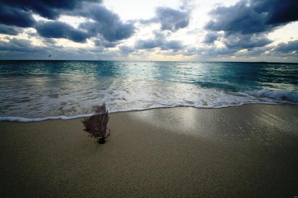
Dead Coral
Sea level rise and increased turbidity are causing corals world-wide to die, littering beaches with their remains.
Sea level rise and increased turbidity are causing corals world-wide to die, littering beaches with their remains.
After the Frost
After the unexpected 2010-2011 winter frost, attributed to climate change, much of south Florida’s coastal vegetation was lost.
After the unexpected 2010-2011 winter frost, attributed to climate change, much of south Florida’s coastal vegetation was lost.

Arches National Park
Small Peekhole.