
Late in the evening, two wolves make use of the trail that leads to the head of the fiord. Studying wolves in the High Arctic allows scientists to follow the wolves during their travels, assuming the scientists can keep up. All-terrain vehicles are needed, and the 24-hour daylight at this time of year is critical.
Images
Images
Filter Total Items: 9454

Dave Mech Following Wolves
Late in the evening, two wolves make use of the trail that leads to the head of the fiord. Studying wolves in the High Arctic allows scientists to follow the wolves during their travels, assuming the scientists can keep up. All-terrain vehicles are needed, and the 24-hour daylight at this time of year is critical.

Brutus the North Pole Wolf
USGS biologist Dave Mech has spent more than 20 summers studying Arctic wolves on Ellesmere Island, where they are unafraid of humans and can be observed at close range.
USGS biologist Dave Mech has spent more than 20 summers studying Arctic wolves on Ellesmere Island, where they are unafraid of humans and can be observed at close range.

Massachusetts inner continental shelf
Massachusetts inner continental shelf bottom photograph showing seafloor life.
Massachusetts inner continental shelf bottom photograph showing seafloor life.

Purple Loosestrife
Many species of birds rely on wetlands such as this baldcypress swamp, one of the ecosystems currently being studied by scientists at the USGS NWRC.
Many species of birds rely on wetlands such as this baldcypress swamp, one of the ecosystems currently being studied by scientists at the USGS NWRC.

Sampling in the Mangroves -- 3-D Twister!
USGS scientists are studying the plants and animals that are part of the coastal mangrove ecotone of Everglades National Park.
USGS scientists are studying the plants and animals that are part of the coastal mangrove ecotone of Everglades National Park.

Geo-locating a Well
GPS unit on well head at a private drinking water well.
GPS unit on well head at a private drinking water well.

Determining Alkalinity of a Sample in the Field
Alk titration in the field as part of NAWQA studies.
Alk titration in the field as part of NAWQA studies.
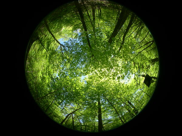
Tree Canopy
Fisheye view of tree canopy in Shenandoah National Park, Virginia.
Fisheye view of tree canopy in Shenandoah National Park, Virginia.

Bear Digging for Food
Bear digging for food in Shenandoah National Park, Virginia.
Bear digging for food in Shenandoah National Park, Virginia.
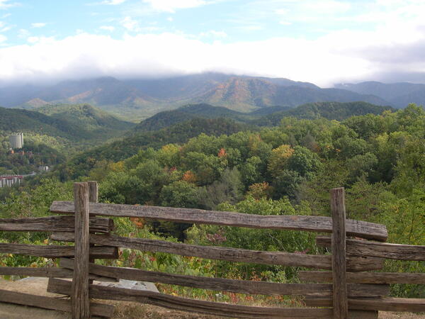
View of Gatlinburg
View of Gatlinburg, TN, in Great Smoky Mountains National Park, Virginia.
View of Gatlinburg, TN, in Great Smoky Mountains National Park, Virginia.

Spiny Dogfish Catch
USGS employee Lisa Gee holds a spiny dogfish that she caught while hook and line sampling.
USGS employee Lisa Gee holds a spiny dogfish that she caught while hook and line sampling.

False Bay, South Africa
False Bay, South Africa

Potomac River
Stream flowing into the Potomac River in Whites Ferry, Virginia.
Stream flowing into the Potomac River in Whites Ferry, Virginia.

Grand Forks Flooding
2009 Red River flooding in Grand Forks, North Dakota
2009 Red River flooding in Grand Forks, North Dakota

What's in My Water?
This cyanobacteria has radiating filaments and basal heterocysts. Green is DNA stain.
This cyanobacteria has radiating filaments and basal heterocysts. Green is DNA stain.

Weather Station Setup
Mike Sabatino working on a weather station in Shenadoah national Park, Virginia.
Mike Sabatino working on a weather station in Shenadoah national Park, Virginia.

Ash Falls
Ash Falls on the Niobrara River showcases the Niobrara's uniqueness. Photo was taken to capture falls' legacy.
Ash Falls on the Niobrara River showcases the Niobrara's uniqueness. Photo was taken to capture falls' legacy.

Instrument in Surf Zone
Instrument on poles in the surf zone for a coastal erosion study.
Instrument on poles in the surf zone for a coastal erosion study.

Coyote Walking Through Post-Wildfires
The next photo on the camera at 11:12 p.m. PST on Oct. 23, 2007, shows a coyote walking out of the wash at night, a day and a half after the fire, heading back in the direction from which the coyote was running on the early morning of Oct. 22, 2007. Photo credit: USGS
The next photo on the camera at 11:12 p.m. PST on Oct. 23, 2007, shows a coyote walking out of the wash at night, a day and a half after the fire, heading back in the direction from which the coyote was running on the early morning of Oct. 22, 2007. Photo credit: USGS
Coyote Walking
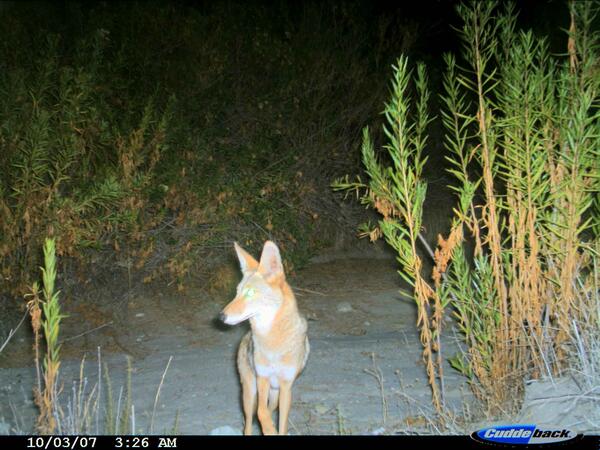
A coyote walking in dry creek bed of streamside scrub vegetation dominated by the native plant, mule fat (Baccharis salidifolia), about 20 days before the fire. In their wildlife research, USGS scientists position camera traps along trails and dry creek beds, places that are likely to be travel routes for carnivores.
A coyote walking in dry creek bed of streamside scrub vegetation dominated by the native plant, mule fat (Baccharis salidifolia), about 20 days before the fire. In their wildlife research, USGS scientists position camera traps along trails and dry creek beds, places that are likely to be travel routes for carnivores.

Bison Cow and Calf
A bison cow and her calf.
A bison cow and her calf.